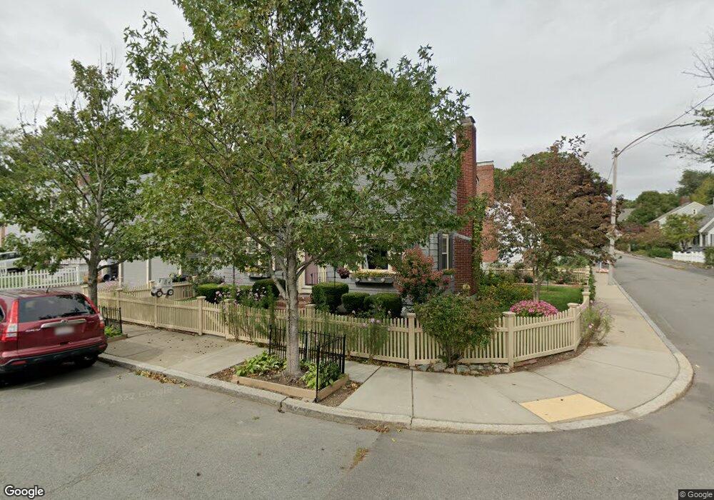
38 Goodway Rd Jamaica Plain, MA 02130
Jamaica Plain NeighborhoodEstimated Value: $740,000 - $838,191
2
Beds
2
Baths
1,317
Sq Ft
$596/Sq Ft
Est. Value
About This Home
This home is located at 38 Goodway Rd, Jamaica Plain, MA 02130 and is currently estimated at $785,048, approximately $596 per square foot. 38 Goodway Rd is a home located in Suffolk County with nearby schools including Brooke Charter School Roslindale, The Croft School - Jamaica Plain, and St. Clare High School.
Ownership History
Date
Name
Owned For
Owner Type
Purchase Details
Closed on
Nov 30, 1989
Sold by
Friend Richard L
Bought by
Cushman Marcos C
Current Estimated Value
Create a Home Valuation Report for This Property
The Home Valuation Report is an in-depth analysis detailing your home's value as well as a comparison with similar homes in the area
Home Values in the Area
Average Home Value in this Area
Purchase History
| Date | Buyer | Sale Price | Title Company |
|---|---|---|---|
| Cushman Marcos C | $157,000 | -- |
Source: Public Records
Mortgage History
| Date | Status | Borrower | Loan Amount |
|---|---|---|---|
| Open | Cushman Marcos C | $126,000 | |
| Closed | Cushman Marcos C | $85,500 | |
| Closed | Cushman Marcos C | $128,000 | |
| Closed | Cushman Marcos C | $131,000 |
Source: Public Records
Tax History Compared to Growth
Tax History
| Year | Tax Paid | Tax Assessment Tax Assessment Total Assessment is a certain percentage of the fair market value that is determined by local assessors to be the total taxable value of land and additions on the property. | Land | Improvement |
|---|---|---|---|---|
| 2025 | $8,801 | $760,000 | $207,500 | $552,500 |
| 2024 | $8,755 | $803,200 | $195,600 | $607,600 |
| 2023 | $8,059 | $750,400 | $182,700 | $567,700 |
| 2022 | $7,488 | $688,200 | $167,600 | $520,600 |
| 2021 | $7,130 | $668,200 | $162,700 | $505,500 |
| 2020 | $6,045 | $572,400 | $159,100 | $413,300 |
| 2019 | $5,727 | $543,400 | $143,500 | $399,900 |
| 2018 | $5,084 | $485,100 | $143,500 | $341,600 |
| 2017 | $5,039 | $475,800 | $143,500 | $332,300 |
| 2016 | $5,130 | $466,400 | $143,500 | $322,900 |
| 2015 | $5,273 | $435,400 | $148,400 | $287,000 |
| 2014 | $4,797 | $381,300 | $148,400 | $232,900 |
Source: Public Records
Map
Nearby Homes
- 50 Southbourne Rd
- 24 Waterman Rd
- 71 Wyvern St
- 18-20 Northbourne Rd Unit 18
- 105 Neponset Ave Unit 105
- 348-350 Hyde Park Ave Unit 2
- 103 Neponset Ave Unit 103A
- 103-105 Neponset Ave
- 31 Rodman St Unit 2
- 31 Rodman St Unit 1
- 36 Neponset Ave Unit 1
- 602 Canterbury St Unit 14
- 602 Canterbury St Unit 4
- 602 Canterbury St Unit 5
- 602 Canterbury St Unit 2
- 602 Canterbury St Unit 9
- 579 American Legion Hwy
- 158 Wachusett St Unit 3
- 577-579 American Legion Hwy
- 140 Wachusett St
- 77 Bourne St
- 34 Goodway Rd
- 87-89 Bourne St
- 73 Bourne St
- 92 Bourne St Unit 92A
- 92 Bourne St Unit 1
- 90 Bourne St
- 30 Goodway Rd
- 29 Goodway Rd
- 94 Bourne St
- 94 Bourne St Unit 1
- 94 Bourne St Unit 2
- 91 Bourne St Unit 93
- 91 Bourne St Unit 221
- 91 Bourne St Unit 91
- 91-93 Bourne St Unit 93
- 26 Goodway Rd
- 84 Bourne St
- 84 Bourne St Unit 2
- 84 Bourne St Unit 1