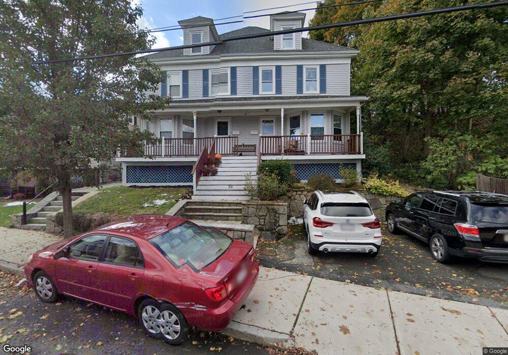
38 Green St Unit 1 Beverly, MA 01915
Ryal Side NeighborhoodEstimated Value: $536,000 - $666,000
3
Beds
1
Bath
1,406
Sq Ft
$416/Sq Ft
Est. Value
About This Home
This home is located at 38 Green St Unit 1, Beverly, MA 01915 and is currently estimated at $584,674, approximately $415 per square foot. 38 Green St Unit 1 is a home located in Essex County with nearby schools including Beverly High School, The Saints Academy, and Mrs Alexander's School.
Ownership History
Date
Name
Owned For
Owner Type
Purchase Details
Closed on
Feb 26, 2021
Sold by
Veden Stacey N
Bought by
Taylor Tamara
Current Estimated Value
Home Financials for this Owner
Home Financials are based on the most recent Mortgage that was taken out on this home.
Original Mortgage
$343,400
Outstanding Balance
$305,023
Interest Rate
2.7%
Mortgage Type
Purchase Money Mortgage
Estimated Equity
$279,651
Purchase Details
Closed on
May 20, 2003
Sold by
Orsett Res 3 Llc
Bought by
Veden Stacey N
Home Financials for this Owner
Home Financials are based on the most recent Mortgage that was taken out on this home.
Original Mortgage
$220,000
Interest Rate
5.84%
Mortgage Type
Purchase Money Mortgage
Create a Home Valuation Report for This Property
The Home Valuation Report is an in-depth analysis detailing your home's value as well as a comparison with similar homes in the area
Home Values in the Area
Average Home Value in this Area
Purchase History
| Date | Buyer | Sale Price | Title Company |
|---|---|---|---|
| Taylor Tamara | $430,500 | None Available | |
| Taylor Tamara | $430,500 | None Available | |
| Veden Stacey N | $275,000 | -- |
Source: Public Records
Mortgage History
| Date | Status | Borrower | Loan Amount |
|---|---|---|---|
| Open | Taylor Tamara | $343,400 | |
| Closed | Taylor Tamara | $343,400 | |
| Previous Owner | Veden Stacey N | $188,183 | |
| Previous Owner | Veden Stacey N | $220,000 |
Source: Public Records
Tax History
| Year | Tax Paid | Tax Assessment Tax Assessment Total Assessment is a certain percentage of the fair market value that is determined by local assessors to be the total taxable value of land and additions on the property. | Land | Improvement |
|---|---|---|---|---|
| 2025 | $5,084 | $462,600 | $0 | $462,600 |
| 2024 | $4,808 | $428,100 | $0 | $428,100 |
| 2023 | $4,536 | $402,800 | $0 | $402,800 |
| 2022 | $4,376 | $359,600 | $0 | $359,600 |
| 2021 | $4,260 | $335,400 | $0 | $335,400 |
| 2020 | $4,016 | $313,000 | $0 | $313,000 |
| 2019 | $3,937 | $298,000 | $0 | $298,000 |
| 2018 | $3,822 | $281,000 | $0 | $281,000 |
| 2017 | $3,891 | $272,500 | $0 | $272,500 |
| 2016 | $3,859 | $268,200 | $0 | $268,200 |
| 2015 | $3,784 | $268,200 | $0 | $268,200 |
Source: Public Records
Map
Nearby Homes
- 13 Giles Ave Unit 2
- 123 Livingstone Ave
- 125 Livingstone Ave
- 6 Pilgrim Heights
- 348 Rantoul St Unit 202
- 315 Rantoul St Unit 406
- 261 Rantoul St
- 34 Chase St
- 28 Arthur St Unit 3
- 50 Balch St Unit 300
- 50 Balch St Unit 200
- 50 Balch St Unit 205
- 50 Balch St Unit 308
- 50 Balch St Unit 511
- 50 Balch St Unit 209
- 50 Balch St Unit 409
- 50 Balch St Unit 316
- 50 Balch St Unit 315
- 50 Balch St Unit 103
- 50 Balch St Unit 412
Your Personal Tour Guide
Ask me questions while you tour the home.