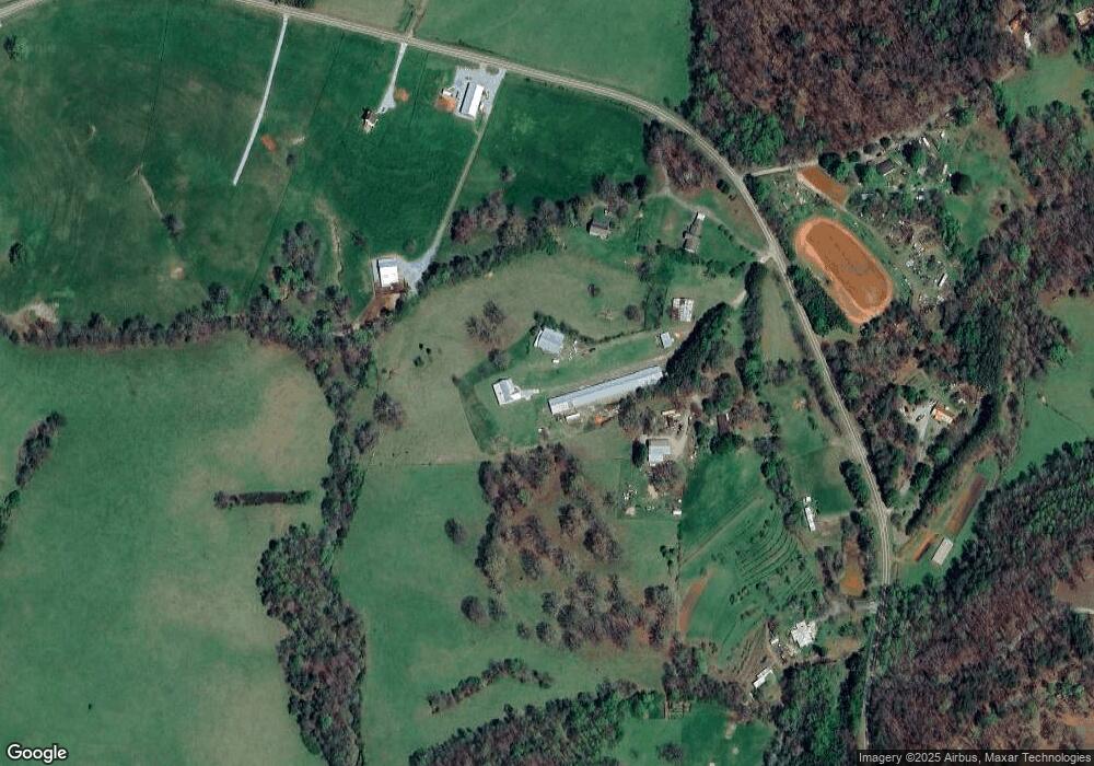
38 Honea Path Dahlonega, GA 30533
Estimated Value: $412,000 - $620,495
--
Bed
--
Bath
1,852
Sq Ft
$276/Sq Ft
Est. Value
About This Home
This home is located at 38 Honea Path, Dahlonega, GA 30533 and is currently estimated at $511,124, approximately $275 per square foot. 38 Honea Path is a home with nearby schools including Lumpkin County High School.
Ownership History
Date
Name
Owned For
Owner Type
Purchase Details
Closed on
May 21, 2020
Sold by
Hester Horace
Bought by
Phillips Hampton and Phillips Mi Cha
Current Estimated Value
Purchase Details
Closed on
Nov 24, 2008
Sold by
Jones Patrick A
Bought by
Hester Horace
Purchase Details
Closed on
Aug 18, 2008
Sold by
Jones Patrick A
Bought by
Jones Carlton and Jones Jeffrey Thomas
Purchase Details
Closed on
Aug 7, 2008
Sold by
Jones Patrick A
Bought by
Jones Patrick Tyler
Purchase Details
Closed on
Aug 6, 2007
Sold by
Not Provided
Bought by
Hester Horace
Purchase Details
Closed on
Jan 9, 2001
Bought by
Jones Marjorie
Create a Home Valuation Report for This Property
The Home Valuation Report is an in-depth analysis detailing your home's value as well as a comparison with similar homes in the area
Home Values in the Area
Average Home Value in this Area
Purchase History
| Date | Buyer | Sale Price | Title Company |
|---|---|---|---|
| Phillips Hampton | $134,521 | -- | |
| Hester Horace | $320,000 | -- | |
| Jones Carlton | $2,500 | -- | |
| Jones Patrick Tyler | -- | -- | |
| Hester Horace | -- | -- | |
| Jones Marjorie | -- | -- |
Source: Public Records
Tax History Compared to Growth
Tax History
| Year | Tax Paid | Tax Assessment Tax Assessment Total Assessment is a certain percentage of the fair market value that is determined by local assessors to be the total taxable value of land and additions on the property. | Land | Improvement |
|---|---|---|---|---|
| 2024 | $4,033 | $225,583 | $56,528 | $169,055 |
| 2023 | $3,788 | $207,561 | $48,290 | $159,271 |
| 2022 | $561 | $69,262 | $40,242 | $29,020 |
| 2021 | $862 | $70,700 | $40,242 | $30,458 |
| 2020 | $886 | $69,019 | $38,561 | $30,458 |
| 2019 | $892 | $69,019 | $38,561 | $30,458 |
| 2018 | $948 | $69,019 | $38,561 | $30,458 |
| 2017 | $833 | $70,338 | $38,561 | $31,777 |
| 2016 | $840 | $70,338 | $38,561 | $31,777 |
| 2015 | $710 | $70,338 | $38,561 | $31,777 |
| 2014 | $710 | $70,697 | $38,561 | $32,136 |
| 2013 | -- | $71,176 | $38,560 | $32,616 |
Source: Public Records
Map
Nearby Homes
- 2717 Damascus Church Rd
- 748 Damascus Church Rd
- 412 Fireside Ridge Dr
- 133 Elkmont Dr
- 3145 Town Creek Church Rd
- 0 Horseshoe Bend Rd Unit 10571975
- 0 Horseshoe Bend Rd Unit 7620338
- 925 Horseshoe Bend Rd
- 529 Eden Cir
- 4936 Town Creek Rd
- 0 Damascus Church Rd Unit 21674636
- 180 Alonzo Cain Rd
- 0 Hester Rd Unit 7591226
- 0 Seabolt Stancil Rd Unit 23277875
- 349 Hester Rd
- 242 Hooper Rd
- 512 Running Deer Rd
- 00 Paradise Valley Rd
- 65 Bear Mountain Trail
- 0 Paradise Valley Rd Unit 10468779
- 1385 Shoffeitt Rd
- 1485 Shoffeitt Rd
- 93 Honea Path
- 96 Honea Path
- 1226 Shoffeitt Rd
- 95 Ridge Point Dr
- 1175 Shoffeitt Rd
- 2338 Damascus Church Rd
- 134 Huckleberry Rd
- 1772 Shoffeitt Rd
- 301 Ridge Point Dr
- Tract 2 Bovine Rd
- 0 Ridge Point Dr Unit 3281915
- 0 Ridge Point Dr
- 474 Vineyard Way
- 512 Lewis School Rd
- 491 Lewis School Rd
- 2400 Frogtown Rd
- 0 Lewis School Rd Unit 7024678
- 0 Lewis School Rd Unit TRACT 2 10033696
