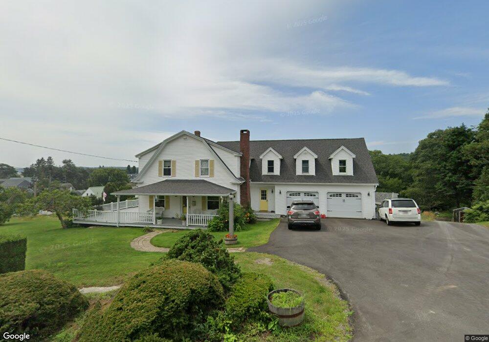
38 Howard St Boothbay Harbor, ME 04538
Estimated Value: $637,947 - $930,000
4
Beds
2
Baths
2,172
Sq Ft
$372/Sq Ft
Est. Value
About This Home
This home is located at 38 Howard St, Boothbay Harbor, ME 04538 and is currently estimated at $808,237, approximately $372 per square foot. 38 Howard St is a home with nearby schools including Boothbay Region Elementary School and Boothbay Region High School.
Ownership History
Date
Name
Owned For
Owner Type
Purchase Details
Closed on
Sep 15, 2023
Sold by
Greenleaf Cleo R
Bought by
Greenleaf Cleo R and Miller Brett R
Current Estimated Value
Purchase Details
Closed on
Jul 13, 2017
Sold by
Howard L Friant Lt and Friant
Bought by
Lafayette Boothbay Inc
Purchase Details
Closed on
Aug 15, 2014
Sold by
Friant George D and Miller-Fiant Stacey A
Bought by
Friant George D and Miller-Friant Stacey A
Home Financials for this Owner
Home Financials are based on the most recent Mortgage that was taken out on this home.
Original Mortgage
$317,900
Interest Rate
4.09%
Mortgage Type
New Conventional
Purchase Details
Closed on
Aug 27, 2012
Sold by
Friant George D and Miller-Friant Stacey A
Bought by
Ellis Joshua S
Create a Home Valuation Report for This Property
The Home Valuation Report is an in-depth analysis detailing your home's value as well as a comparison with similar homes in the area
Home Values in the Area
Average Home Value in this Area
Purchase History
| Date | Buyer | Sale Price | Title Company |
|---|---|---|---|
| Greenleaf Cleo R | -- | None Available | |
| Lafayette Boothbay Inc | -- | -- | |
| Friant George D | -- | -- | |
| Ellis Joshua S | -- | -- |
Source: Public Records
Mortgage History
| Date | Status | Borrower | Loan Amount |
|---|---|---|---|
| Previous Owner | Friant George D | $317,900 |
Source: Public Records
Tax History Compared to Growth
Tax History
| Year | Tax Paid | Tax Assessment Tax Assessment Total Assessment is a certain percentage of the fair market value that is determined by local assessors to be the total taxable value of land and additions on the property. | Land | Improvement |
|---|---|---|---|---|
| 2024 | $4,321 | $457,200 | $176,800 | $280,400 |
| 2023 | $4,092 | $457,200 | $176,800 | $280,400 |
| 2022 | $3,818 | $457,200 | $176,800 | $280,400 |
| 2019 | $2,950 | $246,900 | $90,800 | $156,100 |
| 2018 | $2,864 | $246,900 | $90,800 | $156,100 |
| 2017 | $2,722 | $238,800 | $90,800 | $148,000 |
| 2016 | $2,747 | $245,300 | $90,800 | $154,500 |
| 2014 | $2,603 | $238,800 | $90,800 | $148,000 |
| 2013 | $2,686 | $245,300 | $90,800 | $154,500 |
Source: Public Records
Map
Nearby Homes
- 12 Sea St
- 26 Sea St
- 53 Commercial St
- 34 Townsend Ave
- 27 Townsend Ave
- 66 Townsend Avenue & 43 Oak St
- 43 Oak St
- 37 Townsend Ave
- 66 Townsend Ave
- 31 Bay St
- 74 & 76 Bay St
- 58 Roads End Rd
- 302 Townsend Ave
- 1 Cedar Ln Unit 1
- 3 Cedar Ln Unit 3
- 127 Appalachee Rd
- 17 Cedar Ln Unit 17
- 978 Wiscasset Rd
- 5 Massachusetts Ave
- 98 Meadow Cove Rd