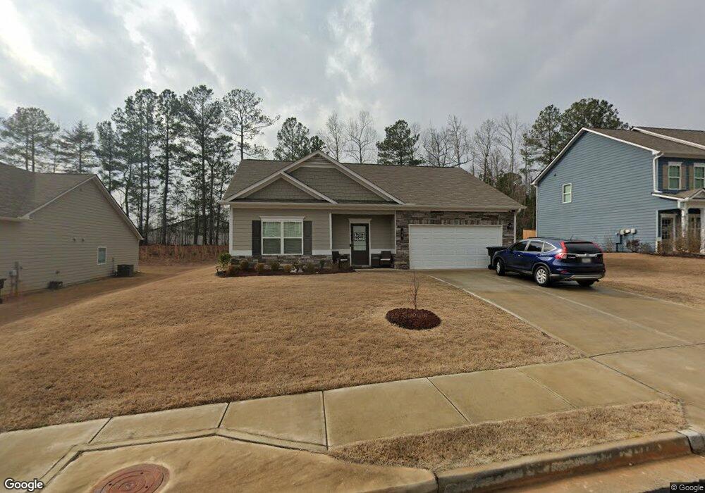
38 Kenneth Dr Dawsonville, GA 30534
Estimated Value: $345,000 - $376,000
--
Bed
--
Bath
1,438
Sq Ft
$250/Sq Ft
Est. Value
About This Home
This home is located at 38 Kenneth Dr, Dawsonville, GA 30534 and is currently estimated at $359,534, approximately $250 per square foot. 38 Kenneth Dr is a home with nearby schools including Robinson Elementary School, Dawson County Junior High School, and Dawson County Middle School.
Ownership History
Date
Name
Owned For
Owner Type
Purchase Details
Closed on
Mar 9, 2021
Sold by
Wells Fargo Bank National Assocation
Bought by
Sdh Atlanta Llc
Current Estimated Value
Home Financials for this Owner
Home Financials are based on the most recent Mortgage that was taken out on this home.
Original Mortgage
$199,384
Interest Rate
2.7%
Mortgage Type
New Conventional
Purchase Details
Closed on
Feb 26, 2021
Sold by
Sdh Atlanta Llc
Bought by
Lackey Kimberly L
Home Financials for this Owner
Home Financials are based on the most recent Mortgage that was taken out on this home.
Original Mortgage
$199,384
Interest Rate
2.7%
Mortgage Type
New Conventional
Create a Home Valuation Report for This Property
The Home Valuation Report is an in-depth analysis detailing your home's value as well as a comparison with similar homes in the area
Home Values in the Area
Average Home Value in this Area
Purchase History
| Date | Buyer | Sale Price | Title Company |
|---|---|---|---|
| Sdh Atlanta Llc | -- | None Available | |
| Lackey Kimberly L | $249,300 | None Available |
Source: Public Records
Mortgage History
| Date | Status | Borrower | Loan Amount |
|---|---|---|---|
| Previous Owner | Lackey Kimberly L | $199,384 |
Source: Public Records
Tax History Compared to Growth
Tax History
| Year | Tax Paid | Tax Assessment Tax Assessment Total Assessment is a certain percentage of the fair market value that is determined by local assessors to be the total taxable value of land and additions on the property. | Land | Improvement |
|---|---|---|---|---|
| 2024 | $2,221 | $132,280 | $24,000 | $108,280 |
| 2023 | $2,151 | $126,680 | $16,000 | $110,680 |
| 2022 | $2,136 | $128,280 | $24,800 | $103,480 |
| 2021 | $931 | $41,160 | $24,800 | $16,360 |
Source: Public Records
Map
Nearby Homes
- 72 Rand Way
- 113 Sandberg Way
- 56 Allen St
- 19 Fausett Ln
- 364 Highway 53 E
- 53 Fausett Ln
- 57 Fausett Ln
- 356 Orange Cir
- 0 Afton #3 Rd
- 87 Thorndale Ln
- 42 Vickie Dr E
- 555 Perimeter Rd
- 0 Dawsonville Unit 10577726
- 0 Highway 53 Unit 10545668
- 0 Highway 53 Unit 10402225
- 0 Highway 53 Unit 7477129
- 653 Highway 9 S
- 270 Shepard Dr
- 28 Reeves Ct
- 54 Kenneth Dr
- 26 Kenneth Dr
- 68 Kenneth Dr
- 10 Kenneth Dr
- 7730 Fireside Farms Dr
- 7750 Fireside Farms Dr
- 7625 Barnwell Ct
- 7760 Fireside Farms Dr
- 7810 Fireside Farms Dr
- 7735 Fireside Farms Dr
- 7710 Magnolia Farm Cir
- 7620 Fireside Farms Dr
- 7625 Barnwell Ct
- 7705 Magnolia Farm Cir
- 7620 Barnwell Ct
- 7545 Fireside Farms Dr
- 7615 Fireside Farms Dr
- 7630 Barnwell Ct
- 7525 Fireside Farms Dr
- 7710 Fireside Farms Dr