
Seller's Agent in 2025
Samita Mandelia
Coldwell Banker Realty - Lexington
(781) 354-6644
2 in this area
28 Total Sales
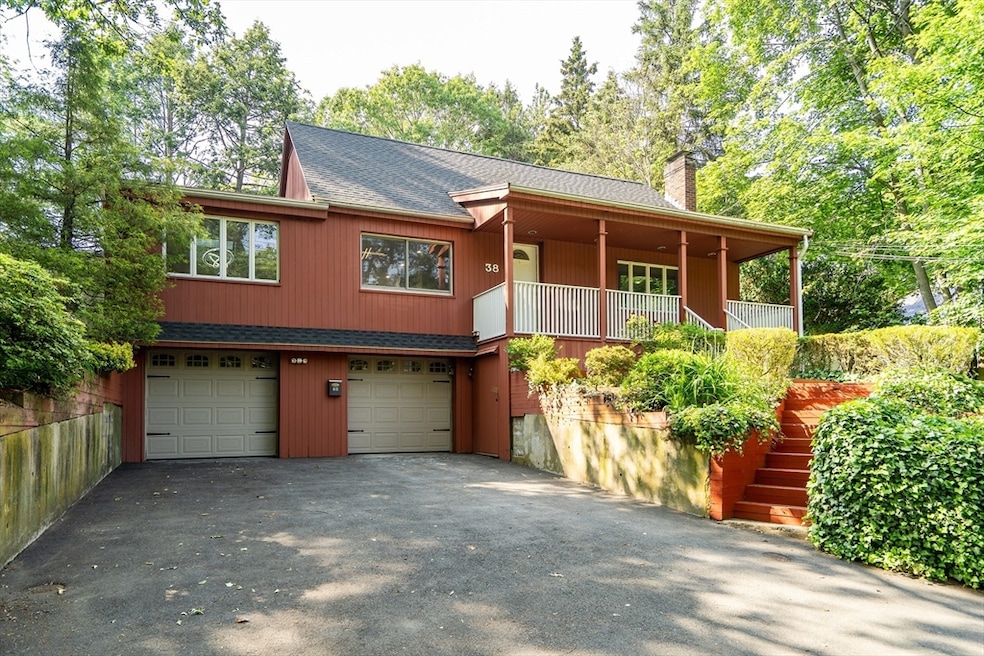
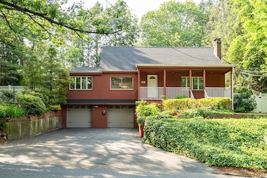
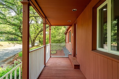
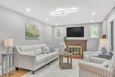
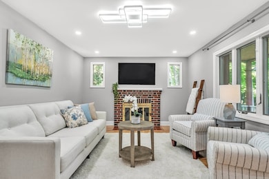
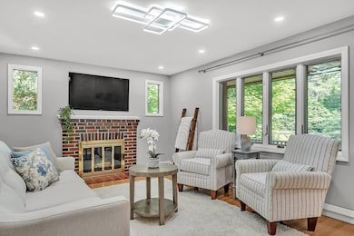
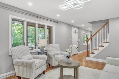
Wow! The one you've been waiting for! This beautifully updated 3-bedroom, 2-bath single-family home is perfectly sited on a 0.29-acre lot and offers the ideal blend of comfort and style. Step inside to a stunning, fully applianced kitchen featuring an oversized quartz island with wine storage, a pot filler, and a cozy breakfast nook. The main level includes a formal living room and a sun-filled family room with a slider leading to a fenced backyard—complete with a patio, firepit, storage shed, and play structure. A bedroom and full bath complete the first floor, while the second level offers two additional bedrooms and another full bath. The finished lower level provides flexible space for a playroom, home office, gym, and laundry. A 2-car garage and ample driveway parking add convenience. Enjoy top-rated schools, easy access to Rt. 2/I-95, and a short walk to Minuteman bike path, the town center, shops, and restaurants. Simply move in and enjoy! Just in time for the new school year!
Last Agent to Sell the Property
Coldwell Banker Realty - Lexington Listed on: 06/05/2025
| Date | Type | Sale Price | Title Company |
|---|---|---|---|
| Quit Claim Deed | $1,288,000 | -- | |
| Deed | $1,288,000 | -- | |
| Deed | $619,000 | -- | |
| Deed | $619,000 | -- | |
| Deed | $619,000 | -- | |
| Deed | $275,000 | -- | |
| Deed | $275,000 | -- |
| Date | Status | Loan Amount | Loan Type |
|---|---|---|---|
| Open | $914,250 | New Conventional | |
| Closed | $914,250 | New Conventional | |
| Previous Owner | $240,000 | No Value Available | |
| Previous Owner | $247,500 | Purchase Money Mortgage |
| Date | Event | Price | List to Sale | Price per Sq Ft |
|---|---|---|---|---|
| 08/11/2025 08/11/25 | Sold | $1,288,000 | -0.3% | $514 / Sq Ft |
| 07/17/2025 07/17/25 | Pending | -- | -- | -- |
| 07/07/2025 07/07/25 | Price Changed | $1,292,000 | -2.1% | $515 / Sq Ft |
| 06/05/2025 06/05/25 | For Sale | $1,320,000 | -- | $526 / Sq Ft |
| Year | Tax Paid | Tax Assessment Tax Assessment Total Assessment is a certain percentage of the fair market value that is determined by local assessors to be the total taxable value of land and additions on the property. | Land | Improvement |
|---|---|---|---|---|
| 2025 | $12,365 | $1,011,000 | $614,000 | $397,000 |
| 2024 | $11,589 | $946,000 | $584,000 | $362,000 |
| 2023 | $11,193 | $861,000 | $531,000 | $330,000 |
| 2022 | $10,736 | $778,000 | $483,000 | $295,000 |
| 2021 | $10,721 | $745,000 | $460,000 | $285,000 |
| 2020 | $10,467 | $745,000 | $460,000 | $285,000 |
| 2019 | $9,969 | $706,000 | $438,000 | $268,000 |
| 2018 | $9,409 | $658,000 | $417,000 | $241,000 |
| 2017 | $9,491 | $655,000 | $397,000 | $258,000 |
| 2016 | $8,891 | $609,000 | $374,000 | $235,000 |
| 2015 | $8,738 | $588,000 | $340,000 | $248,000 |
| 2014 | $8,313 | $536,000 | $309,000 | $227,000 |
Seller's Agent in 2025
Samita Mandelia
Coldwell Banker Realty - Lexington
(781) 354-6644
2 in this area
28 Total Sales
A
Buyer's Agent in 2025
Andria Pintabone
Amo Realty - Boston City Properties
1 in this area
8 Total Sales
Source: MLS Property Information Network (MLS PIN)
MLS Number: 73386758
APN: LEXI-000030-000000-000005A
Disclaimer: Certain information contained herein is derived from information provided by parties other than Homes.com. All information provided is deemed reliable, but is not guaranteed to be accurate and should be independently verified.
![]() The property listing data and information, or the Images, set forth herein were provided to MLS Property Information Network, Inc. from third party sources, including sellers, lessors and public records, and were compiled by MLS Property Information Network, Inc. The property listing data and information, and the Images, are for the personal, non-commercial use of consumers having a good faith interest in purchasing or leasing listed properties of the type displayed to them and may not be used for any purpose other than to identify prospective properties which such consumers may have a good faith interest in purchasing or leasing. MLS Property Information Network, Inc. and its subscribers disclaim any and all representations and warranties as to the accuracy of the property listing data and information, or as to the accuracy of any of the Images, set forth herein.
The property listing data and information, or the Images, set forth herein were provided to MLS Property Information Network, Inc. from third party sources, including sellers, lessors and public records, and were compiled by MLS Property Information Network, Inc. The property listing data and information, and the Images, are for the personal, non-commercial use of consumers having a good faith interest in purchasing or leasing listed properties of the type displayed to them and may not be used for any purpose other than to identify prospective properties which such consumers may have a good faith interest in purchasing or leasing. MLS Property Information Network, Inc. and its subscribers disclaim any and all representations and warranties as to the accuracy of the property listing data and information, or as to the accuracy of any of the Images, set forth herein.
Ask me questions while you tour the home.