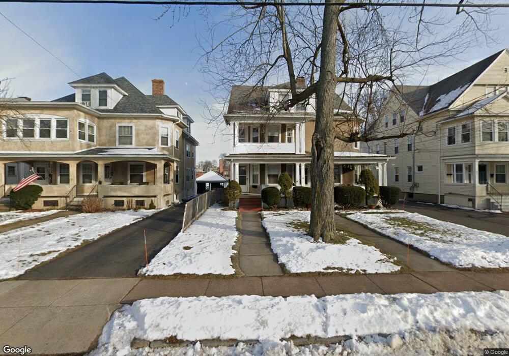
38 Maplewood Ave West Hartford, CT 06119
Estimated Value: $600,000 - $752,239
8
Beds
7
Baths
4,233
Sq Ft
$159/Sq Ft
Est. Value
About This Home
This home is located at 38 Maplewood Ave, West Hartford, CT 06119 and is currently estimated at $672,310, approximately $158 per square foot. 38 Maplewood Ave is a home located in Hartford County with nearby schools including Whiting Lane School, King Philip Middle School, and Hall High School.
Ownership History
Date
Name
Owned For
Owner Type
Purchase Details
Closed on
Sep 16, 2024
Sold by
Patterson Scott
Bought by
Patterson Prop 38-40 Mapl
Current Estimated Value
Home Financials for this Owner
Home Financials are based on the most recent Mortgage that was taken out on this home.
Original Mortgage
$450,000
Outstanding Balance
$445,186
Interest Rate
6.73%
Mortgage Type
Purchase Money Mortgage
Estimated Equity
$227,124
Create a Home Valuation Report for This Property
The Home Valuation Report is an in-depth analysis detailing your home's value as well as a comparison with similar homes in the area
Home Values in the Area
Average Home Value in this Area
Purchase History
| Date | Buyer | Sale Price | Title Company |
|---|---|---|---|
| Patterson Prop 38-40 Mapl | -- | None Available | |
| Patterson Scott | $600,000 | None Available |
Source: Public Records
Mortgage History
| Date | Status | Borrower | Loan Amount |
|---|---|---|---|
| Open | Patterson Scott | $450,000 |
Source: Public Records
Tax History Compared to Growth
Tax History
| Year | Tax Paid | Tax Assessment Tax Assessment Total Assessment is a certain percentage of the fair market value that is determined by local assessors to be the total taxable value of land and additions on the property. | Land | Improvement |
|---|---|---|---|---|
| 2025 | $15,729 | $351,260 | $84,910 | $266,350 |
| 2024 | $13,841 | $326,830 | $84,910 | $241,920 |
| 2023 | $13,374 | $326,830 | $84,910 | $241,920 |
| 2022 | $13,295 | $326,830 | $84,910 | $241,920 |
| 2021 | $13,627 | $321,230 | $83,580 | $237,650 |
| 2020 | $12,766 | $305,410 | $71,680 | $233,730 |
| 2019 | $12,766 | $305,410 | $71,680 | $233,730 |
| 2018 | $12,522 | $305,410 | $71,680 | $233,730 |
| 2017 | $12,534 | $305,410 | $71,680 | $233,730 |
| 2016 | $10,172 | $257,460 | $66,920 | $190,540 |
| 2015 | $9,863 | $257,460 | $66,920 | $190,540 |
| 2014 | $9,621 | $257,460 | $66,920 | $190,540 |
Source: Public Records
Map
Nearby Homes
- 53 Quaker Ln S
- 16 Lilley Rd
- 13 Walkley Rd
- 40 Garden Ln
- 4 Frederick Rd
- 6 W Hill Dr
- 10 Farnham Rd
- 12 Farnham Rd
- 8 Lexington Rd
- 18 Robin Rd Unit 1
- 9 Concord St Unit B1
- 51 Bretton Rd
- 209 Warrenton Ave
- 31 Robin Rd Unit 102
- 120 Ardmore Rd
- 23 Price Blvd
- 889 Farmington Ave Unit 4E
- 24 Troy St
- 237 Fern St Unit 314
- 97 Robin Rd
- 34 Maplewood Ave
- 34 Maplewood Ave Unit 3rd Floor
- 36 Maplewood Ave
- 00 Confidential Ave
- 100 Confidentail Business
- 30 Maplewood Ave
- 46 Maplewood Ave
- 92 Maplewood Ave
- 26 Maplewood Ave
- 50 Maplewood Ave
- 39 Maplewood Ave
- 37 Maplewood Ave
- 37 Maplewood Ave Unit 3
- 22 Maplewood Ave
- 54 Maplewood Ave
- 24 Maplewood Ave
- 33 Maplewood Ave
- 41 Maplewood Ave
- 29 Maplewood Ave
- 29 Maplewood Ave Unit 3