Estimated Value: $237,000 - $277,000
About This Home
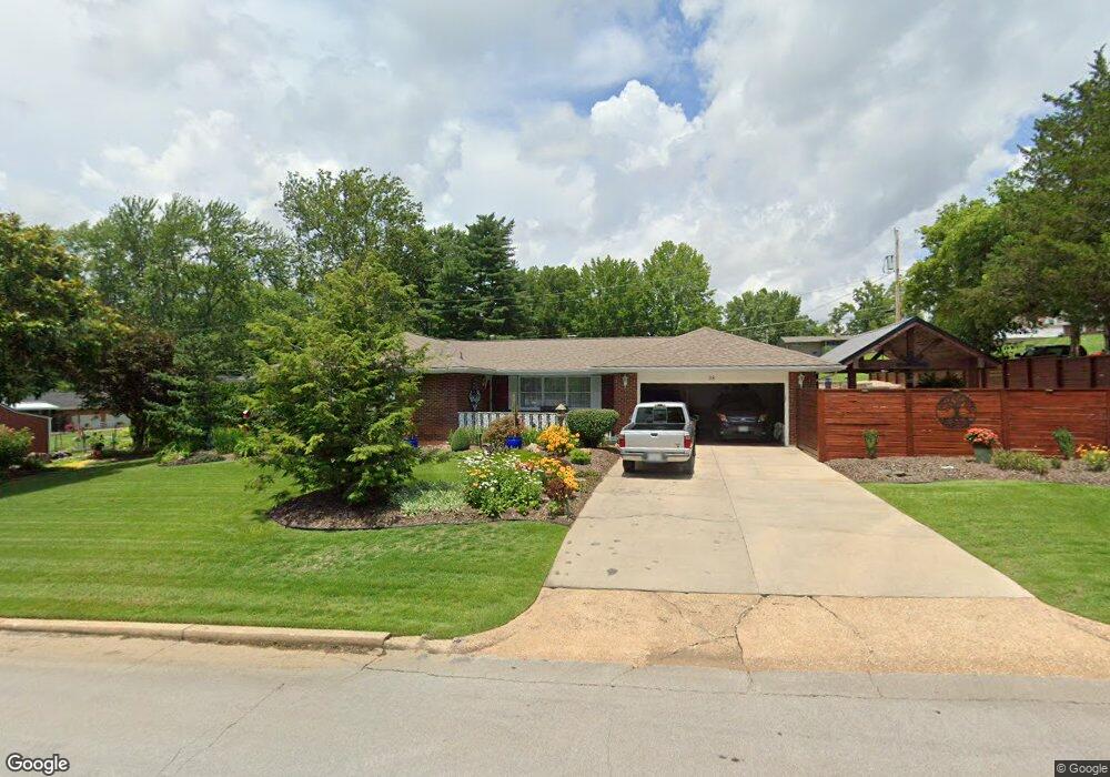
This home is located at 38 Mcfarland Dr, Rolla, MO 65401 and is currently estimated at $260,433, approximately $148 per square foot. 38 Mcfarland Dr is a home located in Phelps County with nearby schools including Rolla Junior High School, Rolla Senior High School, and Rolla Seventh-Day Adventist School.
Ownership History
We collect this data history from publicly available records. To have your information removed, we recommend requesting removal directly through your county’s website.
Purchase Details
Purchase Details
Purchase Details
Purchase Details
Purchase Details
Purchase Details
Purchase Details
Purchase Details
Purchase Details
Home Values in the Area
Average Home Value in this Area
Purchase History
We collect this data history from publicly available records. To have your information removed, we recommend requesting removal directly through your county’s website.
| Date | Buyer | Sale Price | Title Company |
|---|---|---|---|
| -- | -- | ||
| -- | -- | ||
| -- | -- | ||
| -- | -- | ||
| -- | -- | ||
| -- | -- | ||
| -- | -- | ||
| -- | -- | ||
| -- | -- |
Tax History
We collect this data history from publicly available records. To have your information removed, we recommend requesting removal directly through your county’s website.
| Year | Tax Paid | Tax Assessment Tax Assessment Total Assessment is a certain percentage of the fair market value that is determined by local assessors to be the total taxable value of land and additions on the property. | Land | Improvement |
|---|---|---|---|---|
| 2025 | $1,842 | $35,290 | $3,850 | $31,440 |
| 2024 | $1,690 | $31,430 | $2,850 | $28,580 |
| 2023 | $1,700 | $31,430 | $2,850 | $28,580 |
| 2022 | $1,444 | $31,430 | $2,850 | $28,580 |
| 2021 | $1,454 | $31,430 | $2,850 | $28,580 |
| 2020 | $1,313 | $27,700 | $2,850 | $24,850 |
| 2019 | $1,306 | $27,700 | $2,850 | $24,850 |
| 2018 | $1,294 | $27,700 | $2,850 | $24,850 |
| 2017 | $1,292 | $27,700 | $2,850 | $24,850 |
| 2016 | $1,250 | $27,700 | $2,850 | $24,850 |
| 2015 | -- | $27,700 | $2,850 | $24,850 |
| 2014 | -- | $27,700 | $2,850 | $24,850 |
| 2013 | -- | $27,700 | $0 | $0 |
Map
- 32 Sydney Ct
- 1344 E State Route 72
- 1112 Sycamore Dr
- 1108 Mimosa Ct
- 905 Hampton Ct
- Lot 74 B Cedar Hill Ct
- Lot 74 A Cedar Hill Ct
- 905 Cypress Dr
- 621 Scottsvale Dr
- 622 Scottsvale Dr
- 1702 & 1708 E Hwy 72
- 1011 Carriage Ln
- 606 Norwich Dr
- 8 Peachtree Ln
- 1331 Highway O
- 18119 State Route O
- 15098 State Route O
- 822 Oak Knoll Rd
- 687 Salem Ave
- 1599 E State Route 72
- 10 Mcfarland Dr
- 1213 Devonshire Ln
- 11 Mcfarland Dr
- 9 Mcfarland Dr
- 1209 Devonshire Ln
- 39 Mcfarland Dr
- 0 Devonshire Ln
- 1207 Devonshire Ln
- 41 Mcfarland Dr
- 1210 Devonshire Ln
- 12 Mcfarland Dr
- 8 Mcfarland Dr
- 1205 Devonshire Ln
- 1208 Devonshire Ln
- 33 Sydney Ct
- 35 Sydney Ct
- 1206 Devonshire Ln
- 1205 Stratford Ln
- 1207 Stratford Ln
- 37 Mcfarland Dr
Ask me questions while you tour the home.