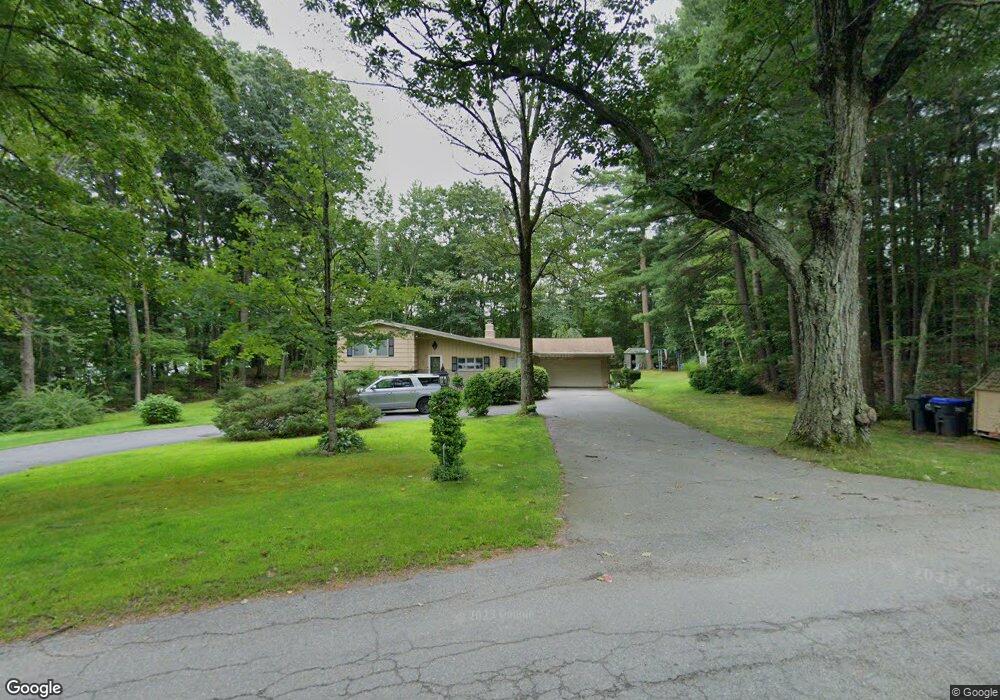
38 Mill Rd Boylston, MA 01505
Estimated Value: $463,000 - $614,000
3
Beds
3
Baths
1,410
Sq Ft
$362/Sq Ft
Est. Value
About This Home
This home is located at 38 Mill Rd, Boylston, MA 01505 and is currently estimated at $510,864, approximately $362 per square foot. 38 Mill Rd is a home located in Worcester County with nearby schools including Tahanto Regional High School, St Mary Elementary School, and Central New England Christian Academy.
Ownership History
Date
Name
Owned For
Owner Type
Purchase Details
Closed on
Sep 1, 2021
Sold by
Gothing Gary R and Gothing Jacqueline
Bought by
Gothing Lt
Current Estimated Value
Purchase Details
Closed on
Nov 29, 1994
Sold by
Markarian George
Bought by
Gothing Gary and Gothing Jacqueline
Home Financials for this Owner
Home Financials are based on the most recent Mortgage that was taken out on this home.
Original Mortgage
$100,000
Interest Rate
8.91%
Mortgage Type
Purchase Money Mortgage
Create a Home Valuation Report for This Property
The Home Valuation Report is an in-depth analysis detailing your home's value as well as a comparison with similar homes in the area
Home Values in the Area
Average Home Value in this Area
Purchase History
| Date | Buyer | Sale Price | Title Company |
|---|---|---|---|
| Gothing Lt | -- | None Available | |
| Gothing Lt | -- | None Available | |
| Gothing Gary | $145,000 | -- |
Source: Public Records
Mortgage History
| Date | Status | Borrower | Loan Amount |
|---|---|---|---|
| Previous Owner | Gothing Gary | $19,200 | |
| Previous Owner | Gothing Gary | $100,000 | |
| Previous Owner | Gothing Gary | $15,000 |
Source: Public Records
Tax History
| Year | Tax Paid | Tax Assessment Tax Assessment Total Assessment is a certain percentage of the fair market value that is determined by local assessors to be the total taxable value of land and additions on the property. | Land | Improvement |
|---|---|---|---|---|
| 2025 | $5,260 | $380,300 | $167,100 | $213,200 |
| 2024 | $4,216 | $305,300 | $157,900 | $147,400 |
| 2023 | $4,396 | $305,300 | $157,900 | $147,400 |
| 2022 | $4,836 | $305,300 | $157,900 | $147,400 |
| 2021 | $4,855 | $285,900 | $157,900 | $128,000 |
| 2020 | $4,259 | $257,500 | $135,900 | $121,600 |
| 2019 | $3,986 | $248,500 | $133,100 | $115,400 |
| 2018 | $4,067 | $243,100 | $133,100 | $110,000 |
| 2017 | $3,616 | $224,300 | $114,300 | $110,000 |
| 2016 | $4,001 | $244,400 | $108,600 | $135,800 |
| 2015 | $4,255 | $244,400 | $108,600 | $135,800 |
| 2014 | $3,942 | $226,700 | $97,300 | $129,400 |
Source: Public Records
Map
Nearby Homes
- 4 Poe Ave Unit 1
- 28 Sewall St
- 5 Barnard Hill Rd
- 5 Ridge Rd
- 39 Cypress Ave
- 80 Compass Cir
- 291 Sewall St Unit 291
- 289 Sewall St Unit 289
- 9 Conifer Cir Unit 26
- 58 Conifer Cir Unit 24
- 56 Conifer Cir Unit 23
- 281 Sewall St Unit 281
- 279 Sewall St Unit 279
- 280 Sewall St
- 24 Shirley Ln
- 22 Shirley Ln
- 79 Humes Ave
- 63 Cobblestone Ln Unit 63
- 31 Enaya Cir Unit 31
- 2 Clover Glen Cir
- 35 Mill Rd
- 6 Poe Ave
- 41 Mill Rd
- 31 Mill Rd
- 12 Nicholas Ave
- 14 Nicholas Ave Unit 14
- 12 Nicholas Ave Unit 12
- 12 Nicholas Ave Unit 12 - A
- 14 Nicholas Ave Unit 14 - B
- 29 Mill Rd
- 16 Nicholas Ave
- 34 Mill Rd
- 1 Heywood St
- 21 Ledgewood Dr
- 13 Nicholas Ave
- 55 Mill Rd
- 17 Ledgewood Dr
- 18 Nicholas Ave
- 58 Mill Rd
- 27 Mill Rd
Your Personal Tour Guide
Ask me questions while you tour the home.