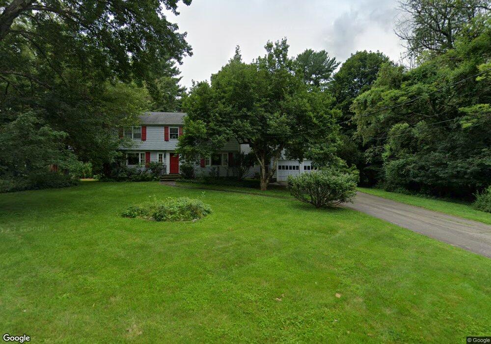
38 Morningside Ln Lincoln, MA 01773
Estimated Value: $1,215,354 - $1,605,000
4
Beds
3
Baths
2,688
Sq Ft
$501/Sq Ft
Est. Value
About This Home
This home is located at 38 Morningside Ln, Lincoln, MA 01773 and is currently estimated at $1,346,339, approximately $500 per square foot. 38 Morningside Ln is a home located in Middlesex County with nearby schools including Lincoln-Sudbury Regional High School, Tremont School, and Concord Academy.
Ownership History
Date
Name
Owned For
Owner Type
Purchase Details
Closed on
Jun 25, 1992
Sold by
Martini William F and Martini Virginia J
Bought by
Servi Leslie D and Haimo Varda T
Current Estimated Value
Home Financials for this Owner
Home Financials are based on the most recent Mortgage that was taken out on this home.
Original Mortgage
$100,000
Interest Rate
8.57%
Mortgage Type
Purchase Money Mortgage
Create a Home Valuation Report for This Property
The Home Valuation Report is an in-depth analysis detailing your home's value as well as a comparison with similar homes in the area
Home Values in the Area
Average Home Value in this Area
Purchase History
| Date | Buyer | Sale Price | Title Company |
|---|---|---|---|
| Servi Leslie D | $370,000 | -- |
Source: Public Records
Mortgage History
| Date | Status | Borrower | Loan Amount |
|---|---|---|---|
| Closed | Servi Leslie D | $100,000 |
Source: Public Records
Tax History Compared to Growth
Tax History
| Year | Tax Paid | Tax Assessment Tax Assessment Total Assessment is a certain percentage of the fair market value that is determined by local assessors to be the total taxable value of land and additions on the property. | Land | Improvement |
|---|---|---|---|---|
| 2025 | $124 | $969,000 | $688,300 | $280,700 |
| 2024 | $12,266 | $951,600 | $674,800 | $276,800 |
| 2023 | $12,476 | $896,300 | $621,500 | $274,800 |
| 2022 | $12,205 | $817,500 | $561,800 | $255,700 |
| 2021 | $42,405 | $736,700 | $497,200 | $239,500 |
| 2020 | $43,019 | $734,700 | $497,200 | $237,500 |
| 2019 | $41,743 | $707,000 | $481,600 | $225,400 |
| 2018 | $9,615 | $707,000 | $481,600 | $225,400 |
| 2017 | $41,507 | $673,900 | $454,600 | $219,300 |
| 2016 | $9,183 | $656,400 | $441,100 | $215,300 |
| 2015 | $8,797 | $621,700 | $408,400 | $213,300 |
| 2014 | $8,140 | $564,900 | $365,800 | $199,100 |
Source: Public Records
Map
Nearby Homes
- 16 Old Cambridge Turnpike
- 22 Old Cambridge Turnpike
- 29 S Commons Unit D
- 5 South Commons Unit D
- 36 Indian Camp Ln Unit D
- 241 Shadyside Ave
- 9 Garland Rd
- 646 Cambridge Turnpike
- 10 Reiling Pond Rd
- 84 Davison Dr
- 22 Lincoln Rd
- 69 Page Rd
- 60 Baker Bridge Rd
- 16 Hatch Farm Ln
- 10 Hatch Farm Ln
- 28 Hatch Farm Ln
- 44 Baker Bridge Rd
- 96 Independence Rd
- 8 Stratford Way
- 140 Revolutionary Rd
- 40 Morningside Ln
- 2 Sunnyside Ln
- 34 Morningside Ln
- 41 Morningside Ln
- 39 Morningside Ln
- 31 Morningside Ln
- 30 Morningside Ln
- 30 Morningside Ln
- 8 Sunnyside Ln
- 27 Morningside Ln
- 7 Sunnyside Ln
- 26 Morningside Ln
- 26 Morningside Ln Unit 1
- 25 Morningside Ln
- 11 Sunnyside Ln
- 20 Morningside Ln
- 23 Morningside Ln
- 16 Sunnyside Ln
- 14 Morningside Ln
- 10 Brooks Hill Rd