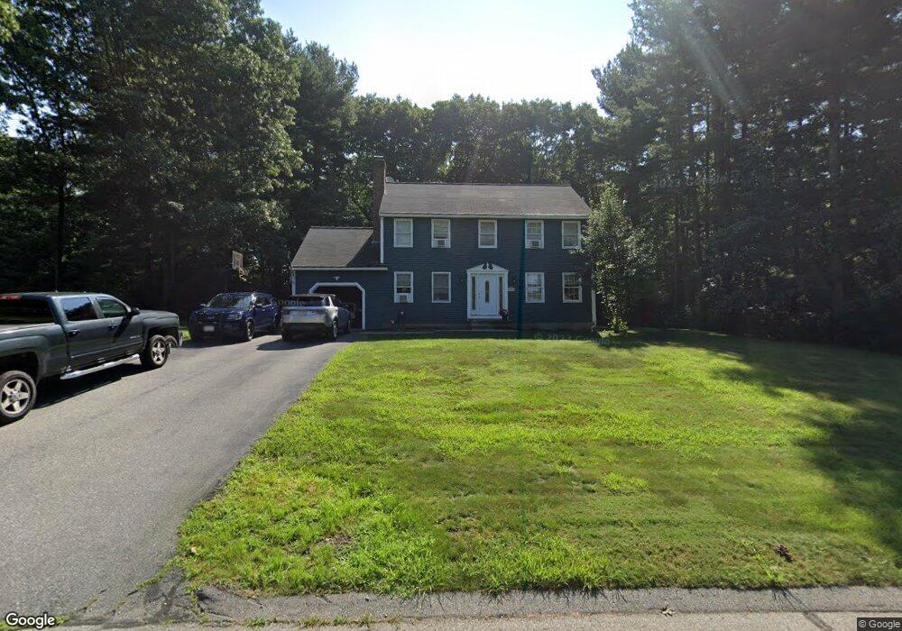
38 Nicole Ave Northbridge, MA 01534
Estimated Value: $563,000 - $631,000
3
Beds
3
Baths
1,536
Sq Ft
$385/Sq Ft
Est. Value
About This Home
This home is located at 38 Nicole Ave, Northbridge, MA 01534 and is currently estimated at $591,705, approximately $385 per square foot. 38 Nicole Ave is a home located in Worcester County with nearby schools including Northbridge Elementary School, Northbridge Middle School, and Northbridge High School.
Ownership History
Date
Name
Owned For
Owner Type
Purchase Details
Closed on
Aug 23, 2001
Sold by
Prapuolenis Thomas O
Bought by
Lavallee Brian F and Lavallee Lisa M
Current Estimated Value
Purchase Details
Closed on
Oct 22, 1999
Sold by
Robbins Orrin R and Robbins Julie M
Bought by
Lavallee Brian F and Divris Lisa M
Purchase Details
Closed on
Jun 24, 1999
Sold by
Saunders John M and Saunders Sandra V
Bought by
Prapuolenis Thomas
Purchase Details
Closed on
May 3, 1995
Sold by
Heritage Park Dev Corp
Bought by
Saunders John M and Saunders Sandra
Create a Home Valuation Report for This Property
The Home Valuation Report is an in-depth analysis detailing your home's value as well as a comparison with similar homes in the area
Home Values in the Area
Average Home Value in this Area
Purchase History
| Date | Buyer | Sale Price | Title Company |
|---|---|---|---|
| Lavallee Brian F | $265,000 | -- | |
| Lavallee Brian F | $265,000 | -- | |
| Lavallee Brian F | $152,500 | -- | |
| Lavallee Brian F | $152,500 | -- | |
| Prapuolenis Thomas | $199,900 | -- | |
| Prapuolenis Thomas | $199,900 | -- | |
| Saunders John M | $159,965 | -- | |
| Saunders John M | $159,965 | -- |
Source: Public Records
Mortgage History
| Date | Status | Borrower | Loan Amount |
|---|---|---|---|
| Open | Saunders John M | $247,000 | |
| Closed | Saunders John M | $20,000 |
Source: Public Records
Tax History Compared to Growth
Tax History
| Year | Tax Paid | Tax Assessment Tax Assessment Total Assessment is a certain percentage of the fair market value that is determined by local assessors to be the total taxable value of land and additions on the property. | Land | Improvement |
|---|---|---|---|---|
| 2025 | $5,811 | $492,900 | $182,500 | $310,400 |
| 2024 | $5,642 | $466,700 | $182,500 | $284,200 |
| 2023 | $5,499 | $424,300 | $167,300 | $257,000 |
| 2022 | $5,012 | $364,000 | $128,700 | $235,300 |
| 2021 | $4,795 | $330,900 | $122,400 | $208,500 |
| 2020 | $4,455 | $321,900 | $122,400 | $199,500 |
| 2019 | $4,030 | $310,700 | $122,400 | $188,300 |
| 2018 | $3,857 | $298,100 | $116,500 | $181,600 |
| 2017 | $3,851 | $284,600 | $116,500 | $168,100 |
| 2016 | $3,732 | $271,400 | $105,900 | $165,500 |
| 2015 | $3,631 | $271,400 | $105,900 | $165,500 |
| 2014 | $3,599 | $271,400 | $105,900 | $165,500 |
Source: Public Records
Map
Nearby Homes
- 1076 Hill St
- 151 Fowler Rd
- 150 Sprague St
- 2767 Providence Rd
- 86 Mikes Way Unit 86
- 84 Mikes Way Unit 84
- 7 Central Turnpike
- 135 Windstone Dr
- 12 Central Turnpike
- 395 Providence Rd Unit 4
- 79-81 Upton St
- 19 Milford Rd
- 119 Susanne Dr
- 191 Hartness Rd
- 86 Kingsnorth St
- 51 Lincoln Rd
- 1880 Providence Rd
- 20 Wunschel Dr
- 42 Shining Rock Dr
- 192 Rebecca Rd