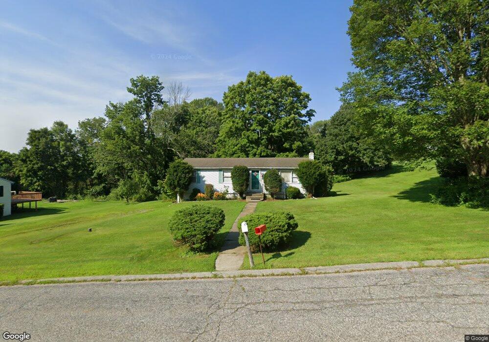
38 Polly Ave Danielson, CT 06239
Estimated Value: $300,000 - $368,000
3
Beds
1
Bath
1,012
Sq Ft
$317/Sq Ft
Est. Value
About This Home
This home is located at 38 Polly Ave, Danielson, CT 06239 and is currently estimated at $320,940, approximately $317 per square foot. 38 Polly Ave is a home located in Windham County with nearby schools including Killingly Central School, Killingly Memorial School, and Killingly Intermediate School.
Ownership History
Date
Name
Owned For
Owner Type
Purchase Details
Closed on
Oct 7, 2004
Sold by
Jones Joyce C and Jones Harold E
Bought by
Farley James and Farley Maureen A
Current Estimated Value
Purchase Details
Closed on
Nov 16, 1994
Sold by
Waterman Lori A
Bought by
Jones Harold E and Jones Joyce
Home Financials for this Owner
Home Financials are based on the most recent Mortgage that was taken out on this home.
Original Mortgage
$85,000
Interest Rate
8%
Mortgage Type
Unknown
Purchase Details
Closed on
Jun 12, 1992
Sold by
Lomas Mtg Usa Inc
Bought by
Lowe Lori
Home Financials for this Owner
Home Financials are based on the most recent Mortgage that was taken out on this home.
Original Mortgage
$75,950
Interest Rate
8.79%
Mortgage Type
Unknown
Create a Home Valuation Report for This Property
The Home Valuation Report is an in-depth analysis detailing your home's value as well as a comparison with similar homes in the area
Home Values in the Area
Average Home Value in this Area
Purchase History
| Date | Buyer | Sale Price | Title Company |
|---|---|---|---|
| Farley James | $155,000 | -- | |
| Farley James V | $155,000 | -- | |
| Jones Harold E | $85,000 | -- | |
| Jones Harold E | $85,000 | -- | |
| Lowe Lori | $75,500 | -- | |
| Lowe Lori | $75,500 | -- |
Source: Public Records
Mortgage History
| Date | Status | Borrower | Loan Amount |
|---|---|---|---|
| Previous Owner | Lowe Lori | $85,000 | |
| Previous Owner | Lowe Lori | $75,950 |
Source: Public Records
Tax History Compared to Growth
Tax History
| Year | Tax Paid | Tax Assessment Tax Assessment Total Assessment is a certain percentage of the fair market value that is determined by local assessors to be the total taxable value of land and additions on the property. | Land | Improvement |
|---|---|---|---|---|
| 2025 | $3,094 | $133,130 | $30,210 | $102,920 |
| 2024 | $2,944 | $133,130 | $30,210 | $102,920 |
| 2023 | $2,979 | $102,480 | $26,040 | $76,440 |
| 2022 | $2,801 | $102,480 | $26,040 | $76,440 |
| 2021 | $2,792 | $102,480 | $26,040 | $76,440 |
| 2020 | $2,740 | $102,480 | $26,040 | $76,440 |
| 2019 | $2,783 | $102,480 | $26,040 | $76,440 |
| 2017 | $2,329 | $81,130 | $20,510 | $60,620 |
| 2016 | $2,329 | $81,130 | $20,510 | $60,620 |
| 2015 | $2,329 | $81,130 | $20,510 | $60,620 |
| 2014 | $2,264 | $81,130 | $20,510 | $60,620 |
Source: Public Records
Map
Nearby Homes
- 612 Cook Hill Rd
- 175 Mashentuck Rd
- 85 Mashentuck Rd
- 330 Cook Hill Rd
- 64 Westcott Rd
- 365 Cranberry Bog Rd
- 9 Colleen St
- 69 Peckham Ln
- 513 Lhomme Street Extension
- 395 Bailey Hill Rd
- 409 Main St
- 300 Valley Rd
- 498 Bailey Hill Rd
- 17 Hillside Terrace
- 61 Deerwood Dr
- 65 Stone St
- 860 N Main St
- 16 James St
- 140 Woodward St
- 102 Cottage St
- 32 Polly Ave
- 44 Polly Ave
- 128 Lafantasie Rd
- 37 Polly Ave
- 43 Polly Ave
- 26 Polly Ave
- 107 Lafantasie Rd
- 136 Lafantasie Rd
- 31 Polly Ave
- 100 Lafantasie Rd
- 25 Polly Ave
- 5 Nauset Ave
- 125 Lafantasie Rd
- 6 Nauset Ave
- 11 Nauset Ave
- 97 Lafantasie Rd
- 14 Polly Ave
- 88 Lafantasie Rd
- 13 Polly Ave
- 999999 Lafantasie Rd