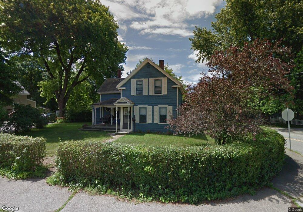
38 Railroad Ave Norwood, MA 02062
Norwood Centre NeighborhoodEstimated Value: $619,000 - $667,000
3
Beds
1
Bath
1,200
Sq Ft
$534/Sq Ft
Est. Value
About This Home
This home is located at 38 Railroad Ave, Norwood, MA 02062 and is currently estimated at $641,372, approximately $534 per square foot. 38 Railroad Ave is a home located in Norfolk County with nearby schools including Norwood High School, St Catherine Of Siena School, and Norwood Montessori School.
Ownership History
Date
Name
Owned For
Owner Type
Purchase Details
Closed on
Nov 21, 1997
Sold by
Cayer Michael J and Cayer Julie A
Bought by
Richard Susan E
Current Estimated Value
Home Financials for this Owner
Home Financials are based on the most recent Mortgage that was taken out on this home.
Original Mortgage
$124,800
Interest Rate
7.17%
Mortgage Type
Purchase Money Mortgage
Create a Home Valuation Report for This Property
The Home Valuation Report is an in-depth analysis detailing your home's value as well as a comparison with similar homes in the area
Home Values in the Area
Average Home Value in this Area
Purchase History
| Date | Buyer | Sale Price | Title Company |
|---|---|---|---|
| Richard Susan E | $156,000 | -- |
Source: Public Records
Mortgage History
| Date | Status | Borrower | Loan Amount |
|---|---|---|---|
| Open | Richard Susan E | $120,000 | |
| Closed | Richard Susan E | $124,800 | |
| Previous Owner | Richard Susan E | $131,250 | |
| Previous Owner | Richard Susan E | $121,500 |
Source: Public Records
Tax History Compared to Growth
Tax History
| Year | Tax Paid | Tax Assessment Tax Assessment Total Assessment is a certain percentage of the fair market value that is determined by local assessors to be the total taxable value of land and additions on the property. | Land | Improvement |
|---|---|---|---|---|
| 2025 | $54 | $514,400 | $262,600 | $251,800 |
| 2024 | $5,263 | $502,700 | $262,600 | $240,100 |
| 2023 | $4,834 | $468,400 | $228,300 | $240,100 |
| 2022 | $4,693 | $436,600 | $207,600 | $229,000 |
| 2021 | $4,433 | $390,900 | $200,000 | $190,900 |
| 2020 | $4,225 | $378,900 | $200,000 | $178,900 |
| 2019 | $3,895 | $357,700 | $190,500 | $167,200 |
| 2018 | $3,866 | $348,600 | $181,400 | $167,200 |
| 2017 | $3,620 | $324,700 | $181,400 | $143,300 |
| 2016 | $3,393 | $305,100 | $181,400 | $123,700 |
| 2015 | $3,404 | $296,800 | $173,200 | $123,600 |
| 2014 | $3,263 | $281,800 | $157,100 | $124,700 |
Source: Public Records
Map
Nearby Homes
- 49 Railroad Ave
- 1 Lenox St Unit 312
- 1 Lenox St Unit 115
- 68-70 Adams St
- 232 Rock St
- 301 Neponset St Unit 17
- 301 Neponset St Unit 25
- 232-234 Nahatan St
- 253 Nahatan St Unit 11
- 28 Shaw St
- 21 Walpole St
- 105 E Cross St
- 785 Washington St Unit 206
- 785 Washington St Unit 207
- 365 Washington St Unit 4
- 11 Beacon Park Rd
- 19-21
- 85 Casey St
- 42 Myrtle St
- 22 Hillside Ave
- 30 Railroad Ave
- 12 Monroe St
- 11 Monroe St
- 46 Railroad Ave
- 16 Monroe St
- 29 Railroad Ave
- 24 Railroad Ave
- 37 Railroad Ave
- 41 Railroad Ave
- 20 Monroe St
- 8 Monroe St E
- 19 Monroe St
- 23 Railroad Ave
- 31 Railroad Ave
- 12 Monroe St E
- 12 Monroe St E
- 20 Railroad Ave
- 52 Railroad Ave
- 52 Railroad Ave Unit 52
- 54 Railroad Ave Unit 2