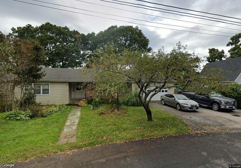
38 Riverbend Dr Mystic, CT 06355
Old Mystic NeighborhoodEstimated Value: $815,177 - $1,033,000
3
Beds
3
Baths
1,826
Sq Ft
$504/Sq Ft
Est. Value
About This Home
This home is located at 38 Riverbend Dr, Mystic, CT 06355 and is currently estimated at $920,044, approximately $503 per square foot. 38 Riverbend Dr is a home with nearby schools including Stonington Middle School and Stonington High School.
Ownership History
Date
Name
Owned For
Owner Type
Purchase Details
Closed on
Nov 9, 2007
Sold by
Burnside Steven E
Bought by
Scott Kenneth E and Scott Jayne F
Current Estimated Value
Purchase Details
Closed on
Apr 9, 2007
Sold by
Burnside 3Rd Robert Hall and Burnside Joyce L
Bought by
Burnside Steven E
Create a Home Valuation Report for This Property
The Home Valuation Report is an in-depth analysis detailing your home's value as well as a comparison with similar homes in the area
Home Values in the Area
Average Home Value in this Area
Purchase History
| Date | Buyer | Sale Price | Title Company |
|---|---|---|---|
| Scott Kenneth E | $585,000 | -- | |
| Scott Kenneth E | $585,000 | -- | |
| Burnside Steven E | $750,000 | -- | |
| Burnside Steven E | $750,000 | -- |
Source: Public Records
Mortgage History
| Date | Status | Borrower | Loan Amount |
|---|---|---|---|
| Open | Burnside Steven E | $156,300 | |
| Closed | Burnside Steven E | $340,000 |
Source: Public Records
Tax History Compared to Growth
Tax History
| Year | Tax Paid | Tax Assessment Tax Assessment Total Assessment is a certain percentage of the fair market value that is determined by local assessors to be the total taxable value of land and additions on the property. | Land | Improvement |
|---|---|---|---|---|
| 2025 | $10,050 | $486,000 | $285,100 | $200,900 |
| 2024 | $9,696 | $486,000 | $285,100 | $200,900 |
| 2023 | $9,647 | $486,000 | $285,100 | $200,900 |
| 2022 | $8,860 | $336,100 | $219,000 | $117,100 |
| 2021 | $8,991 | $336,100 | $219,000 | $117,100 |
| 2020 | $8,826 | $336,100 | $219,000 | $117,100 |
| 2019 | $8,826 | $336,100 | $219,000 | $117,100 |
| 2018 | $8,597 | $336,100 | $219,000 | $117,100 |
| 2017 | $8,941 | $344,800 | $228,900 | $115,900 |
| 2016 | $8,710 | $344,800 | $228,900 | $115,900 |
| 2015 | $8,351 | $344,800 | $228,900 | $115,900 |
| 2014 | $7,973 | $343,200 | $228,900 | $114,300 |
Source: Public Records
Map
Nearby Homes
- 40 Riverbend Dr
- 86 Fair Acres Cir
- 26 Whitehall Pond Unit 26
- 1198 River Rd
- 50 Benjamin Stanton Pkwy
- 1335 Pequot Trail
- 1346 Pequot Trail
- 4 Bindloss Rd
- 5 Pleasant St
- 10 Pleasant St
- 27 Bolles Ln
- 115 Lamphere Rd
- 21 Raul Ct
- 14 Cutter Dr
- 38 Rossie St
- 13 Park Ave
- 23 Fenwick Ct
- 1189 Pequot Trail
- 215 Pequotsepos Rd
- 435 High St Unit 4
- 36 Riverbend Dr
- 51 Riverbend Dr
- 36 Riverbend Dr
- 37 Riverbend Dr
- 42 Riverbend Dr
- 8 Michelle Ln
- 42 Riverbend Dr
- 35 Riverbend Dr
- 7 Michelle Ln
- 7 Michelle Ln Unit 7
- 34 Riverbend Dr
- 1 Michelle Ln
- 12 Michelle Ln
- 1 Michelle Ln Unit 1
- 1 Michelle Ln Unit G1
- 34 Riverbend Dr
- 9 Michelle Ln
- 6 Michelle Ln
- 10 Michelle Ln
- 44 Riverbend Dr