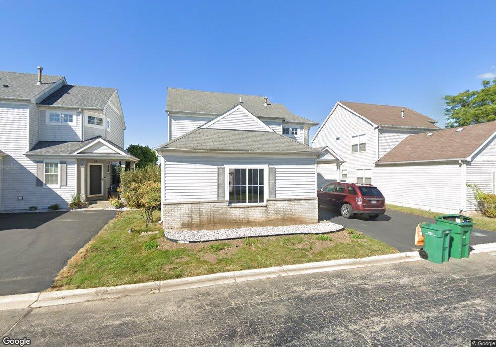
38 Snapdragon Ct Unit 1 Romeoville, IL 60446
Wespark NeighborhoodEstimated Value: $289,700 - $351,000
--
Bed
1
Bath
1,610
Sq Ft
$204/Sq Ft
Est. Value
About This Home
This home is located at 38 Snapdragon Ct Unit 1, Romeoville, IL 60446 and is currently estimated at $328,925, approximately $204 per square foot. 38 Snapdragon Ct Unit 1 is a home located in Will County with nearby schools including Kenneth L. Hermansen Elementary School, A. Vito Martinez Middle School, and Romeoville High School.
Ownership History
Date
Name
Owned For
Owner Type
Purchase Details
Closed on
May 6, 2002
Sold by
Norwood Derek V and Norwood Christel B
Bought by
Hunes Brenda F
Current Estimated Value
Home Financials for this Owner
Home Financials are based on the most recent Mortgage that was taken out on this home.
Original Mortgage
$158,150
Outstanding Balance
$67,438
Interest Rate
7.07%
Estimated Equity
$261,487
Purchase Details
Closed on
Sep 30, 1998
Sold by
Neumann Homes Inc
Bought by
Norwood Derek V and Norwood Christel B
Home Financials for this Owner
Home Financials are based on the most recent Mortgage that was taken out on this home.
Original Mortgage
$138,037
Interest Rate
6.97%
Mortgage Type
FHA
Create a Home Valuation Report for This Property
The Home Valuation Report is an in-depth analysis detailing your home's value as well as a comparison with similar homes in the area
Home Values in the Area
Average Home Value in this Area
Purchase History
| Date | Buyer | Sale Price | Title Company |
|---|---|---|---|
| Hunes Brenda F | $166,500 | -- | |
| Norwood Derek V | $146,000 | Chicago Title Insurance Co |
Source: Public Records
Mortgage History
| Date | Status | Borrower | Loan Amount |
|---|---|---|---|
| Open | Hunes Brenda F | $158,150 | |
| Previous Owner | Norwood Derek V | $138,037 |
Source: Public Records
Tax History Compared to Growth
Tax History
| Year | Tax Paid | Tax Assessment Tax Assessment Total Assessment is a certain percentage of the fair market value that is determined by local assessors to be the total taxable value of land and additions on the property. | Land | Improvement |
|---|---|---|---|---|
| 2024 | $8,607 | $92,466 | $29,150 | $63,316 |
| 2023 | $8,607 | $83,011 | $26,169 | $56,842 |
| 2022 | $7,546 | $75,164 | $23,695 | $51,469 |
| 2021 | $7,184 | $70,637 | $22,268 | $48,369 |
| 2020 | $6,995 | $68,315 | $21,536 | $46,779 |
| 2019 | $6,633 | $64,753 | $20,413 | $44,340 |
| 2018 | $6,102 | $59,270 | $18,685 | $40,585 |
| 2017 | $5,750 | $55,952 | $17,639 | $38,313 |
| 2016 | $5,424 | $52,438 | $16,531 | $35,907 |
| 2015 | $4,638 | $48,441 | $15,271 | $33,170 |
| 2014 | $4,638 | $45,272 | $14,272 | $31,000 |
| 2013 | $4,638 | $45,272 | $14,272 | $31,000 |
Source: Public Records
Map
Nearby Homes
- 68 Freesia Dr Unit 1
- 21157 W Covington Dr
- 87 Freesia Dr
- 46 Harmony Ln
- 109 Yarrow Unit 306
- 135 Azalea Cir Unit 631
- 138 Mountain Laurel Ct
- 142 Azalea Cir Unit 713
- 55 Harmony Ln
- 1565 Azalea Cir Unit 694
- 20941 W Ardmore Cir Unit 1
- 1594 Baytree Dr
- 21419 Frost Ct
- 20837 W Brockton Ct
- 20965 W Ardmore Cir
- 1375 S Alder Creek Ct
- 1647 Rose Ln Unit 3
- 262 E Daisy Cir Unit 1
- 21506 Franklin Cir
- 24041 W Walnut Dr
- 40 Snapdragon Ct
- 36 Snapdragon Ct
- 42 Snapdragon Ct
- 39 Snapdragon Ct Unit 1
- 37 Snapdragon Ct Unit 1
- 44 Snapdragon Ct
- 1489 Snapdragon Ct
- 1484 Snapdragon Ct
- 46 Snapdragon Ct
- 1485 Snapdragon Ct
- 45 Snapdragon Ct Unit 1
- 1480 Snapdragon Ct Unit 1
- 1481 Snapdragon Ct
- 52 Snapdragon Ct Unit 1
- 90 Kenilworth Ct
- 1486 Snapdragon Ct
- 1476 Snapdragon Ct
- 1482 Snapdragon Ct Unit 1
- 88 Kenilworth Ct
- 54 Snapdragon Ct Unit 1