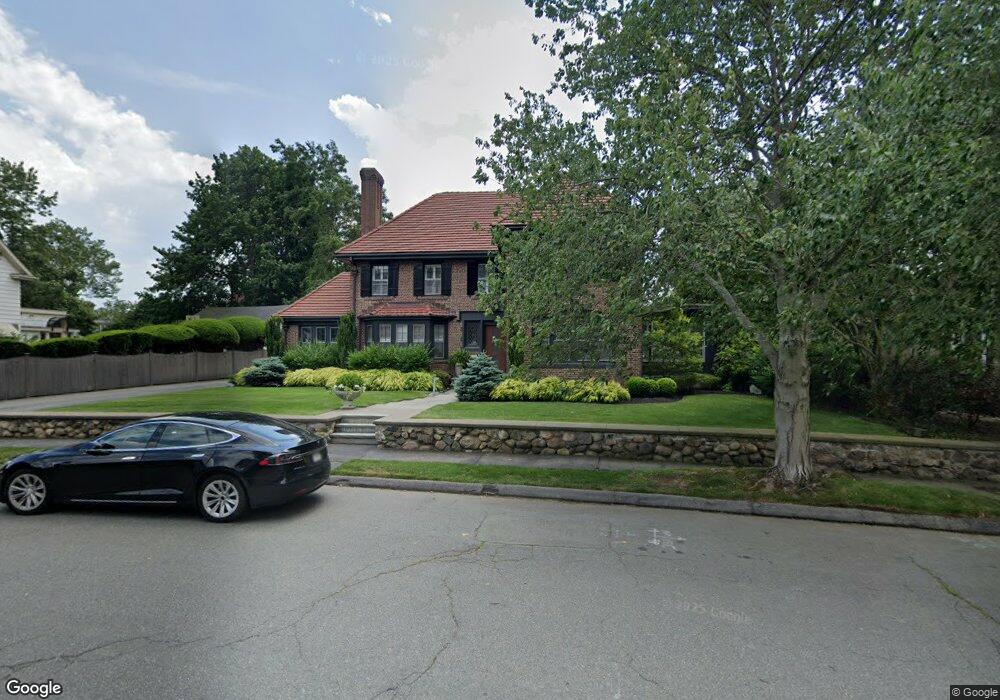
38 Stanley Rd Swampscott, MA 01907
Estimated Value: $1,430,000 - $1,672,000
3
Beds
5
Baths
2,741
Sq Ft
$563/Sq Ft
Est. Value
About This Home
This home is located at 38 Stanley Rd, Swampscott, MA 01907 and is currently estimated at $1,542,348, approximately $562 per square foot. 38 Stanley Rd is a home located in Essex County with nearby schools including Swampscott Middle School, Swampscott High School, and Devereux School.
Create a Home Valuation Report for This Property
The Home Valuation Report is an in-depth analysis detailing your home's value as well as a comparison with similar homes in the area
Home Values in the Area
Average Home Value in this Area
Tax History
| Year | Tax Paid | Tax Assessment Tax Assessment Total Assessment is a certain percentage of the fair market value that is determined by local assessors to be the total taxable value of land and additions on the property. | Land | Improvement |
|---|---|---|---|---|
| 2025 | $16,178 | $1,410,500 | $384,400 | $1,026,100 |
| 2024 | $15,846 | $1,379,100 | $384,400 | $994,700 |
| 2023 | $14,956 | $1,273,900 | $346,900 | $927,000 |
| 2022 | $14,000 | $1,091,200 | $300,000 | $791,200 |
| 2021 | $14,468 | $1,048,400 | $271,900 | $776,500 |
| 2020 | $14,446 | $1,010,200 | $243,700 | $766,500 |
| 2019 | $15,033 | $989,000 | $225,000 | $764,000 |
| 2018 | $14,739 | $921,200 | $206,200 | $715,000 |
| 2017 | $14,763 | $846,000 | $180,000 | $666,000 |
| 2016 | $14,661 | $846,000 | $180,000 | $666,000 |
| 2015 | $14,509 | $846,000 | $180,000 | $666,000 |
| 2014 | $13,638 | $729,300 | $168,700 | $560,600 |
Source: Public Records
Map
Nearby Homes
- 2 Ocean Ave
- 212 Humphrey St Unit 205
- 1002 Paradise Rd Unit PHE
- 11 Angenica Terrace
- 469 Loring Ave
- 1004 Paradise Rd Unit 1K
- 1004 Paradise Rd Unit 1L
- 12 Pickwick Rd
- 16 Pickwick Rd
- 71 Walnut Rd
- 35 Alden Rd
- 22 Hemenway Rd
- 3 Didio Dr
- 49 Weatherly Dr
- 30 Weatherly Dr
- 11 Weatherly Dr
- 445 Essex St Unit 304
- 50 Mountwood Rd
- 51 Mountwood Rd
- 4 Dean Rd
Your Personal Tour Guide
Ask me questions while you tour the home.