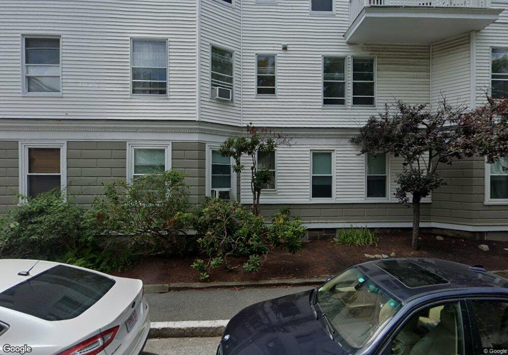
38 Stanton Rd Unit 1 Brookline, MA 02445
Brookline Village NeighborhoodEstimated Value: $1,026,000 - $1,421,000
3
Beds
2
Baths
1,967
Sq Ft
$627/Sq Ft
Est. Value
About This Home
This home is located at 38 Stanton Rd Unit 1, Brookline, MA 02445 and is currently estimated at $1,232,471, approximately $626 per square foot. 38 Stanton Rd Unit 1 is a home located in Norfolk County with nearby schools including Pierce School, Brookline High School, and St. Mary of the Assumption Elementary School.
Ownership History
Date
Name
Owned For
Owner Type
Purchase Details
Closed on
Nov 2, 2012
Sold by
Wieder Deborah and Schuchert Philip
Bought by
Hoffman Aaron and Dhar Shusmita
Current Estimated Value
Home Financials for this Owner
Home Financials are based on the most recent Mortgage that was taken out on this home.
Original Mortgage
$417,000
Outstanding Balance
$289,651
Interest Rate
3.5%
Mortgage Type
New Conventional
Estimated Equity
$942,820
Purchase Details
Closed on
Jun 25, 2007
Sold by
Donner Amy and Arnold Kevin
Bought by
Wieder Deborah and Schuchert Philip
Home Financials for this Owner
Home Financials are based on the most recent Mortgage that was taken out on this home.
Original Mortgage
$245,000
Interest Rate
6.14%
Mortgage Type
Purchase Money Mortgage
Purchase Details
Closed on
Apr 28, 2003
Sold by
Eden Gregory E
Bought by
Arnold Kevin and Donner May
Home Financials for this Owner
Home Financials are based on the most recent Mortgage that was taken out on this home.
Original Mortgage
$371,600
Interest Rate
5.64%
Mortgage Type
Purchase Money Mortgage
Purchase Details
Closed on
Aug 22, 2001
Sold by
Shim Wesley
Bought by
Eden Kathryn H and Eden Gregory E
Home Financials for this Owner
Home Financials are based on the most recent Mortgage that was taken out on this home.
Original Mortgage
$275,000
Interest Rate
7.21%
Mortgage Type
Purchase Money Mortgage
Purchase Details
Closed on
Nov 20, 1998
Sold by
Burns Wendy E
Bought by
Shim Wesley
Home Financials for this Owner
Home Financials are based on the most recent Mortgage that was taken out on this home.
Original Mortgage
$188,000
Interest Rate
6.49%
Mortgage Type
Purchase Money Mortgage
Purchase Details
Closed on
Nov 15, 1995
Sold by
Shulman Janet
Bought by
Burns Wendy
Purchase Details
Closed on
May 20, 1993
Sold by
Hanley Joan
Bought by
Bendheim Andrew J
Create a Home Valuation Report for This Property
The Home Valuation Report is an in-depth analysis detailing your home's value as well as a comparison with similar homes in the area
Home Values in the Area
Average Home Value in this Area
Purchase History
| Date | Buyer | Sale Price | Title Company |
|---|---|---|---|
| Hoffman Aaron | $526,000 | -- | |
| Wieder Deborah | $545,000 | -- | |
| Arnold Kevin | $464,500 | -- | |
| Eden Kathryn H | $390,000 | -- | |
| Shim Wesley | $235,000 | -- | |
| Burns Wendy | $177,000 | -- | |
| Bendheim Andrew J | $10,400 | -- |
Source: Public Records
Mortgage History
| Date | Status | Borrower | Loan Amount |
|---|---|---|---|
| Open | Hoffman Aaron | $417,000 | |
| Previous Owner | Bendheim Andrew J | $241,000 | |
| Previous Owner | Bendheim Andrew J | $245,100 | |
| Previous Owner | Wieder Deborah | $245,000 | |
| Previous Owner | Arnold Kevin | $371,600 | |
| Previous Owner | Eden Kathryn H | $275,000 | |
| Previous Owner | Bendheim Andrew J | $188,000 |
Source: Public Records
Tax History
| Year | Tax Paid | Tax Assessment Tax Assessment Total Assessment is a certain percentage of the fair market value that is determined by local assessors to be the total taxable value of land and additions on the property. | Land | Improvement |
|---|---|---|---|---|
| 2025 | $10,428 | $1,056,500 | $0 | $1,056,500 |
| 2024 | $10,120 | $1,035,800 | $0 | $1,035,800 |
| 2023 | $10,104 | $1,013,400 | $0 | $1,013,400 |
| 2022 | $10,124 | $993,500 | $0 | $993,500 |
| 2021 | $9,640 | $983,700 | $0 | $983,700 |
| 2020 | $9,204 | $974,000 | $0 | $974,000 |
| 2019 | $8,692 | $927,600 | $0 | $927,600 |
| 2018 | $8,442 | $892,400 | $0 | $892,400 |
| 2017 | $8,164 | $826,300 | $0 | $826,300 |
| 2016 | $7,828 | $751,200 | $0 | $751,200 |
| 2015 | $7,293 | $682,900 | $0 | $682,900 |
| 2014 | $7,175 | $629,900 | $0 | $629,900 |
Source: Public Records
Map
Nearby Homes
- 71 Greenough St Unit 71-1
- 75 Greenough St Unit 2
- 401 Washington St Unit 6
- 11 Goodwin Place Unit 1
- 11 Goodwin Place Unit 11-1
- 11 Goodwin Place Unit 11-2
- 12 Goodwin Place Unit 12-1
- 12 Goodwin Place Unit 12-2
- 370 Washington St
- 140 Sumner Rd Unit 1
- 12 Thayer St
- 8 Leverett St Unit 3
- 24 Blake Rd
- 236 Walnut St
- 75-83 Boylston St Unit R3
- 84 Winthrop Rd Unit 1
- 84 Winthrop Rd
- 15 Colbourne Crescent Unit 2
- 80 Vernon St Unit 1-A
- 80 Vernon St Unit 2B
- 30 Stanton Rd Unit 6
- 30 Stanton Rd Unit 5
- 30 Stanton Rd Unit 4
- 30 Stanton Rd Unit 3
- 30 Stanton Rd Unit 2
- 30 Stanton Rd Unit 1
- 30 Stanton Rd Unit 6,30
- 38 Stanton Rd Unit 3
- 38 Stanton Rd Unit 2
- 34 Stanton Rd Unit 3
- 34 Stanton Rd Unit 2
- 34 Stanton Rd Unit 1
- 34 Stanton Rd Unit 2,34
- 40 Stanton Rd Unit 3
- 40 Stanton Rd Unit 2
- 40 Stanton Rd Unit 1
- 36 Stanton Rd Unit 3
- 36 Stanton Rd Unit 2
- 36 Stanton Rd Unit 1
- 32 Stanton Rd Unit 3
Your Personal Tour Guide
Ask me questions while you tour the home.