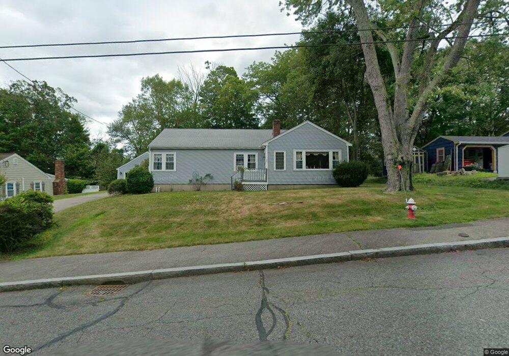
38 Sutherland Rd North Attleboro, MA 02760
North Attleboro NeighborhoodEstimated Value: $483,000 - $599,000
3
Beds
1
Bath
1,400
Sq Ft
$396/Sq Ft
Est. Value
About This Home
This home is located at 38 Sutherland Rd, North Attleboro, MA 02760 and is currently estimated at $554,062, approximately $395 per square foot. 38 Sutherland Rd is a home located in Bristol County with nearby schools including North Attleboro High School, Cadence Academy Preschool - North Attleborough, and Bishop Feehan High School.
Ownership History
Date
Name
Owned For
Owner Type
Purchase Details
Closed on
Apr 5, 2007
Sold by
Thomas Lawrence M and Thomas Marcia L
Bought by
Thomas Marcia
Current Estimated Value
Purchase Details
Closed on
Aug 28, 1998
Sold by
Brown Todd W and Brown Shelly K
Bought by
Thomas Lawrence M and Thomas Marcia L
Home Financials for this Owner
Home Financials are based on the most recent Mortgage that was taken out on this home.
Original Mortgage
$154,000
Interest Rate
6.9%
Mortgage Type
Purchase Money Mortgage
Purchase Details
Closed on
May 31, 1994
Sold by
38 Sutherland Rd Rt
Bought by
Brown Todd W and Brown Shelly K
Home Financials for this Owner
Home Financials are based on the most recent Mortgage that was taken out on this home.
Original Mortgage
$113,000
Interest Rate
8.22%
Mortgage Type
Purchase Money Mortgage
Create a Home Valuation Report for This Property
The Home Valuation Report is an in-depth analysis detailing your home's value as well as a comparison with similar homes in the area
Home Values in the Area
Average Home Value in this Area
Purchase History
| Date | Buyer | Sale Price | Title Company |
|---|---|---|---|
| Thomas Marcia | -- | -- | |
| Thomas Lawrence M | $151,000 | -- | |
| Brown Todd W | $125,625 | -- |
Source: Public Records
Mortgage History
| Date | Status | Borrower | Loan Amount |
|---|---|---|---|
| Previous Owner | Brown Todd W | $154,000 | |
| Previous Owner | Brown Todd W | $113,000 |
Source: Public Records
Tax History Compared to Growth
Tax History
| Year | Tax Paid | Tax Assessment Tax Assessment Total Assessment is a certain percentage of the fair market value that is determined by local assessors to be the total taxable value of land and additions on the property. | Land | Improvement |
|---|---|---|---|---|
| 2025 | $6,113 | $518,500 | $146,000 | $372,500 |
| 2024 | $5,782 | $501,000 | $146,000 | $355,000 |
| 2023 | $5,730 | $448,000 | $152,400 | $295,600 |
| 2022 | $5,182 | $372,000 | $146,000 | $226,000 |
| 2021 | $5,073 | $355,500 | $146,000 | $209,500 |
| 2020 | $4,783 | $333,300 | $146,000 | $187,300 |
| 2019 | $4,558 | $320,100 | $132,800 | $187,300 |
| 2018 | $4,017 | $301,100 | $132,800 | $168,300 |
| 2017 | $3,876 | $293,200 | $132,800 | $160,400 |
| 2016 | $3,842 | $290,600 | $153,900 | $136,700 |
| 2015 | $3,757 | $285,900 | $160,300 | $125,600 |
| 2014 | $3,506 | $264,800 | $140,700 | $124,100 |
Source: Public Records
Map
Nearby Homes
- 130 E Washington St Unit 57
- 130 E Washington St Unit 71
- 80 Broadway Unit 9
- Lot 6 Sperry Ln
- 23-R Eddy Street (Eddy St Rear)
- 121 E Washington St Unit 8
- 121 E Washington St Unit 12
- 121 E Washington St Unit 13
- 121 E Washington St Unit 11
- 300 E Washington St Unit 54R
- 300 E Washington St Unit 20N
- 36 Jefferson St
- 90 Walnut Rd
- 138 Jefferson St
- 137 Sumner St
- 47 Reservoir St
- 17 Holbrook Ave
- 41 Roosevelt Ave
- 40 Roosevelt Ave
- 11 Primrose Terrace
- 30 Sutherland Rd
- 46 Sutherland Rd
- 35 Calvin Rd
- 41 Calvin Rd
- 29 Calvin Rd
- 41 Sutherland Rd
- 28 Sutherland Rd
- 51 Sutherland Rd
- 33 Sutherland Rd
- 47 Calvin Rd
- 54 Sutherland Rd
- 23 Calvin Rd
- 25 Sutherland Rd
- 57 Sutherland Rd
- 53 Calvin Rd
- 18 Sutherland Rd
- 62 Metcalf Rd
- 34 Calvin Rd
- 40 Calvin Rd
- 15 Calvin Rd