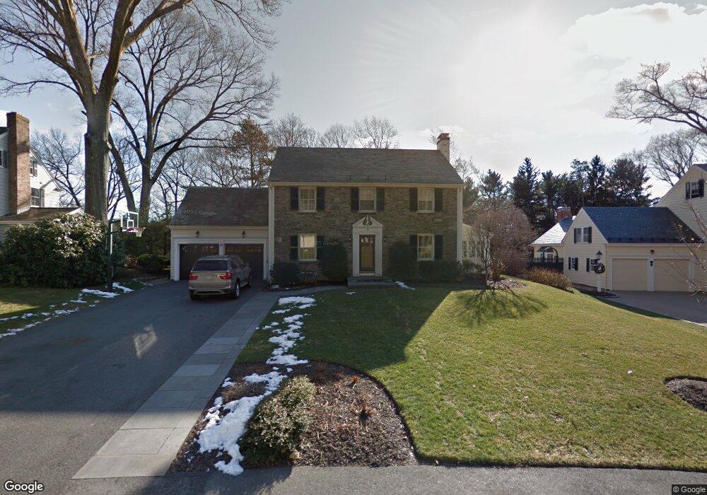
38 Thackeray Rd Wellesley Hills, MA 02481
Wellesley Hills NeighborhoodEstimated Value: $1,582,000 - $2,714,356
4
Beds
3
Baths
3,210
Sq Ft
$730/Sq Ft
Est. Value
About This Home
This home is located at 38 Thackeray Rd, Wellesley Hills, MA 02481 and is currently estimated at $2,342,589, approximately $729 per square foot. 38 Thackeray Rd is a home located in Norfolk County with nearby schools including Schofield Elementary School, Wellesley Middle School, and Wellesley Sr High School.
Ownership History
Date
Name
Owned For
Owner Type
Purchase Details
Closed on
Apr 28, 2017
Sold by
Olton Olton C and Olton Laura S
Bought by
Laura S Olton 2006 Ret
Current Estimated Value
Purchase Details
Closed on
Aug 17, 2004
Sold by
Smith Jill A and Smith Matthew R
Bought by
Olton C Matthew and Olton Laura S
Home Financials for this Owner
Home Financials are based on the most recent Mortgage that was taken out on this home.
Original Mortgage
$649,000
Interest Rate
6.16%
Mortgage Type
Purchase Money Mortgage
Purchase Details
Closed on
Aug 27, 1997
Sold by
Hobbs John Wf
Bought by
Smith Matthew R and Smith Jill A
Home Financials for this Owner
Home Financials are based on the most recent Mortgage that was taken out on this home.
Original Mortgage
$558,000
Interest Rate
7.41%
Mortgage Type
Purchase Money Mortgage
Create a Home Valuation Report for This Property
The Home Valuation Report is an in-depth analysis detailing your home's value as well as a comparison with similar homes in the area
Home Values in the Area
Average Home Value in this Area
Purchase History
| Date | Buyer | Sale Price | Title Company |
|---|---|---|---|
| Laura S Olton 2006 Ret | -- | -- | |
| Olton C Matthew | $1,230,000 | -- | |
| Smith Matthew R | $700,000 | -- |
Source: Public Records
Mortgage History
| Date | Status | Borrower | Loan Amount |
|---|---|---|---|
| Previous Owner | Olton C Matthew | $649,000 | |
| Previous Owner | Olton C Matthew | $600,000 | |
| Previous Owner | Smith Matthew R | $558,000 |
Source: Public Records
Tax History
| Year | Tax Paid | Tax Assessment Tax Assessment Total Assessment is a certain percentage of the fair market value that is determined by local assessors to be the total taxable value of land and additions on the property. | Land | Improvement |
|---|---|---|---|---|
| 2025 | $26,553 | $2,583,000 | $1,758,000 | $825,000 |
| 2024 | $25,130 | $2,414,000 | $1,623,000 | $791,000 |
| 2023 | $21,549 | $1,882,000 | $1,259,000 | $623,000 |
| 2022 | $20,078 | $1,719,000 | $1,089,000 | $630,000 |
| 2021 | $18,824 | $1,602,000 | $972,000 | $630,000 |
| 2020 | $18,519 | $1,602,000 | $972,000 | $630,000 |
| 2019 | $17,633 | $1,524,000 | $894,000 | $630,000 |
| 2018 | $17,339 | $1,451,000 | $760,000 | $691,000 |
| 2017 | $17,107 | $1,451,000 | $760,000 | $691,000 |
| 2016 | $16,704 | $1,412,000 | $747,000 | $665,000 |
| 2015 | $16,323 | $1,412,000 | $747,000 | $665,000 |
Source: Public Records
Map
Nearby Homes
Your Personal Tour Guide
Ask me questions while you tour the home.