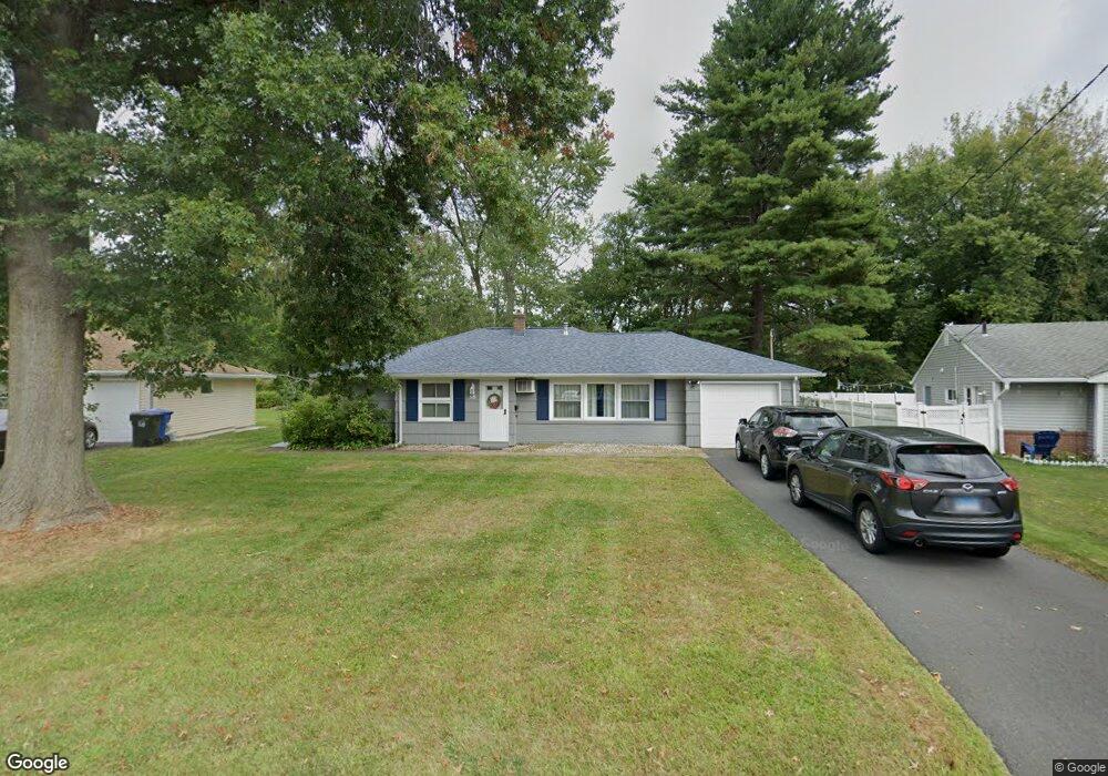
38 Thornton Dr Newington, CT 06111
Estimated Value: $317,000 - $355,000
3
Beds
1
Bath
1,148
Sq Ft
$286/Sq Ft
Est. Value
About This Home
This home is located at 38 Thornton Dr, Newington, CT 06111 and is currently estimated at $328,353, approximately $286 per square foot. 38 Thornton Dr is a home located in Hartford County with nearby schools including Anna Reynolds School, Martin Kellogg Middle School, and Newington High School.
Ownership History
Date
Name
Owned For
Owner Type
Purchase Details
Closed on
Mar 10, 2010
Sold by
Isarai Elton
Bought by
Isarai Linda C
Current Estimated Value
Purchase Details
Closed on
Aug 12, 2004
Sold by
Futterlieb Eric D and Futterlieb Rebecca A
Bought by
Isarai Eltan and Isarai Linda C
Home Financials for this Owner
Home Financials are based on the most recent Mortgage that was taken out on this home.
Original Mortgage
$127,200
Interest Rate
6.16%
Purchase Details
Closed on
May 16, 2000
Sold by
Doyle Anna Dorothy
Bought by
Futterlieb Eric D and Futterlieb Rebecca A
Create a Home Valuation Report for This Property
The Home Valuation Report is an in-depth analysis detailing your home's value as well as a comparison with similar homes in the area
Home Values in the Area
Average Home Value in this Area
Purchase History
| Date | Buyer | Sale Price | Title Company |
|---|---|---|---|
| Isarai Linda C | -- | -- | |
| Isarai Eltan | $159,000 | -- | |
| Futterlieb Eric D | $105,000 | -- |
Source: Public Records
Mortgage History
| Date | Status | Borrower | Loan Amount |
|---|---|---|---|
| Open | Futterlieb Eric D | $120,000 | |
| Previous Owner | Futterlieb Eric D | $127,200 |
Source: Public Records
Tax History Compared to Growth
Tax History
| Year | Tax Paid | Tax Assessment Tax Assessment Total Assessment is a certain percentage of the fair market value that is determined by local assessors to be the total taxable value of land and additions on the property. | Land | Improvement |
|---|---|---|---|---|
| 2024 | $4,748 | $119,690 | $53,550 | $66,140 |
| 2023 | $4,591 | $119,690 | $53,550 | $66,140 |
| 2022 | $4,607 | $119,690 | $53,550 | $66,140 |
| 2021 | $4,645 | $119,690 | $53,550 | $66,140 |
| 2020 | $4,430 | $112,790 | $53,550 | $59,240 |
| 2019 | $4,450 | $112,790 | $53,550 | $59,240 |
| 2018 | $4,342 | $112,790 | $53,550 | $59,240 |
| 2017 | $4,127 | $112,790 | $53,550 | $59,240 |
| 2016 | $4,032 | $112,790 | $53,550 | $59,240 |
| 2014 | $3,987 | $114,660 | $53,420 | $61,240 |
Source: Public Records
Map
Nearby Homes
- 126 Cherry Hill Dr
- 54 Red Top Dr
- 26 Baldwin St
- 305 Hampton Ct
- 25 Fowler Dr
- 179 Hampton Ct Unit 179
- 236 Sterling Dr Unit 236
- 239 Sterling Dr Unit 239
- 293 Elmfield St
- 66 Rosemary Ln Unit 66
- 521 S Main St
- 493 S Main St
- 274 Newington Rd
- 24 Thorne Rd Unit 24
- 135 Village Square Dr Unit 8
- 140 Camp Ave
- 21 Echo Ln
- 18 Federal St
- 9 Federal St
- 38 Mildred Rd
- 42 Thornton Dr
- 34 Thornton Dr
- 48 Thornton Dr
- 30 Thornton Dr
- 41 Thornton Dr
- 54 Thornton Dr
- 26 Thornton Dr
- 29 Thornton Dr
- 76 High Ridge Dr
- 58 Thornton Dr
- 20 Thornton Dr
- 16 Thornton Dr
- 64 Thornton Dr
- 68 High Ridge Dr
- 11 Thornton Dr
- 65 Thornton Dr
- 10 Thornton Dr
- 136 Barnard Dr
- 6 Quincy Ln
- 64 High Ridge Dr