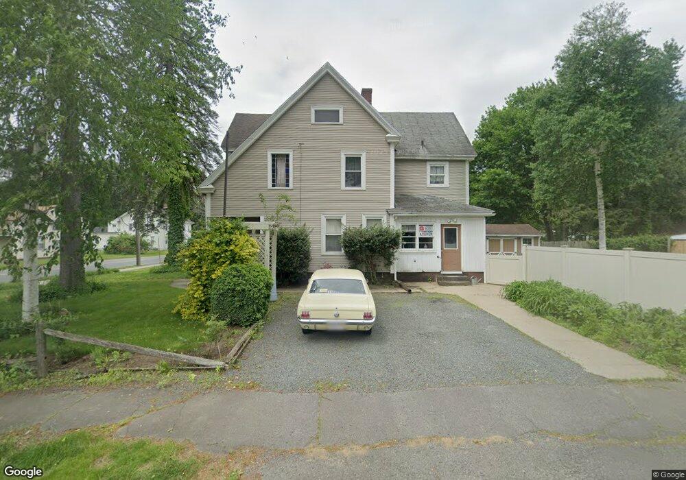
38 Union St Westfield, MA 01085
Estimated Value: $304,826 - $349,000
4
Beds
2
Baths
1,716
Sq Ft
$196/Sq Ft
Est. Value
About This Home
This home is located at 38 Union St, Westfield, MA 01085 and is currently estimated at $336,457, approximately $196 per square foot. 38 Union St is a home located in Hampden County with nearby schools including Westfield High School and Saint Mary High School.
Ownership History
Date
Name
Owned For
Owner Type
Purchase Details
Closed on
Oct 31, 2002
Sold by
Baker Paul D and Baker Dorothy T
Bought by
Allie Daniel J and Allie Theresa M
Current Estimated Value
Home Financials for this Owner
Home Financials are based on the most recent Mortgage that was taken out on this home.
Original Mortgage
$109,100
Interest Rate
6.09%
Mortgage Type
Purchase Money Mortgage
Purchase Details
Closed on
Sep 24, 1999
Sold by
Bankboston
Bought by
Baker Paul D and Baker Dorothy T
Home Financials for this Owner
Home Financials are based on the most recent Mortgage that was taken out on this home.
Original Mortgage
$45,000
Interest Rate
8.1%
Mortgage Type
Purchase Money Mortgage
Purchase Details
Closed on
Apr 21, 1999
Sold by
Kirk Clementine
Bought by
Federal National Mortgage Association
Create a Home Valuation Report for This Property
The Home Valuation Report is an in-depth analysis detailing your home's value as well as a comparison with similar homes in the area
Home Values in the Area
Average Home Value in this Area
Purchase History
| Date | Buyer | Sale Price | Title Company |
|---|---|---|---|
| Allie Daniel J | $129,900 | -- | |
| Baker Paul D | $67,000 | -- | |
| Federal National Mortgage Association | $50,000 | -- |
Source: Public Records
Mortgage History
| Date | Status | Borrower | Loan Amount |
|---|---|---|---|
| Open | Federal National Mortgage Association | $125,000 | |
| Closed | Federal National Mortgage Association | $109,100 | |
| Previous Owner | Federal National Mortgage Association | $45,000 |
Source: Public Records
Tax History Compared to Growth
Tax History
| Year | Tax Paid | Tax Assessment Tax Assessment Total Assessment is a certain percentage of the fair market value that is determined by local assessors to be the total taxable value of land and additions on the property. | Land | Improvement |
|---|---|---|---|---|
| 2025 | $3,745 | $246,700 | $77,500 | $169,200 |
| 2024 | $3,561 | $223,000 | $70,600 | $152,400 |
| 2023 | $3,403 | $200,400 | $67,200 | $133,200 |
| 2022 | $3,247 | $175,600 | $59,900 | $115,700 |
| 2021 | $3,119 | $165,200 | $56,500 | $108,700 |
| 2020 | $3,013 | $156,500 | $56,500 | $100,000 |
| 2019 | $2,784 | $148,500 | $53,800 | $94,700 |
| 2018 | $2,701 | $148,500 | $53,800 | $94,700 |
| 2017 | $2,831 | $145,800 | $54,600 | $91,200 |
| 2016 | $2,834 | $145,800 | $54,600 | $91,200 |
| 2015 | $2,703 | $145,800 | $54,600 | $91,200 |
| 2014 | $2,018 | $145,800 | $54,600 | $91,200 |
Source: Public Records
Map
Nearby Homes