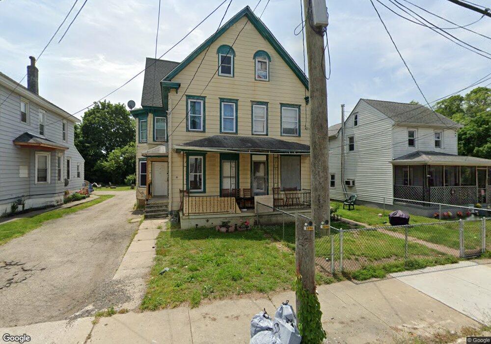
38 W Harmony St Unit 40 Penns Grove, NJ 08069
Estimated Value: $208,000 - $273,000
--
Bed
--
Bath
3,564
Sq Ft
$67/Sq Ft
Est. Value
About This Home
This home is located at 38 W Harmony St Unit 40, Penns Grove, NJ 08069 and is currently estimated at $240,468, approximately $67 per square foot. 38 W Harmony St Unit 40 is a home located in Salem County with nearby schools including Lafayette-Pershing Elementary School, Field Street Elementary School, and Paul W. Carleton Elementary School.
Ownership History
Date
Name
Owned For
Owner Type
Purchase Details
Closed on
Jan 30, 1997
Sold by
Heil Henry T and Heil Marie V
Bought by
Miller William J and Miller Arleen
Current Estimated Value
Home Financials for this Owner
Home Financials are based on the most recent Mortgage that was taken out on this home.
Original Mortgage
$49,600
Outstanding Balance
$4,534
Interest Rate
5.37%
Mortgage Type
Purchase Money Mortgage
Estimated Equity
$235,934
Create a Home Valuation Report for This Property
The Home Valuation Report is an in-depth analysis detailing your home's value as well as a comparison with similar homes in the area
Home Values in the Area
Average Home Value in this Area
Purchase History
| Date | Buyer | Sale Price | Title Company |
|---|---|---|---|
| Miller William J | $62,000 | Intercoastal Title Agency In |
Source: Public Records
Mortgage History
| Date | Status | Borrower | Loan Amount |
|---|---|---|---|
| Open | Miller William J | $49,600 |
Source: Public Records
Tax History Compared to Growth
Tax History
| Year | Tax Paid | Tax Assessment Tax Assessment Total Assessment is a certain percentage of the fair market value that is determined by local assessors to be the total taxable value of land and additions on the property. | Land | Improvement |
|---|---|---|---|---|
| 2025 | $6,112 | $110,200 | $14,400 | $95,800 |
| 2024 | $5,907 | $110,200 | $14,400 | $95,800 |
| 2023 | $5,907 | $110,200 | $14,400 | $95,800 |
| 2022 | $5,694 | $110,200 | $14,400 | $95,800 |
| 2021 | $5,448 | $110,200 | $14,400 | $95,800 |
| 2020 | $5,520 | $110,200 | $14,400 | $95,800 |
| 2019 | $5,543 | $110,200 | $14,400 | $95,800 |
| 2018 | $5,644 | $139,900 | $22,400 | $117,500 |
| 2017 | $5,663 | $139,900 | $22,400 | $117,500 |
| 2016 | $5,449 | $139,900 | $22,400 | $117,500 |
| 2015 | $5,220 | $139,900 | $22,400 | $117,500 |
| 2014 | $5,162 | $139,900 | $22,400 | $117,500 |
Source: Public Records
Map
Nearby Homes
- 36 W Harmony St
- 44 W Harmony St
- 34 W Harmony St
- 24 W Harmony St Unit 26
- 49 W Main St
- 54 W Harmony St
- 22 W Harmony St Unit 22 1/2
- 47 W Main St
- 39 W Main St
- 37 W Harmony St
- 39 W Harmony St
- 35 W Harmony St
- 43 W Harmony St
- 35 W Main St
- 25 W Harmony St
- 56 W Harmony St
- 47 W Harmony St
- 33 W Main St
- 0 State St
- 55 W Harmony St