
Seller's Agent in 2017
Lora Alexander
High Ridge Realty, LLC
(719) 694-1873
28 in this area
67 Total Sales
Estimated Value: $11,319 - $17,000
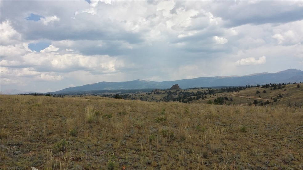
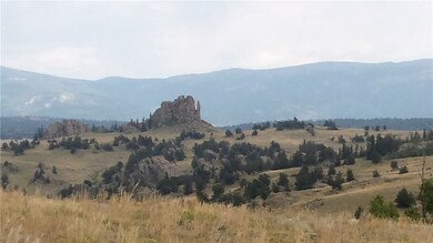
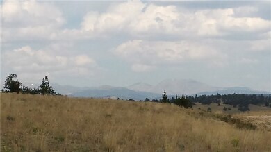
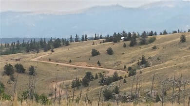
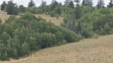
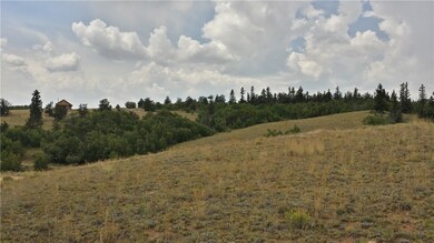
TREES YES, POWER-NO, PHONE-YES. Beautiful panoramic views!! Located close to Tarryall River (walking distance). Property is perfect for camping or a new build. Close to Indian Mountain Recreation Center. Just minutes from Hwy 285. Indian Mountain, Filing #26, Unit #2, Lot #283.
Last Agent to Sell the Property
High Ridge Realty, LLC License #FA100054863 Listed on: 02/10/2017
| Date | Buyer | Sale Price | Title Company |
|---|---|---|---|
| Dekoster Karen T | $7,000 | Fidelity National Title Ins |
| Date | Event | Price | List to Sale | Price per Sq Ft |
|---|---|---|---|---|
| 02/24/2017 02/24/17 | Sold | $7,000 | 0.0% | -- |
| 02/10/2017 02/10/17 | For Sale | $7,000 | -- | -- |
| Year | Tax Paid | Tax Assessment Tax Assessment Total Assessment is a certain percentage of the fair market value that is determined by local assessors to be the total taxable value of land and additions on the property. | Land | Improvement |
|---|---|---|---|---|
| 2025 | $388 | $5,640 | $1,460 | $4,180 |
| 2024 | $295 | $4,620 | $4,620 | $0 |
| 2023 | $295 | $4,805 | $4,805 | $0 |
| 2022 | $163 | $2,264 | $2,264 | $0 |
| 2021 | $160 | $2,264 | $2,264 | $0 |
| 2020 | $152 | $2,100 | $2,100 | $0 |
| 2019 | $149 | $2,100 | $2,100 | $0 |
| 2018 | $153 | $2,100 | $2,100 | $0 |
| 2017 | $134 | $2,130 | $2,130 | $0 |
| 2016 | $152 | $2,390 | $2,390 | $0 |
| 2015 | $155 | $2,390 | $2,390 | $0 |
| 2014 | $136 | $0 | $0 | $0 |
Seller's Agent in 2017
Lora Alexander
High Ridge Realty, LLC
(719) 694-1873
28 in this area
67 Total Sales
Buyer's Agent in 2017
Amy Caniglia
Caniglia Real Estate Group,LLC
(303) 870-6446
15 in this area
180 Total Sales
Source: Summit MLS
MLS Number: S1003716
APN: 32861
Disclaimer: Certain information contained herein is derived from information provided by parties other than Homes.com. All information provided is deemed reliable, but is not guaranteed to be accurate and should be independently verified.
![]() Copyright © 2026 SAR MLS. The information displayed herein was derived from sources believed to be accurate, but has not been verified by SAR MLS. Buyers are cautioned to verify all information to their own satisfaction. This information is exclusively for viewers’ personal, non-commercial use. Any republication or reproduction of the information herein without the express permission of the SAR MLS is strictly prohibited.
Copyright © 2026 SAR MLS. The information displayed herein was derived from sources believed to be accurate, but has not been verified by SAR MLS. Buyers are cautioned to verify all information to their own satisfaction. This information is exclusively for viewers’ personal, non-commercial use. Any republication or reproduction of the information herein without the express permission of the SAR MLS is strictly prohibited.
Ask me questions while you tour the home.