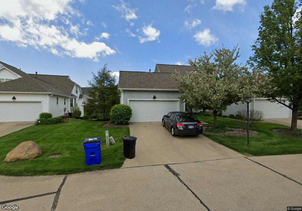
380 Blair Cir Unit I17 Aurora, OH 44202
Estimated Value: $378,641 - $429,000
2
Beds
3
Baths
2,382
Sq Ft
$165/Sq Ft
Est. Value
About This Home
This home is located at 380 Blair Cir Unit I17, Aurora, OH 44202 and is currently estimated at $392,410, approximately $164 per square foot. 380 Blair Cir Unit I17 is a home located in Portage County with nearby schools including Miller Elementary School, Craddock/Miller Elementary School, and Leighton Elementary School.
Ownership History
Date
Name
Owned For
Owner Type
Purchase Details
Closed on
Jun 22, 2010
Sold by
Estate Of Lawrence Frank Vavra and Vavra June Yvonnie
Bought by
Mccullough Sandra
Current Estimated Value
Home Financials for this Owner
Home Financials are based on the most recent Mortgage that was taken out on this home.
Original Mortgage
$31,500
Outstanding Balance
$22,863
Interest Rate
6.75%
Mortgage Type
New Conventional
Estimated Equity
$369,547
Create a Home Valuation Report for This Property
The Home Valuation Report is an in-depth analysis detailing your home's value as well as a comparison with similar homes in the area
Home Values in the Area
Average Home Value in this Area
Purchase History
| Date | Buyer | Sale Price | Title Company |
|---|---|---|---|
| Mccullough Sandra | $210,000 | None Available |
Source: Public Records
Mortgage History
| Date | Status | Borrower | Loan Amount |
|---|---|---|---|
| Open | Mccullough Sandra | $31,500 | |
| Open | Mccullough Sandra | $168,000 |
Source: Public Records
Tax History Compared to Growth
Tax History
| Year | Tax Paid | Tax Assessment Tax Assessment Total Assessment is a certain percentage of the fair market value that is determined by local assessors to be the total taxable value of land and additions on the property. | Land | Improvement |
|---|---|---|---|---|
| 2024 | $5,278 | $118,060 | $10,500 | $107,560 |
| 2023 | $4,781 | $87,080 | $12,250 | $74,830 |
| 2022 | $4,330 | $87,080 | $12,250 | $74,830 |
| 2021 | $4,324 | $85,860 | $12,250 | $73,610 |
| 2020 | $4,630 | $85,860 | $12,250 | $73,610 |
| 2019 | $4,651 | $85,860 | $12,250 | $73,610 |
| 2018 | $4,289 | $72,210 | $12,250 | $59,960 |
| 2017 | $4,289 | $72,210 | $12,250 | $59,960 |
| 2016 | $3,864 | $72,210 | $12,250 | $59,960 |
| 2015 | $3,974 | $72,210 | $12,250 | $59,960 |
| 2014 | $4,054 | $72,210 | $12,250 | $59,960 |
| 2013 | $3,757 | $67,340 | $12,250 | $55,090 |
Source: Public Records
Map
Nearby Homes
- 794 Robinhood Dr
- 676 Nancy Dr
- 777 Nancy Dr
- 915 Cimarron Oval
- 436 Cochran Rd
- 316 High Bluff
- S/L 4 Trentstone Cir
- S/L 8 Trentstone Cir
- S/L 15 Trentstone Cir
- S/L 1 Trentstone Cir
- 185 N Bissell Rd
- 225 Linwood Ln
- 622 Club Dr W
- S/L 3 Iris Place
- 640 Club Dr W
- 405 Club Dr W
- 805 Club Dr W
- 180 Beaumont Trail
- 825 Club Dr W
- 752 Club Dr W
- 390 Blair Cir
- 370 Blair Cir Unit I18
- 410 Blair Cir Unit G14
- 385 Blair Cir Unit 9
- 420 Blair Cir
- 360 Blair Cir
- 375 Blair Cir
- 415 Blair Cir
- 400 Blair Cir Unit H15
- 400 Blair Cir Unit 15H
- 395 Blair Cir
- 405 Blair Cir
- 365 Blair Cir Unit D7
- 350 Blair Cir Unit 20
- 835 Stone Hill Oval
- 330 Blair Cir
- 340 Blair Cir
- 355 Blair Cir Unit C6
- 825 Stone Hill Oval
- 345 Blair Cir Unit C5