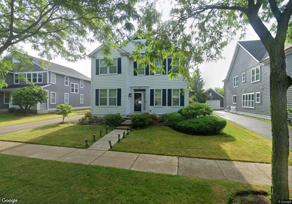
380 Lasalle St Vernon Hills, IL 60061
Estimated Value: $676,375 - $859,000
--
Bed
3
Baths
2,676
Sq Ft
$283/Sq Ft
Est. Value
About This Home
This home is located at 380 Lasalle St, Vernon Hills, IL 60061 and is currently estimated at $758,594, approximately $283 per square foot. 380 Lasalle St is a home located in Lake County with nearby schools including Hawthorn Aspen Elementary School, Hawthorn School Of Dual Language, and Hawthorn Middle School South.
Ownership History
Date
Name
Owned For
Owner Type
Purchase Details
Closed on
Aug 12, 1999
Sold by
Pinnacle Corp
Bought by
Choi Baik Junho and Choi Baik Jungeun Stephanie
Current Estimated Value
Home Financials for this Owner
Home Financials are based on the most recent Mortgage that was taken out on this home.
Original Mortgage
$240,000
Outstanding Balance
$62,103
Interest Rate
6.37%
Estimated Equity
$696,491
Create a Home Valuation Report for This Property
The Home Valuation Report is an in-depth analysis detailing your home's value as well as a comparison with similar homes in the area
Home Values in the Area
Average Home Value in this Area
Purchase History
| Date | Buyer | Sale Price | Title Company |
|---|---|---|---|
| Choi Baik Junho | $335,500 | -- |
Source: Public Records
Mortgage History
| Date | Status | Borrower | Loan Amount |
|---|---|---|---|
| Open | Choi Baik Junho | $240,000 |
Source: Public Records
Tax History Compared to Growth
Tax History
| Year | Tax Paid | Tax Assessment Tax Assessment Total Assessment is a certain percentage of the fair market value that is determined by local assessors to be the total taxable value of land and additions on the property. | Land | Improvement |
|---|---|---|---|---|
| 2024 | $15,178 | $180,629 | $35,278 | $145,351 |
| 2023 | $14,773 | $170,436 | $33,287 | $137,149 |
| 2022 | $14,773 | $164,829 | $32,192 | $132,637 |
| 2021 | $14,783 | $170,919 | $31,845 | $139,074 |
| 2020 | $14,783 | $171,502 | $31,954 | $139,548 |
| 2019 | $14,499 | $170,870 | $31,836 | $139,034 |
| 2018 | $13,627 | $162,817 | $24,721 | $138,096 |
| 2017 | $13,483 | $159,017 | $24,144 | $134,873 |
| 2016 | $13,079 | $152,272 | $23,120 | $129,152 |
| 2015 | $12,902 | $142,404 | $21,622 | $120,782 |
| 2014 | $12,726 | $138,309 | $23,221 | $115,088 |
| 2012 | $12,484 | $138,587 | $23,268 | $115,319 |
Source: Public Records
Map
Nearby Homes
- 339 Lasalle St
- 306 Lasalle St
- 384 Woodland Chase Ln
- 410 Sislow Ln
- 399 Sislow Ln
- 414 Sislow Ln
- 468 Woodland Chase Ln
- 431 Woodland Chase Ln
- 124 Midway Ln
- 116 S Deerpath Dr
- 16197 W Woodbine Cir
- 5825 Blue Heron Dr
- 16231 W Port Clinton Rd
- 16280 W Woodbine Cir
- 5802 Teal Ct
- 396 Forest Edge Dr
- 5881 Teal Ln
- 190 Southgate Dr
- 5898 Partridge Ln
- 128 Lilly Ct
- 376 Lasalle St
- 384 Lasalle St
- 372 Lasalle St
- 388 Lasalle St
- 368 Lasalle St
- 378 Ranney Ave
- 390 Ranney Ave
- 364 Lasalle St
- 340 Ranney Ave
- 379 Ranney Ave
- 371 Ranney Ave
- 387 Ranney Ave
- 360 Lasalle St
- 394 Ranney Ave
- 353 Ranney Ave
- 332 Ranney Ave
- 345 Ranney Ave
- 351 Lasalle St
- 395 Ranney Ave
- 398 Marseilles St