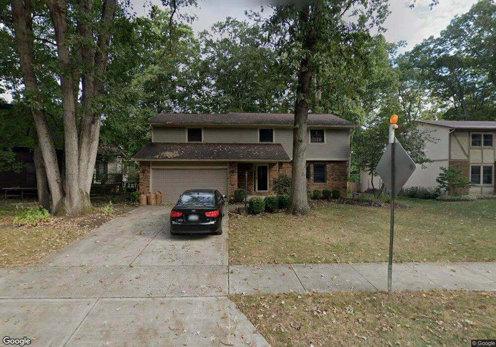
380 Liberty Ln Westerville, OH 43081
Estimated Value: $433,505 - $477,000
4
Beds
3
Baths
2,300
Sq Ft
$201/Sq Ft
Est. Value
About This Home
This home is located at 380 Liberty Ln, Westerville, OH 43081 and is currently estimated at $461,626, approximately $200 per square foot. 380 Liberty Ln is a home located in Franklin County with nearby schools including Mark Twain Elementary School, Walnut Springs Middle School, and Westerville-North High School.
Ownership History
Date
Name
Owned For
Owner Type
Purchase Details
Closed on
Jan 18, 2019
Sold by
Keener Kenneth E and Keener Julia S
Bought by
Light Mark and Light Erika
Current Estimated Value
Home Financials for this Owner
Home Financials are based on the most recent Mortgage that was taken out on this home.
Original Mortgage
$229,600
Outstanding Balance
$201,865
Interest Rate
4.6%
Mortgage Type
New Conventional
Estimated Equity
$259,761
Purchase Details
Closed on
Jul 3, 1995
Sold by
Dodrill Bradley C
Bought by
Keener Kenneth E and Keener Julia S
Home Financials for this Owner
Home Financials are based on the most recent Mortgage that was taken out on this home.
Original Mortgage
$89,000
Interest Rate
7.88%
Mortgage Type
New Conventional
Purchase Details
Closed on
Oct 1, 1986
Purchase Details
Closed on
Jan 1, 1984
Create a Home Valuation Report for This Property
The Home Valuation Report is an in-depth analysis detailing your home's value as well as a comparison with similar homes in the area
Home Values in the Area
Average Home Value in this Area
Purchase History
| Date | Buyer | Sale Price | Title Company |
|---|---|---|---|
| Light Mark | $287,000 | Title First Agency Inc | |
| Keener Kenneth E | $149,900 | -- | |
| -- | $108,000 | -- | |
| -- | $89,000 | -- |
Source: Public Records
Mortgage History
| Date | Status | Borrower | Loan Amount |
|---|---|---|---|
| Open | Light Mark | $229,600 | |
| Previous Owner | Keener Kenneth E | $89,000 |
Source: Public Records
Tax History Compared to Growth
Tax History
| Year | Tax Paid | Tax Assessment Tax Assessment Total Assessment is a certain percentage of the fair market value that is determined by local assessors to be the total taxable value of land and additions on the property. | Land | Improvement |
|---|---|---|---|---|
| 2024 | $6,801 | $119,670 | $31,430 | $88,240 |
| 2023 | $6,657 | $119,665 | $31,430 | $88,235 |
| 2022 | $6,587 | $90,410 | $21,770 | $68,640 |
| 2021 | $6,642 | $90,410 | $21,770 | $68,640 |
| 2020 | $6,623 | $90,410 | $21,770 | $68,640 |
| 2019 | $5,835 | $75,190 | $18,170 | $57,020 |
| 2018 | $5,387 | $75,190 | $18,170 | $57,020 |
| 2017 | $5,478 | $75,190 | $18,170 | $57,020 |
| 2016 | $5,218 | $62,240 | $18,380 | $43,860 |
| 2015 | $5,054 | $62,240 | $18,380 | $43,860 |
| 2014 | $5,058 | $62,240 | $18,380 | $43,860 |
| 2013 | $2,404 | $59,255 | $17,500 | $41,755 |
Source: Public Records
Map
Nearby Homes
- 969 Farrington Dr
- 613 Valley Wood Ct
- 371 Delaware Dr
- 461 Delaware Ct
- 994 Autumn Lake Ct
- 192 Buckeye Ct
- 182 Hillcrest Dr
- 1146 Forest Rise Dr
- 737 Autumn Branch Rd
- 750 Autumn Branch Rd
- 0 Cherrington Rd Unit 225023909
- 800 S Spring Rd
- 1368 Nutmeg Ct
- 768 Collingwood Dr
- 640 Brook Run Dr
- 1209 Chatham Ridge Rd
- 90 Spring Creek Dr
- 810 Applewood Ln
- 1260 Autumn Park Ct
- 1201 Wallean Dr
- 388 Liberty Ln
- 448 S Spring Rd
- 438 S Spring Rd
- 396 Liberty Ln
- 458 S Spring Rd
- 383 Liberty Ln
- 393 Liberty Ln
- 404 Liberty Ln
- 428 S Spring Rd
- 464 S Spring Rd
- 399 Liberty Ln
- 873 Babbington Ct
- 2418 S Spring Rd
- 451 S Spring Rd
- 445 S Spring Rd
- 412 Liberty Ln
- 441 S Spring Rd
- 409 Liberty Ln
- 432 Washington Square Ct
- 606 Valley Forge Ct