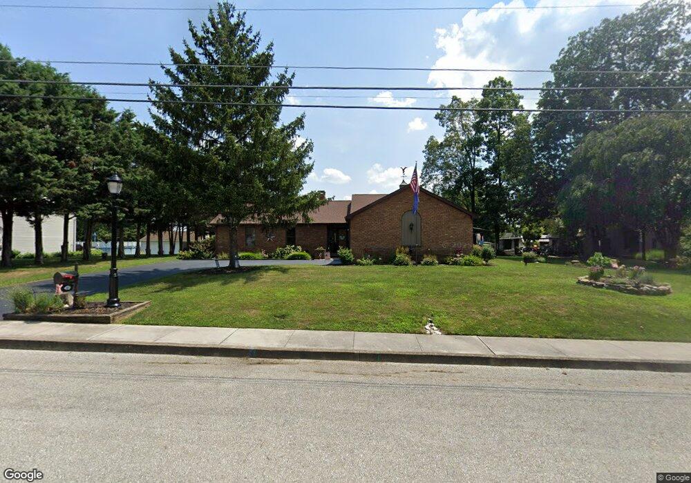
380 McSherry Woods Dr Littlestown, PA 17340
Estimated Value: $289,000 - $388,000
2
Beds
2
Baths
1,743
Sq Ft
$204/Sq Ft
Est. Value
About This Home
This home is located at 380 McSherry Woods Dr, Littlestown, PA 17340 and is currently estimated at $354,794, approximately $203 per square foot. 380 McSherry Woods Dr is a home located in Adams County with nearby schools including Rolling Acres El School, Maple Avenue Middle School, and Littlestown Senior High School.
Ownership History
Date
Name
Owned For
Owner Type
Purchase Details
Closed on
Nov 4, 2021
Sold by
Reynolds Randall V and Study Wendall R
Bought by
Kress Steven A and Kress Kelli L
Current Estimated Value
Purchase Details
Closed on
Oct 2, 1969
Bought by
Reynolds Victor L and Reynolds Marie S
Create a Home Valuation Report for This Property
The Home Valuation Report is an in-depth analysis detailing your home's value as well as a comparison with similar homes in the area
Home Values in the Area
Average Home Value in this Area
Purchase History
| Date | Buyer | Sale Price | Title Company |
|---|---|---|---|
| Kress Steven A | $320,000 | None Available | |
| Reynolds Victor L | $4,800 | -- |
Source: Public Records
Tax History Compared to Growth
Tax History
| Year | Tax Paid | Tax Assessment Tax Assessment Total Assessment is a certain percentage of the fair market value that is determined by local assessors to be the total taxable value of land and additions on the property. | Land | Improvement |
|---|---|---|---|---|
| 2025 | $6,246 | $271,700 | $49,100 | $222,600 |
| 2024 | $6,019 | $271,700 | $49,100 | $222,600 |
| 2023 | $5,786 | $271,700 | $49,100 | $222,600 |
| 2022 | $5,751 | $271,700 | $49,100 | $222,600 |
| 2021 | $5,580 | $271,700 | $49,100 | $222,600 |
| 2020 | $5,514 | $271,700 | $49,100 | $222,600 |
| 2019 | $3,264 | $271,700 | $49,100 | $222,600 |
| 2018 | $5,251 | $271,700 | $49,100 | $222,600 |
| 2017 | $5,116 | $271,700 | $49,100 | $222,600 |
| 2016 | -- | $271,700 | $49,100 | $222,600 |
| 2015 | -- | $271,700 | $49,100 | $222,600 |
| 2014 | -- | $271,700 | $49,100 | $222,600 |
Source: Public Records
Map
Nearby Homes
- 129 W King St
- 22 Rita Marie Ave
- 117 Charles St
- 115 Charles St
- 241 M St
- 61 E King St
- 106 E King St
- 140 Apple Grove Ln Unit 425
- 1024 Frederick Pike Unit 6
- 161 Stoners Cir
- 211 E King St
- 440 N Queen St
- 162 Newark St
- 58 Windsor Ct
- 48 Windsor Ct
- 41 Smith Cir
- 20c Locust Dr
- 0 Locust Dr Unit PAAD2015910
- 535 Lumber St
- 559 Lumber St
- 370 McSherry Woods Dr Unit 1
- 390 McSherry Woods Dr Unit 1
- 360 McSherry Woods Dr Unit 2
- 371 Lafayette Dr Unit 7
- 365 Lafayette Dr Unit 6
- 375 Lafayette Dr Unit 8
- 350 McSherry Woods Dr Unit 3
- 381 McSherry Woods Dr
- 400 McSherry Woods Dr Unit 2
- 371 McSherry Woods Dr Unit 2
- 355 Lafayette Dr Unit 5
- 361 McSherry Woods Dr Unit 3
- 401 McSherry Woods Dr
- 385 Lafayette Dr Unit 9
- 340 McSherry Woods Dr Unit 4
- 351 McSherry Woods Dr Unit 4
- 345 Lafayette Dr Unit 4
- 368 Lafayette Dr Unit 187
- 358 Lafayette Dr Unit 188
- 341 McSherry Woods Dr Unit 5