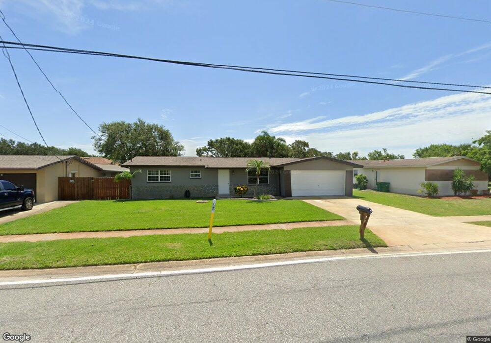
380 Newfound Harbor Dr Merritt Island, FL 32952
Estimated Value: $303,000 - $349,000
3
Beds
2
Baths
1,065
Sq Ft
$305/Sq Ft
Est. Value
About This Home
This home is located at 380 Newfound Harbor Dr, Merritt Island, FL 32952 and is currently estimated at $324,664, approximately $304 per square foot. 380 Newfound Harbor Dr is a home located in Brevard County with nearby schools including Tropical Elementary School, Thomas Jefferson Middle School, and Merritt Island High School.
Ownership History
Date
Name
Owned For
Owner Type
Purchase Details
Closed on
Aug 14, 1998
Sold by
Davis Sylvester Barry and Davis Kathleen M
Bought by
Casey Dennis P
Current Estimated Value
Home Financials for this Owner
Home Financials are based on the most recent Mortgage that was taken out on this home.
Original Mortgage
$69,700
Outstanding Balance
$14,528
Interest Rate
6.91%
Estimated Equity
$310,136
Create a Home Valuation Report for This Property
The Home Valuation Report is an in-depth analysis detailing your home's value as well as a comparison with similar homes in the area
Home Values in the Area
Average Home Value in this Area
Purchase History
| Date | Buyer | Sale Price | Title Company |
|---|---|---|---|
| Casey Dennis P | $71,900 | -- |
Source: Public Records
Mortgage History
| Date | Status | Borrower | Loan Amount |
|---|---|---|---|
| Open | Casey Dennis P | $69,700 |
Source: Public Records
Tax History Compared to Growth
Tax History
| Year | Tax Paid | Tax Assessment Tax Assessment Total Assessment is a certain percentage of the fair market value that is determined by local assessors to be the total taxable value of land and additions on the property. | Land | Improvement |
|---|---|---|---|---|
| 2025 | $1,335 | $109,470 | -- | -- |
| 2024 | $1,305 | $106,390 | -- | -- |
| 2023 | $1,305 | $103,300 | $0 | $0 |
| 2022 | $1,209 | $100,300 | $0 | $0 |
| 2021 | $1,226 | $97,380 | $0 | $0 |
| 2020 | $1,189 | $96,040 | $0 | $0 |
| 2019 | $1,127 | $93,890 | $0 | $0 |
| 2018 | $1,120 | $92,140 | $0 | $0 |
| 2017 | $1,117 | $90,250 | $0 | $0 |
| 2016 | $1,119 | $88,400 | $25,000 | $63,400 |
| 2015 | $873 | $67,720 | $20,000 | $47,720 |
| 2014 | $878 | $67,190 | $20,000 | $47,190 |
Source: Public Records
Map
Nearby Homes
- 365 Newfound Harbor Dr
- 335 Newfound Harbor Dr
- 1125 Newfound Harbor Dr
- 472 Newfound Harbor Dr
- 474 Newfound Harbor Dr
- 513 Summers Creek Dr
- 115 S Marjorie Ct
- 1784 N Merrimac Dr
- 50 N Lee Ct
- 200 S Banana River Dr Unit B-3
- 200 S Banana River Dr Unit C-18
- 200 S Banana River Dr Unit D-17
- 200 S Banana River Dr Unit H-12
- 200 S Banana River Dr Unit E1
- 200 S Banana River Dr Unit D-18
- 200 S Banana River Dr Unit F12
- 200 S Banana River Dr Unit A12
- 200 S Banana River Dr
- 200 S Banana River Dr Unit A18
- 550 S Banana River Dr Unit 101
- 370 Newfound Harbor Dr
- 390 Newfound Harbor Dr
- 403 Summers Creek Dr
- 360 Newfound Harbor Dr
- 393 Summers Creek Dr
- 413 Summers Creek Dr
- 410 Newfound Harbor Dr
- 375 Newfound Harbor Dr
- 395 Newfound Harbor Dr
- 383 Summers Creek Dr
- 350 Newfound Harbor Dr
- 420 Newfound Harbor Dr
- 423 Summers Creek Dr
- 373 Summers Creek Dr
- 420 Monitor St
- 432 Summers Creek Dr
- 355 Newfound Harbor Dr
- 340 Newfound Harbor Dr
- 430 Newfound Harbor Dr
- 433 Summers Creek Dr