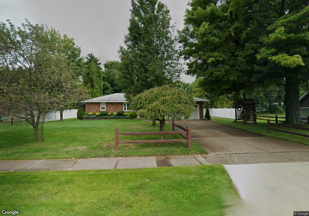
380 Residence St Conneaut, OH 44030
Estimated Value: $194,163 - $265,000
3
Beds
2
Baths
1,496
Sq Ft
$148/Sq Ft
Est. Value
About This Home
This home is located at 380 Residence St, Conneaut, OH 44030 and is currently estimated at $221,541, approximately $148 per square foot. 380 Residence St is a home located in Ashtabula County with nearby schools including Lakeshore Primary Elementary School, Gateway Elementary School, and Conneaut Middle School.
Ownership History
Date
Name
Owned For
Owner Type
Purchase Details
Closed on
Aug 21, 2008
Sold by
Jason Henry and Jason Doris E
Bought by
Palagyi Robert M
Current Estimated Value
Purchase Details
Closed on
Mar 24, 2004
Sold by
Jason Henry and Jason Doris E
Bought by
Jason Henry and Jason Doris E
Purchase Details
Closed on
Apr 13, 2000
Sold by
Colangelo Joseph C
Bought by
Jason Henry and Jason Doris
Create a Home Valuation Report for This Property
The Home Valuation Report is an in-depth analysis detailing your home's value as well as a comparison with similar homes in the area
Home Values in the Area
Average Home Value in this Area
Purchase History
| Date | Buyer | Sale Price | Title Company |
|---|---|---|---|
| Palagyi Robert M | $115,000 | Chicago Title | |
| Jason Henry | -- | -- | |
| Jason Henry | $97,000 | -- |
Source: Public Records
Tax History Compared to Growth
Tax History
| Year | Tax Paid | Tax Assessment Tax Assessment Total Assessment is a certain percentage of the fair market value that is determined by local assessors to be the total taxable value of land and additions on the property. | Land | Improvement |
|---|---|---|---|---|
| 2024 | $4,176 | $57,090 | $7,140 | $49,950 |
| 2023 | $2,223 | $57,090 | $7,140 | $49,950 |
| 2022 | $1,780 | $42,500 | $5,500 | $37,000 |
| 2021 | $1,811 | $42,500 | $5,500 | $37,000 |
| 2020 | $1,810 | $42,500 | $5,500 | $37,000 |
| 2019 | $1,630 | $38,580 | $5,290 | $33,290 |
| 2018 | $1,554 | $38,580 | $5,290 | $33,290 |
| 2017 | $1,551 | $38,580 | $5,290 | $33,290 |
| 2016 | $1,363 | $37,310 | $5,110 | $32,200 |
| 2015 | $1,377 | $37,310 | $5,110 | $32,200 |
| 2014 | $1,213 | $37,310 | $5,110 | $32,200 |
| 2013 | $1,214 | $38,160 | $4,800 | $33,360 |
Source: Public Records
Map
Nearby Homes
- 688 Grove St
- 703 Sandusky St
- 644 Mill St
- 716 Chestnut St
- 630 Mill St
- 770 Buffalo St
- 554 Sandusky St
- 794 Buffalo St
- 0 Chestnut St Unit 5120761
- 533 Mill St
- 536 Mill St
- 381 Bliss Ave
- 405 Bliss Ave
- 169 River St
- 281 Depot St
- 459 Mill St
- 448 Sandusky St Unit 450
- 429 Depot St
- 973 Buffalo St
- 179 Hayward Ave