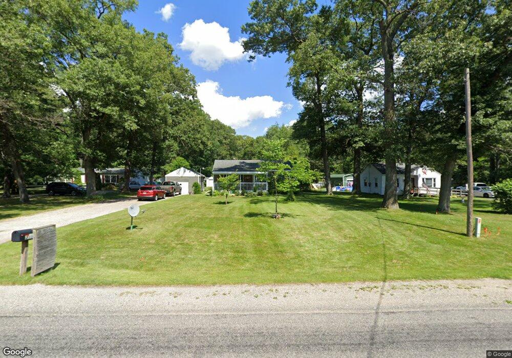
380 S Brooks Rd Muskegon, MI 49442
Estimated Value: $229,827 - $355,000
--
Bed
1
Bath
1,234
Sq Ft
$219/Sq Ft
Est. Value
About This Home
This home is located at 380 S Brooks Rd, Muskegon, MI 49442 and is currently estimated at $269,707, approximately $218 per square foot. 380 S Brooks Rd is a home located in Muskegon County with nearby schools including Oakridge Lower Elementary School, Oakridge Middle School, and Oakridge Upper Elementary School.
Ownership History
Date
Name
Owned For
Owner Type
Purchase Details
Closed on
Jun 26, 2017
Sold by
Wilbur Louis Earl and Wilbur Christine L
Bought by
Wilbur Louis Earl and Wilbur Christine L
Current Estimated Value
Purchase Details
Closed on
Dec 10, 2014
Sold by
Sorensen Carl W and Sorensen Frances
Bought by
Wilbur Louis Earl and Wilbur Christine L
Home Financials for this Owner
Home Financials are based on the most recent Mortgage that was taken out on this home.
Original Mortgage
$45,000
Outstanding Balance
$34,558
Interest Rate
3.99%
Mortgage Type
New Conventional
Estimated Equity
$235,149
Purchase Details
Closed on
Aug 20, 2013
Sold by
Shaft Little M and Wilbur Louis E
Bought by
Sorensen Carl W and Shaft Lillie M
Purchase Details
Closed on
Jan 9, 2013
Sold by
Sorensen Frances
Bought by
Shaft Lillie M and Wilbur Louis E
Create a Home Valuation Report for This Property
The Home Valuation Report is an in-depth analysis detailing your home's value as well as a comparison with similar homes in the area
Home Values in the Area
Average Home Value in this Area
Purchase History
| Date | Buyer | Sale Price | Title Company |
|---|---|---|---|
| Wilbur Louis Earl | -- | Attorney | |
| Wilbur Louis Earl | $50,000 | Midstate Title Agency Llc | |
| Sorensen Carl W | -- | None Available | |
| Shaft Lillie M | -- | None Available |
Source: Public Records
Mortgage History
| Date | Status | Borrower | Loan Amount |
|---|---|---|---|
| Open | Wilbur Louis Earl | $45,000 |
Source: Public Records
Tax History Compared to Growth
Tax History
| Year | Tax Paid | Tax Assessment Tax Assessment Total Assessment is a certain percentage of the fair market value that is determined by local assessors to be the total taxable value of land and additions on the property. | Land | Improvement |
|---|---|---|---|---|
| 2025 | $1,856 | $106,200 | $0 | $0 |
| 2024 | $607 | $99,800 | $0 | $0 |
| 2023 | $581 | $84,900 | $0 | $0 |
| 2022 | $1,731 | $72,600 | $0 | $0 |
| 2021 | $1,704 | $66,600 | $0 | $0 |
| 2020 | $1,674 | $63,400 | $0 | $0 |
| 2019 | $1,599 | $58,100 | $0 | $0 |
| 2018 | $1,556 | $50,400 | $0 | $0 |
| 2017 | $1,387 | $45,300 | $0 | $0 |
| 2016 | $408 | $37,400 | $0 | $0 |
| 2015 | -- | $34,500 | $0 | $0 |
| 2014 | -- | $34,400 | $0 | $0 |
| 2013 | -- | $33,600 | $0 | $0 |
Source: Public Records
Map
Nearby Homes
- 3861 Forest Edge Rd
- 170 S Brooks Rd
- 4228 Hall Rd
- 4493 Hall Rd
- 3884 E Apple Ave
- 110 Willow Wood Dr
- 4639 Pine Hollow Rd
- VL E Apple Ave Unit 17 & 18
- V/L E Apple Ave
- 261 Taffy Ln Unit 602
- 3059 E Apple Ave
- 306 N Brooks Rd
- VL N Brooks Rd
- 4825 Pullman Ave
- 4502 E Apple Ave
- 4927 Winesap Dr
- 556 S Macintosh Ln
- 587 Harvest Ln
- 3486 Polonaise Dr
- 3172 Hall Rd
- 392 S Brooks Rd
- 348 S Brooks Rd
- 383 S Brooks Rd
- 371 S Brooks Rd
- 410 S Brooks Rd
- 359 S Brooks Rd
- 337 S Brooks Rd
- 327 S Brooks Rd
- 411 S Brooks Rd
- 318 S Brooks Rd
- 4046 Tompkins Trail
- 450 S Brooks Rd
- 302 S Brooks Rd
- 307 S Brooks Rd
- 457 N Brooks Rd
- 312 Logger Ln
- 301 S Brooks Rd
- V/L S Barnes
- 0 S Brooks Rd Unit 71015037150
- 0 S Brooks Rd Unit 71013011655