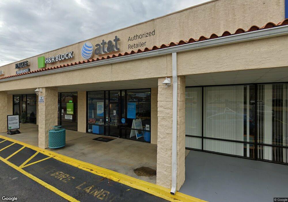
380 S Davis Rd Lagrange, GA 30241
Studio
2
Baths
12,600
Sq Ft
1.56
Acres
About This Home
This home is located at 380 S Davis Rd, Lagrange, GA 30241. 380 S Davis Rd is a home located in Troup County with nearby schools including Hollis Hand Elementary School, Franklin Forest Elementary School, and Ethel W. Kight Elementary School.
Ownership History
Date
Name
Owned For
Owner Type
Purchase Details
Closed on
May 22, 2024
Sold by
Reyes Jose
Bought by
Capital Partners Uc Llc
Home Financials for this Owner
Home Financials are based on the most recent Mortgage that was taken out on this home.
Original Mortgage
$2,600,000
Outstanding Balance
$2,537,338
Interest Rate
7.17%
Mortgage Type
New Conventional
Purchase Details
Closed on
Apr 21, 2023
Sold by
Reyes Jose
Bought by
Reyes Jose and Reyes Kathy
Purchase Details
Closed on
Jul 1, 1999
Sold by
Lowe Corp
Bought by
Reyes Jose
Purchase Details
Closed on
Dec 29, 1994
Sold by
Lowe Corp
Bought by
Lowe Corp
Purchase Details
Closed on
May 9, 1990
Sold by
Robert Morton
Bought by
Lowe Corp
Purchase Details
Closed on
Oct 27, 1989
Bought by
Robert Morton
Purchase Details
Closed on
Oct 26, 1982
Sold by
Richard Mallory
Purchase Details
Closed on
Dec 1, 1970
Sold by
Trippe
Bought by
Richard Mallory
Create a Home Valuation Report for This Property
The Home Valuation Report is an in-depth analysis detailing your home's value as well as a comparison with similar homes in the area
Purchase History
| Date | Buyer | Sale Price | Title Company |
|---|---|---|---|
| Capital Partners Uc Llc | $3,250,000 | -- | |
| Reyes Jose | -- | -- | |
| Reyes Jose | $230,000 | -- | |
| Lowe Corp | $240,000 | -- | |
| Lowe Corp | -- | -- | |
| Robert Morton | -- | -- | |
| -- | -- | -- | |
| Richard Mallory | -- | -- |
Source: Public Records
Mortgage History
| Date | Status | Borrower | Loan Amount |
|---|---|---|---|
| Open | Capital Partners Uc Llc | $2,600,000 |
Source: Public Records
Tax History Compared to Growth
Tax History
| Year | Tax Paid | Tax Assessment Tax Assessment Total Assessment is a certain percentage of the fair market value that is determined by local assessors to be the total taxable value of land and additions on the property. | Land | Improvement |
|---|---|---|---|---|
| 2025 | $18,380 | $684,440 | $187,200 | $497,240 |
| 2024 | $18,380 | $673,920 | $187,200 | $486,720 |
| 2023 | $11,839 | $434,080 | $124,800 | $309,280 |
| 2022 | $18,713 | $788,800 | $212,800 | $576,000 |
| 2021 | $20,744 | $687,800 | $212,800 | $475,000 |
| 2020 | $20,744 | $687,800 | $212,800 | $475,000 |
| 2019 | $20,418 | $677,000 | $212,800 | $464,200 |
| 2018 | $20,418 | $677,000 | $212,800 | $464,200 |
| 2017 | $20,418 | $677,000 | $212,800 | $464,200 |
| 2016 | $20,140 | $667,760 | $212,800 | $454,960 |
| 2015 | $20,173 | $667,760 | $212,800 | $454,960 |
| 2014 | $20,206 | $667,760 | $212,800 | $454,960 |
| 2013 | -- | $667,760 | $212,800 | $454,960 |
Source: Public Records
Map
Nearby Homes
- 113 Pine Cir
- 113 Mallory Dr
- 200 River Meadow Dr
- 234 River Meadow Dr
- 143 Shenandoah Ln
- 145 Shenandoah Ln
- 147 Shenandoah Ln
- 151 Shenandoah Ln
- 112 Shenandoah Ln Unit 29E
- 114 Shenandoah Ln
- 114 Shenandoah Ln Unit 30E
- 142 Shenandoah Ln
- 106 Shenandoah Ln Unit 26E
- 106 Shenandoah Ln
- 300 Glenhaven Dr Unit 1D
- 108 Shenandoah Ln
- 108 Shenandoah Ln Unit 27E
- 156 Pine Cir
- Hemingway Plan at Crossvine Village
- Mira Plan at Crossvine Village
- 207 Marchman Dr
- 0 S Davis Rd Unit 1.5 ACRES 20002535
- 0 S Davis Rd Unit 20078622
- 0 S Davis Rd Unit 8141219
- 0 S Davis Rd Unit 8825262
- 0 S Davis Rd Unit 1.8 Ac 8756474
- 208 Marchman Dr
- 200 Johnston St
- 203 Marchman Dr
- 204 Marchman Dr
- 204 Harmon Rd
- 205 Johnston St
- 203 Johnston St
- 201 Johnston St
- 300 Harmon Rd
- 1495 Lafayette Pkwy
- 302 Harmon Rd
- 1423 Lafayette Pkwy
- 301 Harmon Rd
- 206 Millwood Ct
