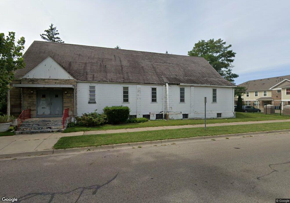
380 S Mccord St Benton Harbor, MI 49022
Estimated Value: $29,387
--
Bed
--
Bath
1,225
Sq Ft
$24/Sq Ft
Est. Value
About This Home
This home is located at 380 S Mccord St, Benton Harbor, MI 49022 and is currently estimated at $29,387, approximately $23 per square foot. 380 S Mccord St is a home located in Berrien County with nearby schools including Fair Plain Middle School, Benton Harbor High School, and Benton Harbor Charter School Academy.
Ownership History
Date
Name
Owned For
Owner Type
Purchase Details
Closed on
May 21, 2021
Sold by
Saint Paul Methodist Episcopal Churchs
Bought by
Greater Faith Center Church Inc
Current Estimated Value
Home Financials for this Owner
Home Financials are based on the most recent Mortgage that was taken out on this home.
Original Mortgage
$5,000
Interest Rate
3.1%
Mortgage Type
Purchase Money Mortgage
Create a Home Valuation Report for This Property
The Home Valuation Report is an in-depth analysis detailing your home's value as well as a comparison with similar homes in the area
Home Values in the Area
Average Home Value in this Area
Purchase History
| Date | Buyer | Sale Price | Title Company |
|---|---|---|---|
| Greater Faith Center Church Inc | $20,000 | Chicago Title Of Mi Inc |
Source: Public Records
Mortgage History
| Date | Status | Borrower | Loan Amount |
|---|---|---|---|
| Closed | Greater Faith Center Church Inc | $5,000 |
Source: Public Records
Tax History Compared to Growth
Tax History
| Year | Tax Paid | Tax Assessment Tax Assessment Total Assessment is a certain percentage of the fair market value that is determined by local assessors to be the total taxable value of land and additions on the property. | Land | Improvement |
|---|---|---|---|---|
| 2025 | -- | $0 | $0 | $0 |
| 2024 | -- | $0 | $0 | $0 |
| 2023 | -- | $0 | $0 | $0 |
| 2022 | $0 | $0 | $0 | $0 |
| 2021 | $103 | $0 | $0 | $0 |
| 2020 | $0 | $0 | $0 | $0 |
| 2019 | $0 | $0 | $0 | $0 |
| 2018 | $0 | $0 | $0 | $0 |
| 2017 | $0 | $0 | $0 | $0 |
| 2016 | $0 | $0 | $0 | $0 |
| 2015 | -- | $0 | $0 | $0 |
| 2014 | -- | $0 | $0 | $0 |
Source: Public Records
Map
Nearby Homes
- 419 Packard St
- 710 Buss Ave
- 806 Pitkins Ave
- 696 Highland Ave
- 416 E Britain Ave
- 391 Pipestone St
- 688 S Fair Ave
- 992 Highland Ave
- 378 Pipestone St
- 137 Cornelia St
- 363 Brunson Ave
- 309 High St
- 730 Superior St
- 238 Pine St
- 6525 Territorial Rd
- 1069 E Main St
- 255 High St
- 614 Pavone St
- 234 Walnut St
- 0 V/L E Empire Ave
- 725 Mcguigan Ave
- 757 Mcguigan Ave
- 717 Mcguigan Ave
- 740 Mcguigan Ave
- 765 Mcguigan Ave
- 407 Packard St
- 754 E Vineyard Ave
- 773 Mcguigan Ave
- 711 Mcguigan Ave
- 703 Mcguigan Ave
- 400 Packard St
- 411 Packard St
- 781 Mcguigan Ave
- 700 Mcguigan Ave
- 772 E Vineyard Ave
- 687 Mcguigan Ave
- 780 E Vineyard Ave
- 325 S Mccord St
- 785 Mcguigan Ave
- 794 E Vineyard Ave