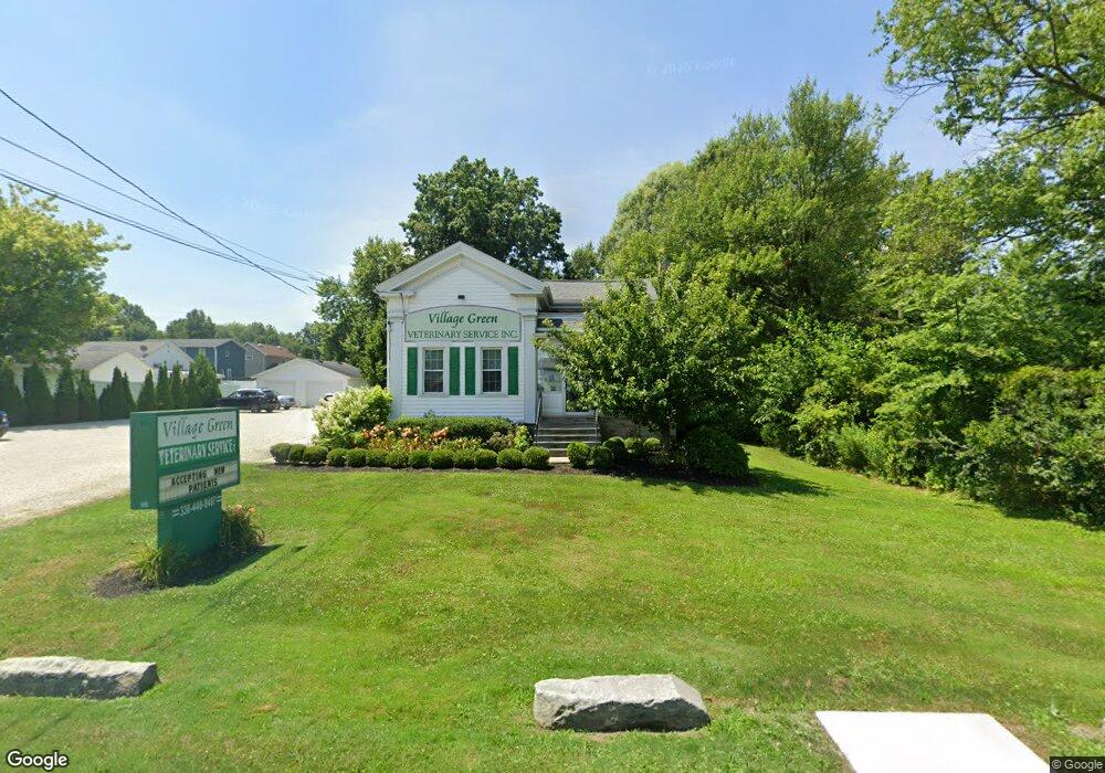
380 State Route 7 SE Brookfield, OH 44403
2
Beds
1
Bath
1,729
Sq Ft
0.75
Acres
About This Home
This home is located at 380 State Route 7 SE, Brookfield, OH 44403. 380 State Route 7 SE is a home located in Trumbull County with nearby schools including Brookfield Elementary School, Brookfield Middle School, and Brookfield High School.
Ownership History
Date
Name
Owned For
Owner Type
Purchase Details
Closed on
May 2, 2024
Sold by
Kilar Properties Llc
Bought by
Premium Pet Hospitals Inc
Purchase Details
Closed on
Jun 15, 2011
Sold by
Trunick Gail D
Bought by
Kilar Properties Llc
Home Financials for this Owner
Home Financials are based on the most recent Mortgage that was taken out on this home.
Original Mortgage
$264,000
Interest Rate
4.75%
Mortgage Type
Future Advance Clause Open End Mortgage
Purchase Details
Closed on
Jan 1, 1990
Bought by
Robert Robert E and Robert S
Create a Home Valuation Report for This Property
The Home Valuation Report is an in-depth analysis detailing your home's value as well as a comparison with similar homes in the area
Home Values in the Area
Average Home Value in this Area
Purchase History
| Date | Buyer | Sale Price | Title Company |
|---|---|---|---|
| Premium Pet Hospitals Inc | $130,000 | Talon Title | |
| Kilar Properties Llc | $80,000 | Attorney | |
| Robert Robert E | -- | -- |
Source: Public Records
Mortgage History
| Date | Status | Borrower | Loan Amount |
|---|---|---|---|
| Previous Owner | Kilar Properties Llc | $264,000 |
Source: Public Records
Tax History Compared to Growth
Tax History
| Year | Tax Paid | Tax Assessment Tax Assessment Total Assessment is a certain percentage of the fair market value that is determined by local assessors to be the total taxable value of land and additions on the property. | Land | Improvement |
|---|---|---|---|---|
| 2024 | $2,954 | $41,930 | $8,610 | $33,320 |
| 2023 | $2,954 | $41,930 | $8,610 | $33,320 |
| 2022 | $2,621 | $31,440 | $7,180 | $24,260 |
| 2021 | $2,505 | $31,440 | $7,180 | $24,260 |
| 2020 | $2,504 | $31,440 | $7,180 | $24,260 |
| 2019 | $2,531 | $31,440 | $7,180 | $24,260 |
| 2018 | $2,520 | $31,440 | $7,180 | $24,260 |
| 2017 | $2,494 | $31,440 | $7,180 | $24,260 |
| 2016 | $2,538 | $31,510 | $7,180 | $24,330 |
| 2015 | $2,535 | $31,510 | $7,180 | $24,330 |
| 2014 | $2,524 | $31,510 | $7,180 | $24,330 |
| 2013 | $2,509 | $31,510 | $7,180 | $24,330 |
Source: Public Records
Map
Nearby Homes
- 7086 Warren Sharon Rd
- 7085 Sunnydell Dr
- 7290 Lee Rd NE
- 209 Wyngate Dr
- 887 State Route 7 SE
- 1212 State Route 7 NE
- 6855 Stewart Sharon Rd
- 928 Bedford Rd
- 7182 Stewart Sharon Rd
- 6130 Warren Sharon Rd
- 7440 Stewart Sharon Rd
- 872 Yankee Run Rd
- 365 Brookfield Ave
- 1370 Custer Orangeville Rd
- 0 Albright McKay Rd NE
- 1354 Stevenson Rd
- 609 Syme St
- 6976 White Oak Dr
- 545 & 625 Davis St
- 766 S Irvine Ave
- 368 State Route 7 SE
- 394 State Route 7 SE
- 254111 Ohio 7
- 6901 Grove St
- 6897 Grove St
- 358 State Route 7 SE
- 6891 Grove St
- 6892 Warren Sharon Rd
- 379 State Route 7 SE
- 369 State Route 7 SE
- 6888 Warren Sharon Rd
- 0 Warren Sharon Rd
- 0 Warren Sharon Rd Unit 3821857
- 0 Warren Sharon Rd Unit 4049046
- 363 State Route 7 SE
- 6888 Grove St
- 6874 Warren Sharon Rd
- 6963 Warren Sharon Rd
- 6949 Warren Sharon Rd
- 6974 Grove St