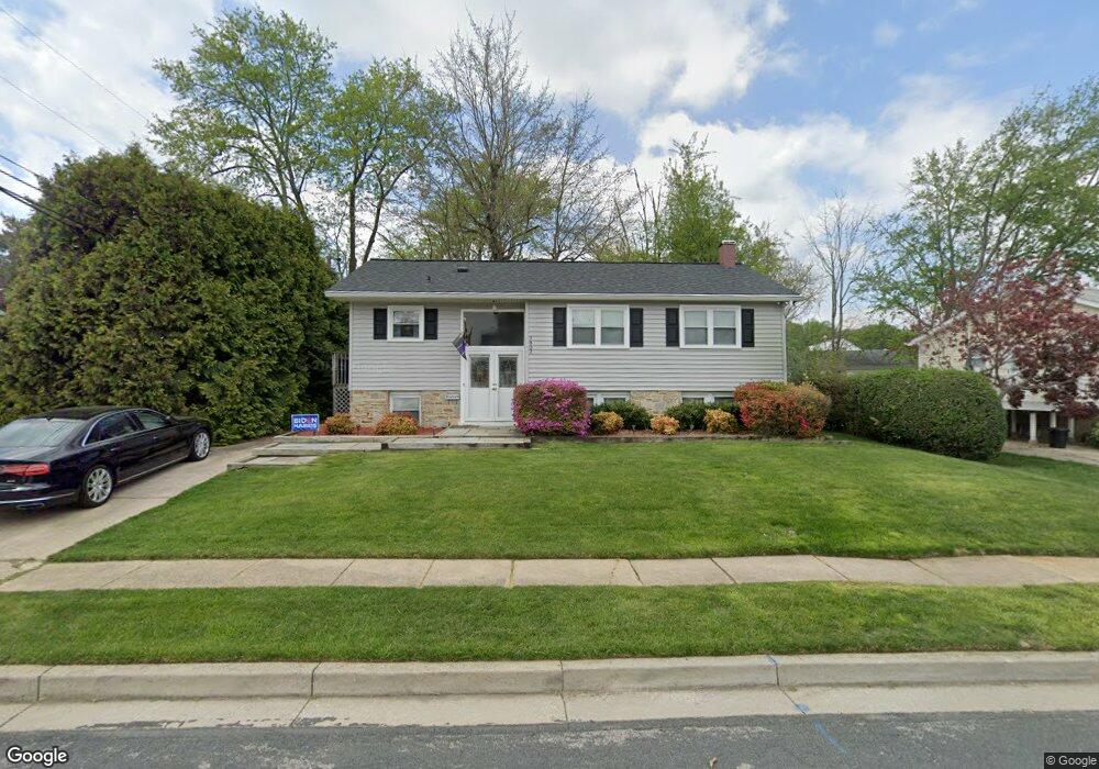
3802 Cassandra Rd Randallstown, MD 21133
Estimated Value: $321,000 - $371,491
--
Bed
3
Baths
1,075
Sq Ft
$325/Sq Ft
Est. Value
About This Home
This home is located at 3802 Cassandra Rd, Randallstown, MD 21133 and is currently estimated at $349,873, approximately $325 per square foot. 3802 Cassandra Rd is a home located in Baltimore County with nearby schools including Randallstown Elementary School, Deer Park Middle Magnet School, and Randallstown High School.
Ownership History
Date
Name
Owned For
Owner Type
Purchase Details
Closed on
Oct 7, 2003
Sold by
Koonce Karen Rose
Bought by
Thompson Joseph G
Current Estimated Value
Purchase Details
Closed on
Oct 28, 1996
Sold by
Vinci Agostino Joseph
Bought by
Koonce Karen Rose
Purchase Details
Closed on
Jan 16, 1987
Sold by
Jednorski Charles A
Bought by
Vinci Agostino Joseph
Create a Home Valuation Report for This Property
The Home Valuation Report is an in-depth analysis detailing your home's value as well as a comparison with similar homes in the area
Home Values in the Area
Average Home Value in this Area
Purchase History
| Date | Buyer | Sale Price | Title Company |
|---|---|---|---|
| Thompson Joseph G | $165,000 | -- | |
| Koonce Karen Rose | $121,900 | -- | |
| Vinci Agostino Joseph | $78,000 | -- |
Source: Public Records
Tax History Compared to Growth
Tax History
| Year | Tax Paid | Tax Assessment Tax Assessment Total Assessment is a certain percentage of the fair market value that is determined by local assessors to be the total taxable value of land and additions on the property. | Land | Improvement |
|---|---|---|---|---|
| 2025 | $3,330 | $265,600 | -- | -- |
| 2024 | $3,330 | $238,600 | $73,500 | $165,100 |
| 2023 | $1,607 | $227,367 | $0 | $0 |
| 2022 | $3,085 | $216,133 | $0 | $0 |
| 2021 | $3,032 | $204,900 | $55,500 | $149,400 |
| 2020 | $3,032 | $201,767 | $0 | $0 |
| 2019 | $2,859 | $198,633 | $0 | $0 |
| 2018 | $2,750 | $195,500 | $55,500 | $140,000 |
| 2017 | $2,589 | $180,600 | $0 | $0 |
| 2016 | $2,462 | $165,700 | $0 | $0 |
| 2015 | $2,462 | $150,800 | $0 | $0 |
| 2014 | $2,462 | $150,800 | $0 | $0 |
Source: Public Records
Map
Nearby Homes
- 3816 Cassandra Rd
- 3805 Terka Cir
- 3854 Terka Cir
- 9112 Meadow Heights Rd
- 9202 Samoset Rd
- 9406 Painted Tree Dr
- 9317 Edway Cir
- 9208A Liberty Rd
- 9012 Allenswood Rd
- 9210 Liberty Rd
- 3705 Allenswood Ct
- 1205/99 Winands Rd
- 28 Sunrise Ct
- 8908 Meadow Heights Rd
- 4135 Brookside Oaks
- 3506 Bayer Ave
- 4108 Brown Bark Cir
- 9401 Summer Squal Dr
- 9519 Branchleigh Rd
- 9302 Silver Charm Dr
- 3804 Cassandra Rd
- 9202 Allenswood Rd
- 9200 Allenswood Rd
- 9203 Turnbull Rd
- 9204 Allenswood Rd
- 3805 Cassandra Rd
- 3807 Cassandra Rd
- 3803 Cassandra Rd
- 9206 Allenswood Rd
- 9205 Turnbull Rd
- 3809 Cassandra Rd
- 3801 Cassandra Rd
- 9200 Turnbull Rd
- 9208 Allenswood Rd
- 3811 Cassandra Rd
- 9205 Allenswood Rd
- 9203 Allenswood Rd
- 9202 Turnbull Rd
- 9207 Turnbull Rd
- 9207 Allenswood Rd