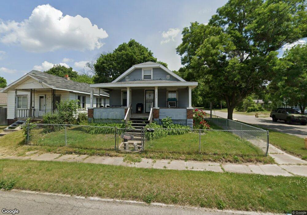
3802 N Franklin Ave Flint, MI 48506
Eastside NeighborhoodEstimated Value: $28,000 - $57,000
3
Beds
1
Bath
852
Sq Ft
$55/Sq Ft
Est. Value
About This Home
This home is located at 3802 N Franklin Ave, Flint, MI 48506 and is currently estimated at $46,634, approximately $54 per square foot. 3802 N Franklin Ave is a home located in Genesee County with nearby schools including Brownell STEM Academy, Richfield Public School Academy, and Richfield Early Learning Center.
Ownership History
Date
Name
Owned For
Owner Type
Purchase Details
Closed on
May 2, 2025
Sold by
Marchbanks Michael W
Bought by
Vaughn Deondrick Duan
Current Estimated Value
Home Financials for this Owner
Home Financials are based on the most recent Mortgage that was taken out on this home.
Original Mortgage
$53,350
Outstanding Balance
$53,113
Interest Rate
6.65%
Mortgage Type
New Conventional
Estimated Equity
-$6,479
Purchase Details
Closed on
Aug 28, 2000
Sold by
Brewer Leona
Bought by
Marchbanks Michael W and Marchbanks Karen D
Create a Home Valuation Report for This Property
The Home Valuation Report is an in-depth analysis detailing your home's value as well as a comparison with similar homes in the area
Home Values in the Area
Average Home Value in this Area
Purchase History
| Date | Buyer | Sale Price | Title Company |
|---|---|---|---|
| Vaughn Deondrick Duan | $55,000 | None Listed On Document | |
| Marchbanks Michael W | $24,000 | Sargents Abstract & Title Co |
Source: Public Records
Mortgage History
| Date | Status | Borrower | Loan Amount |
|---|---|---|---|
| Open | Vaughn Deondrick Duan | $53,350 |
Source: Public Records
Tax History Compared to Growth
Tax History
| Year | Tax Paid | Tax Assessment Tax Assessment Total Assessment is a certain percentage of the fair market value that is determined by local assessors to be the total taxable value of land and additions on the property. | Land | Improvement |
|---|---|---|---|---|
| 2025 | $954 | $23,400 | $0 | $0 |
| 2024 | $887 | $19,500 | $0 | $0 |
| 2023 | $871 | $14,200 | $0 | $0 |
| 2022 | $0 | $10,800 | $0 | $0 |
| 2021 | $881 | $10,300 | $0 | $0 |
| 2020 | $815 | $9,900 | $0 | $0 |
| 2019 | $800 | $9,100 | $0 | $0 |
| 2018 | $780 | $8,000 | $0 | $0 |
| 2017 | $1,020 | $0 | $0 | $0 |
| 2016 | $1,013 | $0 | $0 | $0 |
| 2015 | -- | $0 | $0 | $0 |
| 2014 | -- | $0 | $0 | $0 |
Source: Public Records
Map
Nearby Homes
- 1805 Montana Ave
- 1623 Montana Ave
- 2310 Thom St
- 1733 Oklahoma Ave
- 1546 Colorado Ave
- 3912 Western Rd
- 1526 Montana Ave
- 2435 Oklahoma Ave
- 1518 Leith St
- 2935 Richfield Rd
- 1721 New York Ave
- 2506 Arlington Ave
- 1629 New York Ave
- 1445 Maryland Ave
- 1622 New York Ave
- 3710 Branch Rd
- 3702 Branch Rd
- 1449 New York Ave
- 2225 Arlington Ave
- 4923 Alpha Way
- 3808 N Franklin Ave
- 1905 Knapman St
- 3810 N Franklin Ave
- 3718 N Franklin Ave
- 3814 N Franklin Ave
- 1906 Knapman St
- 1919 Knapman St
- 1916 Colon St
- 1918 Knapman St
- 1924 Colon St
- 1913 Marshall St
- 1928 Colon St
- 3902 N Franklin Ave
- 1919 Marshall St
- 2005 Knapman St
- 2002 Knapman St
- 2010 Colon St
- 1923 Marshall St
- 1915 Colon St
- 3906 N Franklin Ave