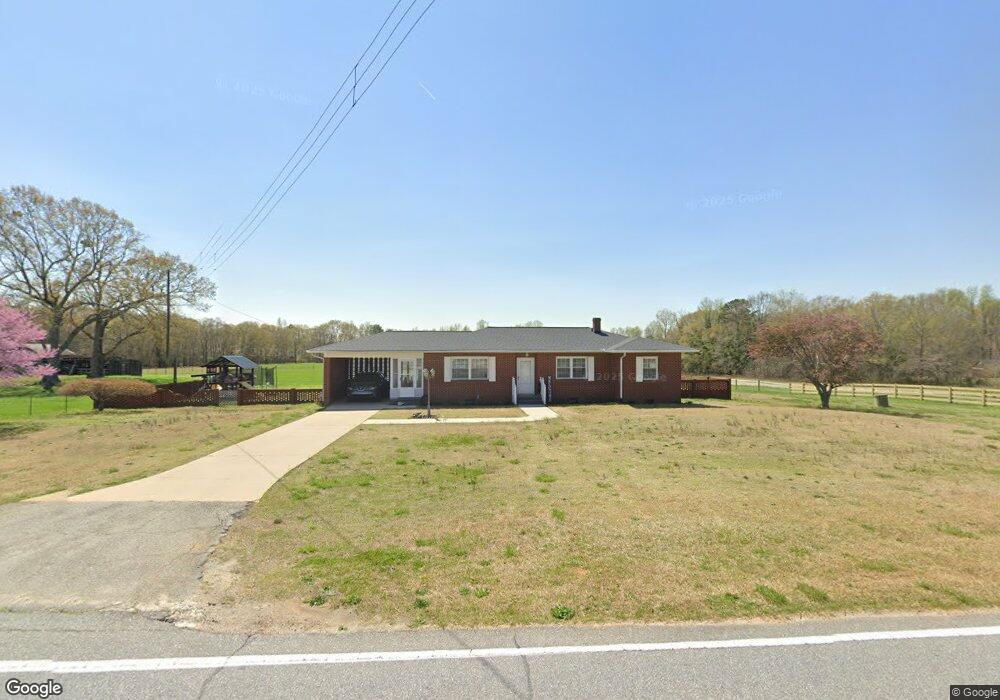
3802 Shady Grove Rd Unit Tract 3 Honea Path, SC 29654
Estimated Value: $255,000 - $554,538
--
Bed
--
Bath
1,307
Sq Ft
$295/Sq Ft
Est. Value
About This Home
This home is located at 3802 Shady Grove Rd Unit Tract 3, Honea Path, SC 29654 and is currently estimated at $385,885, approximately $295 per square foot. 3802 Shady Grove Rd Unit Tract 3 is a home located in Anderson County with nearby schools including Belton Honea Path High School.
Ownership History
Date
Name
Owned For
Owner Type
Purchase Details
Closed on
Dec 20, 2023
Sold by
Black David W and Black Greg L
Bought by
Shady Grove Land Co Llc
Current Estimated Value
Home Financials for this Owner
Home Financials are based on the most recent Mortgage that was taken out on this home.
Original Mortgage
$835,000
Interest Rate
7.5%
Mortgage Type
Construction
Purchase Details
Closed on
Dec 22, 2008
Sold by
Black David W and Black Barbara
Bought by
Black Greg L
Purchase Details
Closed on
Dec 10, 2008
Sold by
Black David W and Black David Warren
Bought by
Black David W and Black Barbara
Create a Home Valuation Report for This Property
The Home Valuation Report is an in-depth analysis detailing your home's value as well as a comparison with similar homes in the area
Home Values in the Area
Average Home Value in this Area
Purchase History
| Date | Buyer | Sale Price | Title Company |
|---|---|---|---|
| Shady Grove Land Co Llc | $772,480 | None Listed On Document | |
| Shady Grove Land Co Llc | $772,480 | None Listed On Document | |
| Black Greg L | -- | -- | |
| Black David W | -- | -- |
Source: Public Records
Mortgage History
| Date | Status | Borrower | Loan Amount |
|---|---|---|---|
| Previous Owner | Shady Grove Land Co Llc | $835,000 |
Source: Public Records
Tax History Compared to Growth
Tax History
| Year | Tax Paid | Tax Assessment Tax Assessment Total Assessment is a certain percentage of the fair market value that is determined by local assessors to be the total taxable value of land and additions on the property. | Land | Improvement |
|---|---|---|---|---|
| 2024 | $1,804 | $11,980 | $650 | $11,330 |
| 2023 | $4,361 | $4,400 | $290 | $4,110 |
| 2022 | $258 | $4,400 | $290 | $4,110 |
| 2021 | $208 | $3,930 | $290 | $3,640 |
| 2020 | $210 | $3,930 | $290 | $3,640 |
| 2019 | $207 | $3,930 | $290 | $3,640 |
| 2018 | $210 | $3,930 | $290 | $3,640 |
| 2017 | -- | $3,930 | $290 | $3,640 |
| 2016 | $164 | $3,730 | $320 | $3,410 |
| 2015 | $175 | $3,730 | $320 | $3,410 |
| 2014 | $177 | $3,730 | $320 | $3,410 |
Source: Public Records
Map
Nearby Homes
- 723 723 Holliday Dam Rd
- 723 Holliday Dam Rd
- 800 Holliday Dam Rd
- 09 Holliday Dam Rd
- 011 Holliday Dam Rd
- 010 Holliday Dam Rd
- 1624 Taylor Rd
- 00 Corner Rd
- TR 4 Corner Rd
- 00 Holliday Dam Rd
- 43 Joe Burton Rd
- 01 Taylor Rd
- 0 Taylor Rd Unit 25536448
- 6 State Road S-4-937
- 013 Taylor Rd
- 350 Blue Willow Cir
- 111 Susan Ave
- 11900 Belton Honea Path Hwy
- 00 French Rd
- 105 Sally Reed Rd
- 3802 Shady Grove Rd Unit Tract 2
- 3802 Shady Grove Rd
- 3812 Shady Grove Rd
- 3801 Shady Grove Rd
- 3715 Shady Grove Rd
- 3716 Shady Grove Rd
- 715 Holliday Dam Rd
- 0 Shady Grove Rd
- 706 Holliday Dam Rd
- 700 Holliday Dam Rd
- 3900 Shady Grove Rd
- 3903 Shady Grove Rd
- 3904 Shady Grove Rd
- 3921 Shady Grove Rd
- 315 Vaughn Rd
- 3917 Shady Grove Rd
- 3615 Shady Grove Rd
- 726 Holliday Dam Rd
- 731 Holliday Dam Rd
- 309 Vaughn Rd