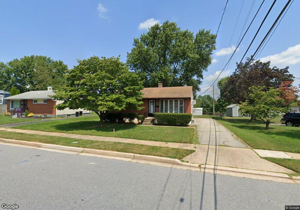
3803 Fernside Rd Randallstown, MD 21133
Estimated Value: $217,000 - $293,000
--
Bed
2
Baths
936
Sq Ft
$275/Sq Ft
Est. Value
About This Home
This home is located at 3803 Fernside Rd, Randallstown, MD 21133 and is currently estimated at $257,528, approximately $275 per square foot. 3803 Fernside Rd is a home located in Baltimore County with nearby schools including Church Lane Elementary Technology School, Northwest Academy of Health Sciences, and Randallstown High School.
Ownership History
Date
Name
Owned For
Owner Type
Purchase Details
Closed on
Dec 22, 2021
Sold by
Bereshis Holdings Llc
Bought by
Baltimore Sfr Portfolio 1A Llc
Current Estimated Value
Purchase Details
Closed on
Dec 21, 2015
Sold by
4Th Baltimore Acqusition Llc
Bought by
Baltimore Propertys Group Llc
Purchase Details
Closed on
Apr 22, 2011
Sold by
Richards William R
Bought by
4Th Baltimore Acquisition Llc
Purchase Details
Closed on
Sep 28, 2010
Sold by
Richards William R
Bought by
4Th Baltimore Acquisition Llc
Purchase Details
Closed on
Jul 10, 1993
Sold by
Lee George W
Bought by
Richards William R
Create a Home Valuation Report for This Property
The Home Valuation Report is an in-depth analysis detailing your home's value as well as a comparison with similar homes in the area
Home Values in the Area
Average Home Value in this Area
Purchase History
| Date | Buyer | Sale Price | Title Company |
|---|---|---|---|
| Baltimore Sfr Portfolio 1A Llc | $34,667,384 | Lakeside Title | |
| Baltimore Propertys Group Llc | -- | Attorney | |
| 4Th Baltimore Acquisition Llc | $90,000 | -- | |
| 4Th Baltimore Acquisition Llc | $90,000 | -- | |
| Richards William R | $91,300 | -- |
Source: Public Records
Tax History Compared to Growth
Tax History
| Year | Tax Paid | Tax Assessment Tax Assessment Total Assessment is a certain percentage of the fair market value that is determined by local assessors to be the total taxable value of land and additions on the property. | Land | Improvement |
|---|---|---|---|---|
| 2025 | $3,128 | $229,733 | -- | -- |
| 2024 | $3,128 | $218,700 | $75,200 | $143,500 |
| 2023 | $2,952 | $203,867 | $0 | $0 |
| 2022 | $2,715 | $189,033 | $0 | $0 |
| 2021 | $2,421 | $174,200 | $57,200 | $117,000 |
| 2020 | $2,421 | $163,633 | $0 | $0 |
| 2019 | $2,256 | $153,067 | $0 | $0 |
| 2018 | $2,085 | $142,500 | $57,200 | $85,300 |
| 2017 | $2,001 | $136,467 | $0 | $0 |
| 2016 | $2,622 | $138,467 | $0 | $0 |
| 2015 | $2,622 | $124,400 | $0 | $0 |
| 2014 | $2,622 | $124,400 | $0 | $0 |
Source: Public Records
Map
Nearby Homes
- 8513 Charlton Rd
- 8541 Lucerne Rd
- 3659 Brenbrook Dr
- 4934 Old Court Rd
- 8808 Church Ln
- 4818 Oakland Park Rd
- 4816 Valley Forge Rd
- 8403 Downey Dale Dr
- 3646 Clifmar Rd
- 4812 Valley Forge Rd
- 8829 Sigrid Rd
- 4001 Starbrook Rd
- 3714 Stoneybrook Rd
- 8400 Liberty Rd
- 8422 Merryview Dr
- 3312 Lauri Rd
- 8908 Meadow Heights Rd
- 3907 Roxanne Rd
- 4105 Winterhazel Rd
- 3414 Courtleigh Dr
- 3805 Fernside Rd
- 3806 Elmcroft Rd
- 3808 Elmcroft Rd
- 3807 Fernside Rd
- 3803 Dovedale Ct
- 3801 Dovedale Ct
- 3810 Elmcroft Rd
- 3809 Fernside Rd
- 3800 Fernside Rd
- 3805 Dovedale Ct
- 3802 Fernside Rd
- 3804 Fernside Rd
- 3812 Elmcroft Rd
- 3800 Dovedale Ct
- 3811 Fernside Rd
- 3806 Fernside Rd
- 3807 Dovedale Ct
- 3800 Brownhill Rd
- 3802 Elmcroft Rd
- 3808 Fernside Rd