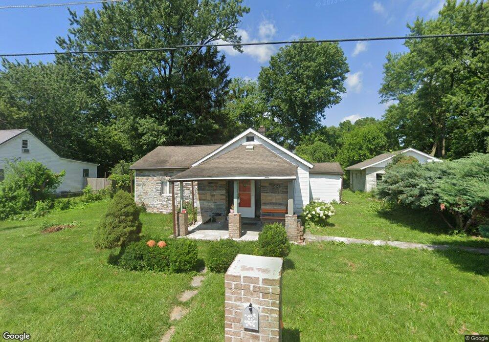
3803 Strack Rd Columbus, OH 43207
Marion Franklin NeighborhoodEstimated Value: $196,000 - $262,000
3
Beds
1
Bath
1,373
Sq Ft
$163/Sq Ft
Est. Value
About This Home
This home is located at 3803 Strack Rd, Columbus, OH 43207 and is currently estimated at $224,439, approximately $163 per square foot. 3803 Strack Rd is a home located in Franklin County with nearby schools including Groveport Madison High School, South Columbus Preparatory Academy at Southfield, and South Scioto Academy.
Ownership History
Date
Name
Owned For
Owner Type
Purchase Details
Closed on
Apr 9, 2004
Sold by
Garren William T and Garren Joan M
Bought by
Perez Galdino and Perez De Ponce Maria B
Current Estimated Value
Home Financials for this Owner
Home Financials are based on the most recent Mortgage that was taken out on this home.
Original Mortgage
$47,700
Outstanding Balance
$27,455
Interest Rate
9.5%
Mortgage Type
Purchase Money Mortgage
Estimated Equity
$196,984
Purchase Details
Closed on
Sep 12, 1995
Sold by
Estep William
Bought by
Garren William T and Garren Joan M
Create a Home Valuation Report for This Property
The Home Valuation Report is an in-depth analysis detailing your home's value as well as a comparison with similar homes in the area
Home Values in the Area
Average Home Value in this Area
Purchase History
| Date | Buyer | Sale Price | Title Company |
|---|---|---|---|
| Perez Galdino | $47,700 | -- | |
| Garren William T | $28,500 | -- |
Source: Public Records
Mortgage History
| Date | Status | Borrower | Loan Amount |
|---|---|---|---|
| Open | Perez Galdino | $47,700 |
Source: Public Records
Tax History
| Year | Tax Paid | Tax Assessment Tax Assessment Total Assessment is a certain percentage of the fair market value that is determined by local assessors to be the total taxable value of land and additions on the property. | Land | Improvement |
|---|---|---|---|---|
| 2025 | $4,962 | $68,850 | $31,850 | $37,000 |
| 2024 | $4,962 | $68,850 | $31,850 | $37,000 |
| 2023 | $2,892 | $68,845 | $31,850 | $36,995 |
| 2022 | $2,797 | $35,250 | $12,810 | $22,440 |
| 2021 | $2,069 | $35,250 | $12,810 | $22,440 |
| 2020 | $1,837 | $35,250 | $12,810 | $22,440 |
| 2019 | $1,832 | $31,540 | $11,170 | $20,370 |
| 2018 | $1,467 | $31,540 | $11,170 | $20,370 |
| 2017 | $1,561 | $30,880 | $11,170 | $19,710 |
| 2016 | $1,300 | $17,470 | $6,020 | $11,450 |
| 2015 | $1,106 | $17,470 | $6,020 | $11,450 |
| 2014 | $1,119 | $17,470 | $6,020 | $11,450 |
| 2013 | $493 | $18,375 | $6,335 | $12,040 |
Source: Public Records
Map
Nearby Homes
- 4310 Charlotte Rd
- 3768 Pendent Ln
- 3847 Pendent Ln
- 1977 Poplar St
- 2366 E Howard Rd
- 3025 Representation Terrace Unit 219
- 3548 Chantilly St
- 2291 E Howard Rd
- 2047 Bridlewood Blvd Unit 2049
- 2637 Four Seasons Dr Unit 639
- 4167 Bartle Dr Unit 169
- 2057 Bridlewood Blvd Unit 2059
- 2647 Four Seasons Dr Unit 649
- 4142 Oldentime Ct
- 1433 Venice Dr
- 4587 Sandridge St
- 3551 Groveport Rd
- 1583 Metcalfe Ave
- 2714 Four Seasons Dr Unit 716
- 4061 Greenup Dr
Your Personal Tour Guide
Ask me questions while you tour the home.