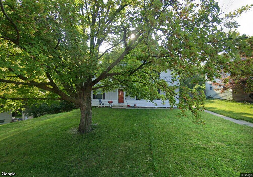
3804 N Saint Michael Ave Peoria, IL 61615
North Peoria NeighborhoodEstimated Value: $178,000 - $194,239
3
Beds
3
Baths
2,226
Sq Ft
$84/Sq Ft
Est. Value
About This Home
This home is located at 3804 N Saint Michael Ave, Peoria, IL 61615 and is currently estimated at $187,060, approximately $84 per square foot. 3804 N Saint Michael Ave is a home located in Peoria County with nearby schools including Dr Maude A Sanders Primary School, Sterling Middle School, and Peoria High School.
Ownership History
Date
Name
Owned For
Owner Type
Purchase Details
Closed on
May 16, 2019
Sold by
Wamack Earl B and Wamack Jannette C
Bought by
Phillips Rhylander D
Current Estimated Value
Home Financials for this Owner
Home Financials are based on the most recent Mortgage that was taken out on this home.
Original Mortgage
$105,061
Outstanding Balance
$93,137
Interest Rate
4.62%
Mortgage Type
FHA
Estimated Equity
$93,923
Create a Home Valuation Report for This Property
The Home Valuation Report is an in-depth analysis detailing your home's value as well as a comparison with similar homes in the area
Home Values in the Area
Average Home Value in this Area
Purchase History
| Date | Buyer | Sale Price | Title Company |
|---|---|---|---|
| Phillips Rhylander D | $107,000 | Attorney Only | |
| Phillips Rhylander D | $107,000 | None Listed On Document |
Source: Public Records
Mortgage History
| Date | Status | Borrower | Loan Amount |
|---|---|---|---|
| Open | Phillips Rhylander D | $105,061 | |
| Closed | Phillips Rhylander D | $4,280 | |
| Closed | Phillips Rhylander D | $4,280 |
Source: Public Records
Tax History Compared to Growth
Tax History
| Year | Tax Paid | Tax Assessment Tax Assessment Total Assessment is a certain percentage of the fair market value that is determined by local assessors to be the total taxable value of land and additions on the property. | Land | Improvement |
|---|---|---|---|---|
| 2024 | $3,673 | $46,610 | $7,460 | $39,150 |
| 2023 | $3,459 | $42,760 | $6,840 | $35,920 |
| 2022 | $3,291 | $40,120 | $6,490 | $33,630 |
| 2021 | $3,202 | $38,210 | $6,180 | $32,030 |
| 2020 | $3,189 | $37,830 | $6,120 | $31,710 |
| 2019 | $2,750 | $38,600 | $6,240 | $32,360 |
| 2018 | $2,314 | $42,520 | $6,300 | $36,220 |
| 2017 | $2,291 | $42,950 | $6,360 | $36,590 |
| 2016 | $2,974 | $42,950 | $6,360 | $36,590 |
| 2015 | $2,879 | $42,110 | $6,240 | $35,870 |
| 2014 | $2,891 | $42,270 | $6,200 | $36,070 |
| 2013 | -- | $42,790 | $6,280 | $36,510 |
Source: Public Records
Map
Nearby Homes
- 3720 N Saint Michael Ave
- 2214 W Bainter Ln
- 2011 W Richwoods Blvd
- 3623 N Sterling Ave Unit b-17
- 4011 N Sterling Ave
- 3423 N El Vista Ave
- 2036 W Richwoods Blvd
- 2221 W Tripp Ave
- 2705 W Millbrook Ct
- 2318 W Albany Ave
- 3808 N Walround Ln
- 2315 W Hudson St
- 2029 W Forrest Hill Ave
- 4212 N Keenland Ave
- 1413 W Aire Ave
- 2910 W Westport Rd
- 4023 N University St
- 2922 W Larchmont Ln
- 3010 W Brookside Dr
- 2909 N Mission Rd
- 3804 St Michael
- 3728 N Street Michael Ave
- 3728 N Saint Michael Ave
- 3812 N Saint Michael Ave
- 3720 N St Michael Ave
- 3801 St Michael
- 3809 St Michael Ave
- 3801 N Saint Michael Ave
- 3801 N Street Michael Ave
- 3809 N Saint Michael Ave
- 3723 N St Michael
- 3723 N Saint Michael Ave
- 3815 N Saint Michael Ave
- 3720 N Street Michael Ave
- 3815 N St Michael Ave
- 3714 N Street Michael Ave
- 3714 N Saint Michael Ave
- 3717 N Street Michael Ave
- 3717 N Saint Michael Ave
- 3823 N St Michael