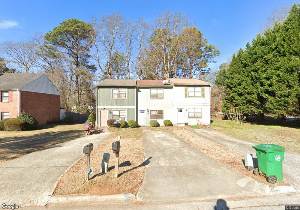
3806 Travis Trace Unit 1 Decatur, GA 30032
Estimated Value: $158,000 - $190,000
2
Beds
2
Baths
1,152
Sq Ft
$146/Sq Ft
Est. Value
About This Home
This home is located at 3806 Travis Trace Unit 1, Decatur, GA 30032 and is currently estimated at $167,636, approximately $145 per square foot. 3806 Travis Trace Unit 1 is a home located in DeKalb County with nearby schools including Rowland Elementary School, Mary McLeod Bethune Middle School, and Towers High School.
Ownership History
Date
Name
Owned For
Owner Type
Purchase Details
Closed on
Jun 26, 2025
Sold by
Cowan Rutha M
Bought by
James & Rutha Trust
Current Estimated Value
Purchase Details
Closed on
Nov 2, 2004
Sold by
White Sherol P
Bought by
Mers Inc
Purchase Details
Closed on
Feb 10, 2000
Sold by
Brumfield Prince A
Bought by
White Sherol P
Home Financials for this Owner
Home Financials are based on the most recent Mortgage that was taken out on this home.
Original Mortgage
$46,400
Interest Rate
12.79%
Mortgage Type
New Conventional
Create a Home Valuation Report for This Property
The Home Valuation Report is an in-depth analysis detailing your home's value as well as a comparison with similar homes in the area
Home Values in the Area
Average Home Value in this Area
Purchase History
| Date | Buyer | Sale Price | Title Company |
|---|---|---|---|
| James & Rutha Trust | -- | -- | |
| Mers Inc | $65,550 | -- | |
| White Sherol P | $48,000 | -- |
Source: Public Records
Mortgage History
| Date | Status | Borrower | Loan Amount |
|---|---|---|---|
| Previous Owner | White Sherol P | $46,400 |
Source: Public Records
Tax History Compared to Growth
Tax History
| Year | Tax Paid | Tax Assessment Tax Assessment Total Assessment is a certain percentage of the fair market value that is determined by local assessors to be the total taxable value of land and additions on the property. | Land | Improvement |
|---|---|---|---|---|
| 2025 | $3,265 | $64,920 | $6,000 | $58,920 |
| 2024 | $3,515 | $70,760 | $6,000 | $64,760 |
| 2023 | $3,515 | $47,120 | $1,200 | $45,920 |
| 2022 | $2,181 | $42,560 | $1,200 | $41,360 |
| 2021 | $1,380 | $24,320 | $1,200 | $23,120 |
| 2020 | $1,305 | $22,600 | $1,200 | $21,400 |
| 2019 | $1,078 | $17,440 | $1,200 | $16,240 |
| 2018 | $815 | $17,440 | $1,200 | $16,240 |
| 2017 | $643 | $7,480 | $1,200 | $6,280 |
| 2016 | $548 | $5,320 | $440 | $4,880 |
| 2014 | $471 | $3,480 | $440 | $3,040 |
Source: Public Records
Map
Nearby Homes
- 3800 Travis Trace
- 3814 Kensingwood Trace Unit 3814
- 3834 Kensingwood Trace
- 3800 Kensingwood Trace
- 3782 Kensingwood Trace
- 1129 Winston Dr
- 1178 Winston Dr
- 1068 Longshore Dr
- 3744 Redan Rd
- 3806 London Dr
- 3873 Jane Marie Ln
- 4011 Redan Rd Unit 6
- 4011 Redan Rd Unit 8
- 1089 Canal St
- 980 Porter Rd
- 880 Porter Rd Unit 2
- 876 Porter Rd Unit Lot 4
- 874 Porter Rd
- 1019 Privy Ln Unit 74
- 1146 Canal St
- 3804 Travis Trace
- 3802 Travis Trace
- 3808 Travis Trace Unit 1
- 3808 Travis Trace
- 3798 Travis Trace
- 3796 Travis Trace
- 3794 Travis Trace
- 3794 Travis Trace Unit 3794
- 3801 Travis Trace
- 3803 Travis Trace
- 3799 Travis Trace
- 3792 Travis Trace
- 3797 Travis Trace
- 3795 Travis Trace
- 3795 Travis Trace
- 3790 Travis Trace
- 3793 Travis Trace
- 3791 Travis Trace
- 3786 Travis Trace
- 3789 Travis Trace