
Seller's Agent in 2013
Jerry O'Neal
Southern Elite Realty
(256) 503-7949
107 Total Sales


Estimated Value: $331,000 - $380,000
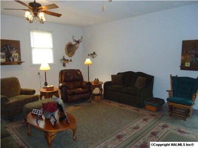
Take a look as this beautiful home with a breathtaking bluff view!! This 3 BR/ 2 BA home situated on 4.2 acres of land is your perfect private space. The oversized kitchen has tons of cabinets and counterspace. It also would be perfect for a center island!! Bedrooms and laundry are oversized and offers storage space that every family needs. It has wonderful features including a detached garage/workshop and a pond in the front of the property. Beautiful scenery!!!
Last Agent to Sell the Property
Southern Elite Realty License #95653 Listed on: 02/08/2013
| Date | Buyer | Sale Price | Title Company |
|---|---|---|---|
| Smith Bryan Dale | $72,000 | None Listed On Document | |
| Smith Bryan Dale | $72,000 | None Listed On Document | |
| Smith Bryan Dale | $70,500 | None Listed On Document | |
| Smith Bryan Dale | $70,500 | None Listed On Document | |
| Smith Bryan D | $161,000 | None Available |
| Date | Status | Borrower | Loan Amount |
|---|---|---|---|
| Previous Owner | Smith Bryan D | $164,126 |
| Date | Event | Price | List to Sale | Price per Sq Ft |
|---|---|---|---|---|
| 07/29/2013 07/29/13 | Off Market | $161,000 | -- | -- |
| 04/29/2013 04/29/13 | Sold | $161,000 | -10.5% | $85 / Sq Ft |
| 03/01/2013 03/01/13 | Pending | -- | -- | -- |
| 02/08/2013 02/08/13 | For Sale | $179,900 | -- | $95 / Sq Ft |
| Year | Tax Paid | Tax Assessment Tax Assessment Total Assessment is a certain percentage of the fair market value that is determined by local assessors to be the total taxable value of land and additions on the property. | Land | Improvement |
|---|---|---|---|---|
| 2024 | $1,029 | $25,460 | $0 | $0 |
| 2023 | $962 | $25,120 | $0 | $0 |
| 2022 | $858 | $22,680 | $0 | $0 |
| 2021 | $809 | $21,380 | $0 | $0 |
| 2020 | $651 | $17,180 | $0 | $0 |
| 2017 | $616 | $16,240 | $0 | $0 |
| 2015 | -- | $13,660 | $0 | $0 |
| 2014 | -- | $13,660 | $0 | $0 |
Seller's Agent in 2013
Jerry O'Neal
Southern Elite Realty
(256) 503-7949
107 Total Sales
Source: ValleyMLS.com
MLS Number: 898665
APN: 050929-0-000-022000
Disclaimer: Certain information contained herein is derived from information provided by parties other than Homes.com. All information provided is deemed reliable, but is not guaranteed to be accurate and should be independently verified.
![]() Properties marked with this icon are provided courtesy of the Valley MLS IDX Database. Some or all of the listings displayed may not belong to the firm whose website is being visited.
Properties marked with this icon are provided courtesy of the Valley MLS IDX Database. Some or all of the listings displayed may not belong to the firm whose website is being visited.
All information provided is deemed reliable but is not guaranteed and should be independently verified.
Copyright 2025 Valley MLS