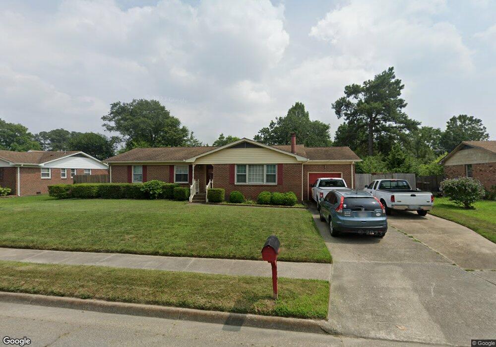
3809 Cannon Point Dr Chesapeake, VA 23321
Western Branch NeighborhoodEstimated Value: $349,000 - $412,000
3
Beds
2
Baths
1,759
Sq Ft
$216/Sq Ft
Est. Value
About This Home
This home is located at 3809 Cannon Point Dr, Chesapeake, VA 23321 and is currently estimated at $380,450, approximately $216 per square foot. 3809 Cannon Point Dr is a home located in Chesapeake City with nearby schools including Western Branch Primary School, Western Branch Intermediate School, and Western Branch Middle School.
Ownership History
Date
Name
Owned For
Owner Type
Purchase Details
Closed on
Jul 29, 1999
Sold by
Frampton Charles H
Bought by
Powers David D
Current Estimated Value
Home Financials for this Owner
Home Financials are based on the most recent Mortgage that was taken out on this home.
Original Mortgage
$121,890
Outstanding Balance
$34,918
Interest Rate
7.61%
Estimated Equity
$345,532
Create a Home Valuation Report for This Property
The Home Valuation Report is an in-depth analysis detailing your home's value as well as a comparison with similar homes in the area
Home Values in the Area
Average Home Value in this Area
Purchase History
| Date | Buyer | Sale Price | Title Company |
|---|---|---|---|
| Powers David D | $119,500 | -- |
Source: Public Records
Mortgage History
| Date | Status | Borrower | Loan Amount |
|---|---|---|---|
| Open | Powers David D | $121,890 |
Source: Public Records
Tax History Compared to Growth
Tax History
| Year | Tax Paid | Tax Assessment Tax Assessment Total Assessment is a certain percentage of the fair market value that is determined by local assessors to be the total taxable value of land and additions on the property. | Land | Improvement |
|---|---|---|---|---|
| 2025 | $3,369 | $352,400 | $150,000 | $202,400 |
| 2024 | $3,369 | $333,600 | $150,000 | $183,600 |
| 2023 | $3,011 | $311,100 | $140,000 | $171,100 |
| 2022 | $3,107 | $307,600 | $130,000 | $177,600 |
| 2021 | $2,689 | $256,100 | $100,000 | $156,100 |
| 2020 | $2,546 | $242,500 | $95,000 | $147,500 |
| 2019 | $2,449 | $233,200 | $95,000 | $138,200 |
| 2018 | $2,435 | $215,200 | $85,000 | $130,200 |
| 2017 | $2,361 | $224,900 | $85,000 | $139,900 |
| 2016 | $2,361 | $224,900 | $85,000 | $139,900 |
| 2015 | $2,333 | $222,200 | $85,000 | $137,200 |
| 2014 | $2,260 | $215,200 | $85,000 | $130,200 |
Source: Public Records
Map
Nearby Homes
- 3826 Whitechapel Arch
- 2935 Bruce Station
- 3909 Point Elizabeth Dr
- 2929 Tyre Neck Rd
- 3012 Princess Anne Crescent
- 3037 Tyre Neck Rd
- 2829 Meadow Wood Dr E
- 34 Sandie Point Ln
- 32 Sandie Point Ln
- 22 Sandie Point Ln
- 14 Sandie Point Ln
- 330 Thelmar Ln
- 5212 Lake Cir
- 3917 Oak Dr E
- 2537 Lakewood Ln
- 2935 Sterling Point Dr
- 2922 Replica Ct
- 2944 Replica Ln
- 2513 Quail Ridge Ct
- 412 Robin Rd
- 3805 Cannon Point Dr
- 3811 Cannon Point Dr
- 2904 Luxford Ct
- 3808 Cannon Point Dr
- 3801 Cannon Point Dr
- 2900 Luxford Ct
- 3804 Cannon Point Dr
- 3813 Cannon Point Dr
- 3812 Cannon Point Dr
- 3713 Point Elizabeth Dr
- 2908 Luxford Ct
- 3800 Cannon Point Dr
- 2901 Luxford Ct
- 3711 Point Elizabeth Dr
- 3817 Cannon Point Dr
- 3805 Forsythe Ct
- 3816 Cannon Point Dr
- 2905 Luxford Ct
- 3805 Point Elizabeth Dr
- 3809 Forsythe Ct