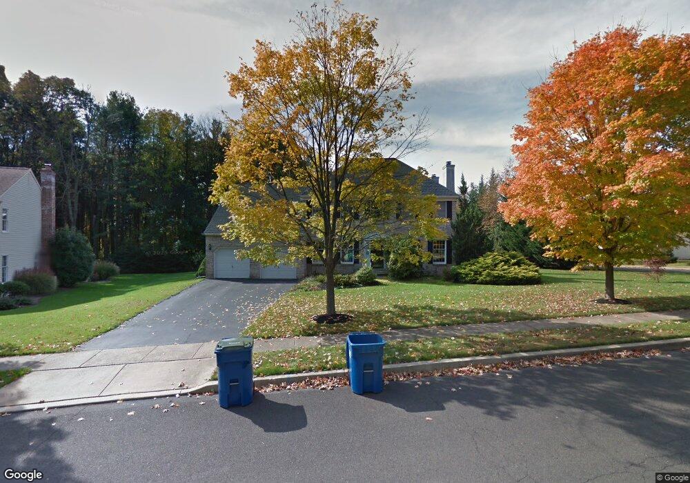
381 Birdsong Way Doylestown, PA 18901
Estimated Value: $802,000 - $958,623
4
Beds
3
Baths
2,770
Sq Ft
$320/Sq Ft
Est. Value
About This Home
This home is located at 381 Birdsong Way, Doylestown, PA 18901 and is currently estimated at $887,406, approximately $320 per square foot. 381 Birdsong Way is a home located in Bucks County with nearby schools including Linden El School, Lenape Middle School, and Central Bucks High School-West.
Ownership History
Date
Name
Owned For
Owner Type
Purchase Details
Closed on
Sep 19, 2007
Sold by
Gussin Michael and Gussin Marie
Bought by
Mccabe Timothy J and Mccabe Kathy S
Current Estimated Value
Home Financials for this Owner
Home Financials are based on the most recent Mortgage that was taken out on this home.
Original Mortgage
$51,500
Interest Rate
6.14%
Mortgage Type
Stand Alone Second
Purchase Details
Closed on
Jul 11, 1991
Bought by
Gussin Michael and Gussin Marie
Create a Home Valuation Report for This Property
The Home Valuation Report is an in-depth analysis detailing your home's value as well as a comparison with similar homes in the area
Home Values in the Area
Average Home Value in this Area
Purchase History
| Date | Buyer | Sale Price | Title Company |
|---|---|---|---|
| Mccabe Timothy J | $515,000 | None Available | |
| Gussin Michael | $255,600 | -- |
Source: Public Records
Mortgage History
| Date | Status | Borrower | Loan Amount |
|---|---|---|---|
| Closed | Mccabe Timothy J | $51,500 | |
| Previous Owner | Mccabe Timothy J | $412,000 |
Source: Public Records
Tax History Compared to Growth
Tax History
| Year | Tax Paid | Tax Assessment Tax Assessment Total Assessment is a certain percentage of the fair market value that is determined by local assessors to be the total taxable value of land and additions on the property. | Land | Improvement |
|---|---|---|---|---|
| 2025 | $8,678 | $49,040 | $12,320 | $36,720 |
| 2024 | $8,678 | $49,040 | $12,320 | $36,720 |
| 2023 | $8,275 | $49,040 | $12,320 | $36,720 |
| 2022 | $8,183 | $49,040 | $12,320 | $36,720 |
| 2021 | $8,014 | $49,040 | $12,320 | $36,720 |
| 2020 | $7,978 | $49,040 | $12,320 | $36,720 |
| 2019 | $7,892 | $49,040 | $12,320 | $36,720 |
| 2018 | $7,867 | $49,040 | $12,320 | $36,720 |
| 2017 | $7,806 | $49,040 | $12,320 | $36,720 |
| 2016 | $7,757 | $49,040 | $12,320 | $36,720 |
| 2015 | -- | $49,040 | $12,320 | $36,720 |
| 2014 | -- | $49,040 | $12,320 | $36,720 |
Source: Public Records
Map
Nearby Homes
- 272 Fox Chase Ln
- 3 Steeplechase Dr
- 195 Lafayette St
- 403 S Main St Unit S201
- 9 Mill Creek Dr
- 89 Homestead Dr
- 236 Green St
- 78 Tower Hill Rd
- 37 N Clinton St
- 32 Hibiscus Ct Unit 32
- 114 Progress Dr
- 110 E Ashland St
- 130 N Clinton St
- 69 E Oakland Ave
- 20 E Court St
- 2320 Turk Rd
- 1 Barnes Ct
- 155 E Oakland Ave
- 82 Avalon Ct Unit 2005
- 146 E Court St
- 379 Birdsong Way
- 378 Birdsong Way
- 377 Birdsong Way
- 30 Steeplechase Dr
- 32 Steeplechase Dr
- 255 Fox Chase Ln
- 28 Steeplechase Dr
- 34 Steeplechase Dr
- 21 Steeplechase Dr
- 376 Birdsong Way
- 257 Fox Chase Ln
- 346 Birdsong Way
- 26 Steeplechase Dr
- 375 Birdsong Way
- 254 Fox Chase Ln
- 256 Fox Chase Ln
- 19 Steeplechase Dr
- 36 Steeplechase Dr
- 24 Steeplechase Dr
- 150 Hart Ave