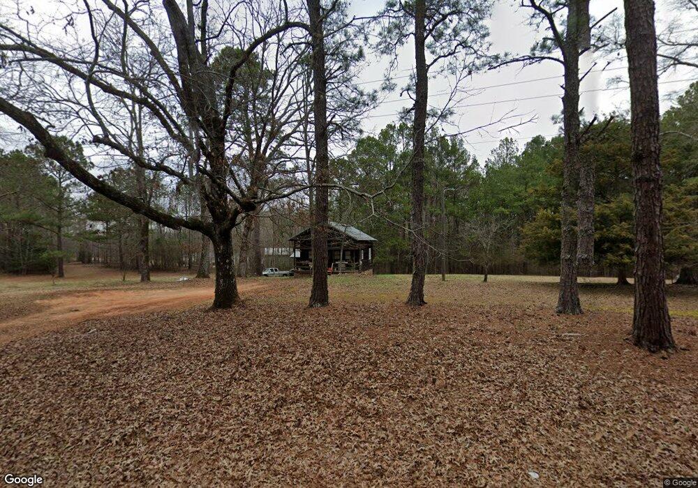
381 Blount Rd Forsyth, GA 31029
Estimated Value: $77,594 - $307,000
--
Bed
1
Bath
792
Sq Ft
$225/Sq Ft
Est. Value
About This Home
This home is located at 381 Blount Rd, Forsyth, GA 31029 and is currently estimated at $178,399, approximately $225 per square foot. 381 Blount Rd is a home located in Monroe County with nearby schools including Katherine B. Sutton Elementary School and Mary Persons High School.
Ownership History
Date
Name
Owned For
Owner Type
Purchase Details
Closed on
Feb 27, 2010
Sold by
Speir John C
Bought by
Stephens Kyle B
Current Estimated Value
Home Financials for this Owner
Home Financials are based on the most recent Mortgage that was taken out on this home.
Original Mortgage
$53,809
Interest Rate
4.97%
Mortgage Type
Future Advance Clause Open End Mortgage
Purchase Details
Closed on
Oct 13, 2005
Sold by
Speir John Charles
Bought by
Speir John C and Speir Carol F
Purchase Details
Closed on
Sep 24, 1999
Bought by
Speir John Charles
Purchase Details
Closed on
May 23, 1994
Create a Home Valuation Report for This Property
The Home Valuation Report is an in-depth analysis detailing your home's value as well as a comparison with similar homes in the area
Home Values in the Area
Average Home Value in this Area
Purchase History
| Date | Buyer | Sale Price | Title Company |
|---|---|---|---|
| Stephens Kyle B | $53,000 | -- | |
| Speir John C | -- | -- | |
| Speir John Charles | -- | -- | |
| -- | $30,000 | -- |
Source: Public Records
Mortgage History
| Date | Status | Borrower | Loan Amount |
|---|---|---|---|
| Closed | Stephens Kyle B | $53,809 |
Source: Public Records
Tax History Compared to Growth
Tax History
| Year | Tax Paid | Tax Assessment Tax Assessment Total Assessment is a certain percentage of the fair market value that is determined by local assessors to be the total taxable value of land and additions on the property. | Land | Improvement |
|---|---|---|---|---|
| 2024 | $222 | $20,200 | $4,120 | $16,080 |
| 2023 | $222 | $17,520 | $4,120 | $13,400 |
| 2022 | $149 | $17,520 | $4,120 | $13,400 |
| 2021 | $155 | $17,520 | $4,120 | $13,400 |
| 2020 | $134 | $16,680 | $3,280 | $13,400 |
| 2019 | $136 | $16,680 | $3,280 | $13,400 |
| 2018 | $136 | $16,680 | $3,280 | $13,400 |
| 2017 | $485 | $16,680 | $3,280 | $13,400 |
| 2016 | $129 | $16,680 | $3,280 | $13,400 |
| 2015 | $145 | $17,520 | $4,120 | $13,400 |
| 2014 | $141 | $17,520 | $4,120 | $13,400 |
Source: Public Records
Map
Nearby Homes
- 0 Garr Rd Unit 10439858
- 739 Westbrooks Rd
- 0 Duncan Cir Unit 24915548
- 40 Timber Dr
- 381 Homestead Cir
- 120 Homestead Cir
- 837 Weldon Rd
- 788 Teagle Rd
- 49 Homestead Cir Unit LOT 49A
- 122 Towaliga Rd S
- 353 Weldon Rd
- 40 Towaliga Rd
- 6418 Georgia 42
- 412 Towaliga Trail
- 240 Riverview Rd
- 160 Aaron Ct
- 401 Towaliga Trail
- 2489 Boxankle Rd
- 674 Stokes Store Rd
- 104 Old Oak Dr
- 405 Blount Rd
- 323 Blount Rd
- 423 Blount Rd
- 307 Blount Rd
- 307 Blount Rd
- 288 Blount Rd
- 265 Blount Rd
- 261 Blount Rd
- 731 Blount Rd
- 735 Blount Rd
- 3571 Brownlee Rd
- 31 Westbrooks Rd
- 31 Westbrooks Rd
- 53 Westbrooks Rd
- 0 Westbrooks Rd
- 0 Westbrooks Rd Unit 116175
- 0 Westbrooks Rd Unit 8730269
- 0 Westbrooks Rd Unit 8327644
- 0 Westbrooks Rd Unit 8047190
- 0 Westbrooks Rd Unit 2919855