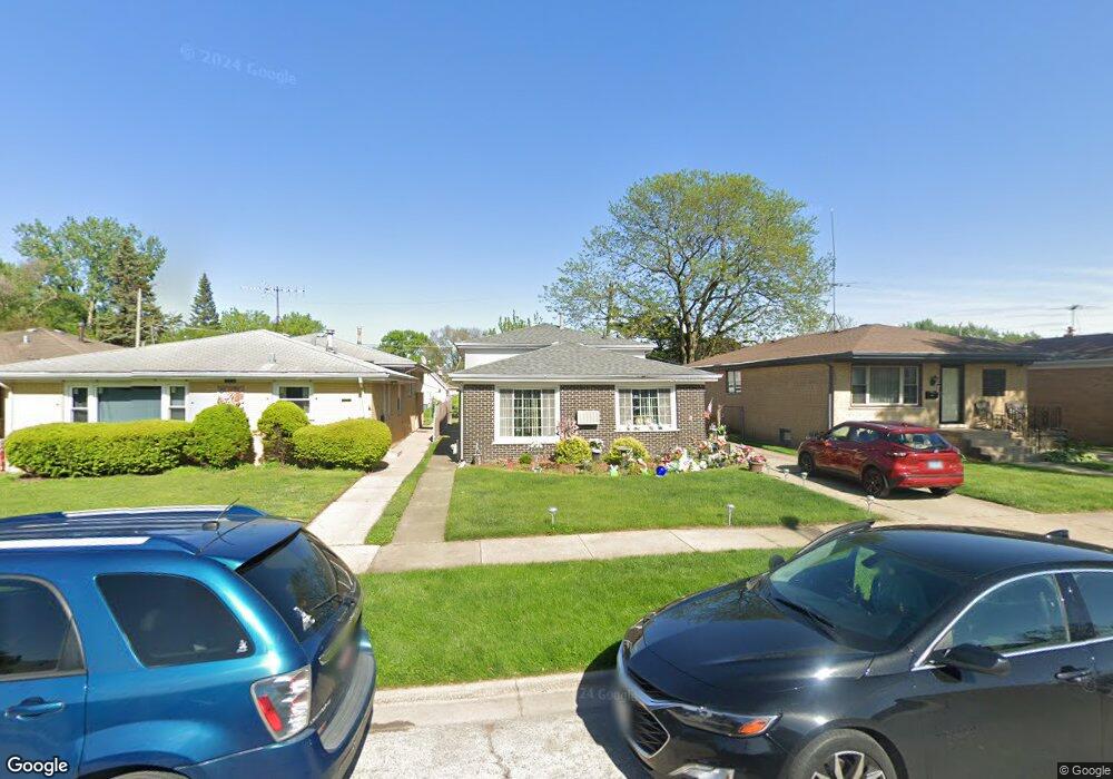
381 Buffalo Ave Calumet City, IL 60409
Estimated Value: $158,000 - $242,000
3
Beds
2
Baths
1,121
Sq Ft
$178/Sq Ft
Est. Value
About This Home
This home is located at 381 Buffalo Ave, Calumet City, IL 60409 and is currently estimated at $199,553, approximately $178 per square foot. 381 Buffalo Ave is a home located in Cook County with nearby schools including Wilson Elementary School, Wentworth Intermediate School, and Wentworth Jr High School.
Ownership History
Date
Name
Owned For
Owner Type
Purchase Details
Closed on
May 6, 1994
Sold by
Sheffield Capital Partners Ltd
Bought by
Singleton Gale L
Current Estimated Value
Home Financials for this Owner
Home Financials are based on the most recent Mortgage that was taken out on this home.
Original Mortgage
$78,323
Interest Rate
8.78%
Mortgage Type
FHA
Purchase Details
Closed on
Mar 21, 1994
Sold by
Old Kent Bank
Bought by
Sheffield Capital Partners Ltd
Home Financials for this Owner
Home Financials are based on the most recent Mortgage that was taken out on this home.
Original Mortgage
$78,323
Interest Rate
8.78%
Mortgage Type
FHA
Create a Home Valuation Report for This Property
The Home Valuation Report is an in-depth analysis detailing your home's value as well as a comparison with similar homes in the area
Home Values in the Area
Average Home Value in this Area
Purchase History
| Date | Buyer | Sale Price | Title Company |
|---|---|---|---|
| Singleton Gale L | $79,000 | -- | |
| Sheffield Capital Partners Ltd | -- | -- |
Source: Public Records
Mortgage History
| Date | Status | Borrower | Loan Amount |
|---|---|---|---|
| Previous Owner | Singleton Gale L | $78,323 |
Source: Public Records
Tax History Compared to Growth
Tax History
| Year | Tax Paid | Tax Assessment Tax Assessment Total Assessment is a certain percentage of the fair market value that is determined by local assessors to be the total taxable value of land and additions on the property. | Land | Improvement |
|---|---|---|---|---|
| 2024 | $1,125 | $14,000 | $2,000 | $12,000 |
| 2023 | $1,452 | $14,000 | $2,000 | $12,000 |
| 2022 | $1,452 | $10,402 | $1,750 | $8,652 |
| 2021 | $1,360 | $10,402 | $1,750 | $8,652 |
| 2020 | $1,188 | $10,402 | $1,750 | $8,652 |
| 2019 | $1,380 | $9,179 | $1,625 | $7,554 |
| 2018 | $1,354 | $9,179 | $1,625 | $7,554 |
| 2017 | $1,286 | $9,179 | $1,625 | $7,554 |
| 2016 | $2,663 | $8,719 | $1,500 | $7,219 |
| 2015 | $2,748 | $8,719 | $1,500 | $7,219 |
| 2014 | $3,059 | $8,719 | $1,500 | $7,219 |
| 2013 | $4,774 | $10,875 | $1,500 | $9,375 |
Source: Public Records
Map
Nearby Homes
- 413 Greenbay Ave
- 455 Buffalo Ave
- 760 Sibley Blvd
- 811 Sibley Blvd
- 510 Mackinaw Ave
- 409 Price Ave
- 1129 Sibley Blvd
- 318 Campbell Ave
- 1074 George St
- 525 Price Ave
- 772 Memorial Dr
- 2736 E Goodrich Ave
- 492 Freeland Ave
- 566 Hirsch Ave
- 527 Gordon Ave
- 1119 Lucas St
- 498 Harrison Ave
- 1155 Harding Ave
- 580 Hirsch Ave
- 491 Escanaba Ave
- 385 Buffalo Ave
- 379 Buffalo Ave
- 375 Buffalo Ave
- 387 Buffalo Ave
- 389 Buffalo Ave
- 371 Buffalo Ave Unit 2
- 378 Mackinaw Ave
- 384 Mackinaw Ave
- 391 Buffalo Ave
- 386 Mackinaw Ave
- 374 Mackinaw Ave
- 378 Buffalo Ave
- 380 Buffalo Ave
- 388 Mackinaw Ave
- 370 Mackinaw Ave
- 384 Buffalo Ave
- 393 Buffalo Ave
- 386 Buffalo Ave
- 390 Mackinaw Ave
- 372 Buffalo Ave Unit FRONT