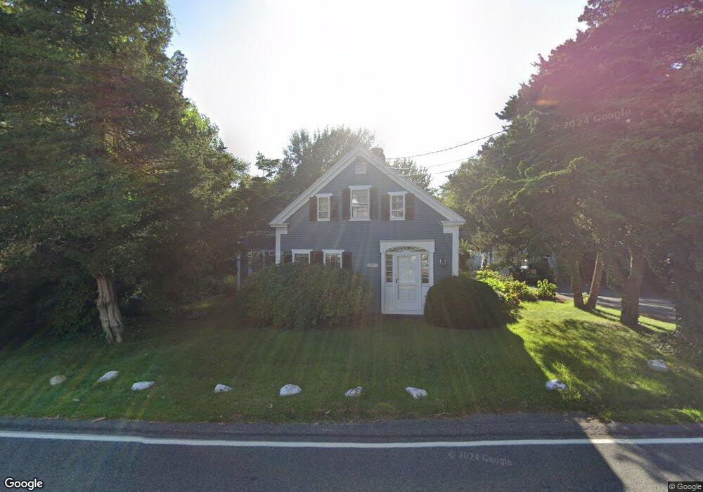
381 Main St West Dennis, MA 2670
West Dennis NeighborhoodEstimated Value: $604,000 - $851,000
3
Beds
2
Baths
1,560
Sq Ft
$481/Sq Ft
Est. Value
About This Home
This home is located at 381 Main St, West Dennis, MA 2670 and is currently estimated at $751,007, approximately $481 per square foot. 381 Main St is a home located in Barnstable County with nearby schools including Dennis-Yarmouth Regional High School and St. Pius X. School.
Ownership History
Date
Name
Owned For
Owner Type
Purchase Details
Closed on
May 20, 2016
Sold by
Church Henry C and Church William H
Bought by
Dunn Matthew C and Dunn Elizabeth B
Current Estimated Value
Home Financials for this Owner
Home Financials are based on the most recent Mortgage that was taken out on this home.
Original Mortgage
$315,000
Outstanding Balance
$250,188
Interest Rate
3.59%
Mortgage Type
New Conventional
Estimated Equity
$500,819
Purchase Details
Closed on
Feb 18, 2015
Sold by
Anne Church Rt
Bought by
Church Henry C and Church William H
Purchase Details
Closed on
Jun 3, 2008
Sold by
Church Anne E
Bought by
Anne Church Rt
Purchase Details
Closed on
May 9, 1994
Sold by
Handy Frank H and Church Anne E
Bought by
Church Anne E
Create a Home Valuation Report for This Property
The Home Valuation Report is an in-depth analysis detailing your home's value as well as a comparison with similar homes in the area
Home Values in the Area
Average Home Value in this Area
Purchase History
| Date | Buyer | Sale Price | Title Company |
|---|---|---|---|
| Dunn Matthew C | $405,000 | -- | |
| Church Henry C | -- | -- | |
| Anne Church Rt | -- | -- | |
| Church Anne E | $70,000 | -- |
Source: Public Records
Mortgage History
| Date | Status | Borrower | Loan Amount |
|---|---|---|---|
| Open | Dunn Matthew C | $315,000 | |
| Previous Owner | Church Anne E | $80,000 |
Source: Public Records
Tax History Compared to Growth
Tax History
| Year | Tax Paid | Tax Assessment Tax Assessment Total Assessment is a certain percentage of the fair market value that is determined by local assessors to be the total taxable value of land and additions on the property. | Land | Improvement |
|---|---|---|---|---|
| 2025 | $2,890 | $667,500 | $203,900 | $463,600 |
| 2024 | $2,820 | $642,300 | $196,100 | $446,200 |
| 2023 | $2,727 | $584,000 | $178,300 | $405,700 |
| 2022 | $2,615 | $467,000 | $160,600 | $306,400 |
| 2021 | $2,698 | $447,500 | $157,400 | $290,100 |
| 2020 | $2,704 | $443,200 | $157,400 | $285,800 |
| 2019 | $2,756 | $446,600 | $154,400 | $292,200 |
| 2018 | $2,397 | $378,100 | $120,200 | $257,900 |
| 2017 | $2,591 | $421,300 | $120,200 | $301,100 |
| 2016 | $2,584 | $395,700 | $146,900 | $248,800 |
| 2015 | $2,669 | $417,000 | $146,900 | $270,100 |
| 2014 | $2,700 | $425,200 | $146,900 | $278,300 |
Source: Public Records
Map
Nearby Homes
- 401 Main St Unit 201
- 401 Main St Unit 101
- 23 Doric Ave
- 467 Main St
- 428 Main St Unit 1-11
- 209 Main St Unit 3
- 209 Main St Unit 6
- 209 Main St Unit 1
- 209 Main St Unit 2
- 209 Main St Unit 4
- 209 Main St Unit 5
- 14 Schoolhouse Ln
- 178 School St
- 61 Trotters Ln
- 15 Woodside Park Rd
- 45 Seth Ln
- 3 Pinefield Ln
- 2 Rita Mary Way
- 29 Bass River Rd
- 40 Kelley Rd
- 371 Manin Unit 26
- 389 Main St
- 397 Main St
- 393 Main St
- 371 Main (Rte 28) Unit 22
- 371 Main Rte 28 Unit 18
- 369 Route 28
- 369 Main St
- 371 Main St Unit 28
- 371 Main St Unit 8
- 371 Main Street Rte 28 Unit 17
- 371 Main St Unit 17
- 371 Main St Unit 25
- 371 Main St Unit 15
- 371 Main St Unit 3
- 371 Main St Unit 23
- 371 Main St Unit 18
- 371 Main St Unit 2
- 371 Main St Unit 24
- 371 Main St Unit 19