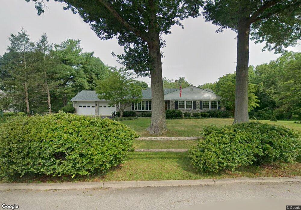
381 Rittenhouse Blvd Norristown, PA 19403
Estimated Value: $550,000 - $574,966
3
Beds
2
Baths
2,043
Sq Ft
$275/Sq Ft
Est. Value
About This Home
This home is located at 381 Rittenhouse Blvd, Norristown, PA 19403 and is currently estimated at $561,742, approximately $274 per square foot. 381 Rittenhouse Blvd is a home located in Montgomery County with nearby schools including Marshall Street Elementary School, Charles Blockson Middle School, and East Norriton Middle School.
Ownership History
Date
Name
Owned For
Owner Type
Purchase Details
Closed on
Sep 9, 2005
Sold by
Lessig William E and Lessig Charlotte A
Bought by
Capone Margaret J and Baker Susan A
Current Estimated Value
Home Financials for this Owner
Home Financials are based on the most recent Mortgage that was taken out on this home.
Original Mortgage
$281,250
Outstanding Balance
$151,131
Interest Rate
5.92%
Mortgage Type
Stand Alone First
Estimated Equity
$410,611
Purchase Details
Closed on
Jul 20, 2005
Sold by
Lessig William E and Lessig Charlotte A
Bought by
Lessig William E and Lessig Charlotte A
Home Financials for this Owner
Home Financials are based on the most recent Mortgage that was taken out on this home.
Original Mortgage
$281,250
Outstanding Balance
$151,131
Interest Rate
5.92%
Mortgage Type
Stand Alone First
Estimated Equity
$410,611
Create a Home Valuation Report for This Property
The Home Valuation Report is an in-depth analysis detailing your home's value as well as a comparison with similar homes in the area
Home Values in the Area
Average Home Value in this Area
Purchase History
| Date | Buyer | Sale Price | Title Company |
|---|---|---|---|
| Capone Margaret J | $375,000 | -- | |
| Lessig William E | -- | -- |
Source: Public Records
Mortgage History
| Date | Status | Borrower | Loan Amount |
|---|---|---|---|
| Open | Capone Margaret J | $281,250 | |
| Previous Owner | Lessig William E | $281,250 |
Source: Public Records
Tax History Compared to Growth
Tax History
| Year | Tax Paid | Tax Assessment Tax Assessment Total Assessment is a certain percentage of the fair market value that is determined by local assessors to be the total taxable value of land and additions on the property. | Land | Improvement |
|---|---|---|---|---|
| 2025 | $9,195 | $188,230 | -- | -- |
| 2024 | $9,195 | $188,230 | -- | -- |
| 2023 | $9,092 | $188,230 | $0 | $0 |
| 2022 | $9,034 | $188,230 | $0 | $0 |
| 2021 | $8,979 | $188,230 | $0 | $0 |
| 2020 | $8,711 | $188,230 | $0 | $0 |
| 2019 | $8,516 | $188,230 | $0 | $0 |
| 2018 | $6,703 | $188,230 | $0 | $0 |
| 2017 | $8,040 | $188,230 | $0 | $0 |
| 2016 | $7,966 | $188,230 | $0 | $0 |
| 2015 | $7,380 | $188,230 | $0 | $0 |
| 2014 | $7,380 | $188,230 | $0 | $0 |
Source: Public Records
Map
Nearby Homes
- 391 Rittenhouse Blvd
- 1721 Peachtree Ln
- 443 Brandon Rd
- 618 Brandon Rd
- 392 Joseph St
- 1633 Williams Way
- 1924 Juniata Rd
- 121 Woodstream Dr Unit CONDO 121
- 1992 Keswick Way
- 143 Riversedge Dr Unit CONDO 143
- 1749 W Marshall St
- 1914 Yorktown S
- 1107 Middleton Place
- 68 Jefferson Ave
- 0 Sheridan Ln Unit PAMC2130926
- 0 Sheridan Ln Unit PAMC2131012
- 108 N Prospect Ave
- 1635 W Marshall W Marshall St
- 122 N Prospect Ave
- 2055 W Marshall St
- 401 Rittenhouse Blvd
- 405 Rittenhouse Blvd
- 1736 Christopher Ln
- 390 Rittenhouse Blvd
- 411 Rittenhouse Blvd
- 300 S Whitehall Rd Unit 4
- 1750 Peachtree Ln
- 421 Rittenhouse Blvd
- 420 Rittenhouse Blvd
- 1741 Peachtree Ln
- 1741 Magnolia Ln
- 402 Rittenhouse Blvd
- 404 Rittenhouse Blvd
- 125 S Whitehall Rd
- 1731 Peachtree Ln
- 528 Brandon Rd
- 529 Brandon Rd
- 1730 Peachtree Ln
- 530 Brandon Rd
- 531 Brandon Rd