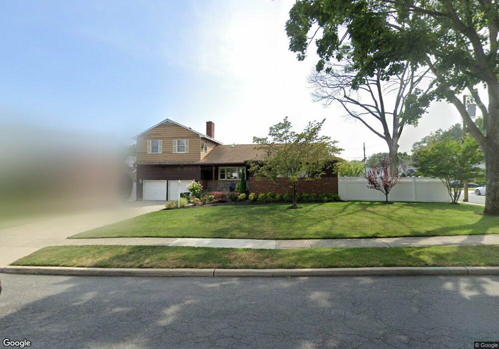
381 Roosevelt Blvd West Hempstead, NY 11552
Estimated Value: $994,000 - $1,015,753
5
Beds
4
Baths
2,138
Sq Ft
$470/Sq Ft
Est. Value
About This Home
This home is located at 381 Roosevelt Blvd, West Hempstead, NY 11552 and is currently estimated at $1,004,877, approximately $470 per square foot. 381 Roosevelt Blvd is a home located in Nassau County with nearby schools including Chestnut Street School, West Hempstead Middle School, and West Hempstead Secondary School.
Ownership History
Date
Name
Owned For
Owner Type
Purchase Details
Closed on
Nov 17, 2015
Sold by
Blachor Isaac and Blachor Evelyn
Bought by
Feldman Jay N and Feldman Shoshana H
Current Estimated Value
Home Financials for this Owner
Home Financials are based on the most recent Mortgage that was taken out on this home.
Original Mortgage
$515,000
Outstanding Balance
$405,622
Interest Rate
3.83%
Mortgage Type
Purchase Money Mortgage
Estimated Equity
$599,255
Create a Home Valuation Report for This Property
The Home Valuation Report is an in-depth analysis detailing your home's value as well as a comparison with similar homes in the area
Home Values in the Area
Average Home Value in this Area
Purchase History
| Date | Buyer | Sale Price | Title Company |
|---|---|---|---|
| Feldman Jay N | $645,000 | None Available |
Source: Public Records
Mortgage History
| Date | Status | Borrower | Loan Amount |
|---|---|---|---|
| Open | Feldman Jay N | $515,000 |
Source: Public Records
Tax History Compared to Growth
Tax History
| Year | Tax Paid | Tax Assessment Tax Assessment Total Assessment is a certain percentage of the fair market value that is determined by local assessors to be the total taxable value of land and additions on the property. | Land | Improvement |
|---|---|---|---|---|
| 2025 | $14,738 | $575 | $302 | $273 |
| 2024 | $4,528 | $588 | $309 | $279 |
| 2023 | $12,565 | $600 | $315 | $285 |
| 2022 | $12,565 | $600 | $315 | $285 |
| 2021 | $15,252 | $621 | $302 | $319 |
| 2020 | $11,232 | $781 | $437 | $344 |
| 2019 | $14,355 | $727 | $437 | $290 |
| 2018 | $12,572 | $727 | $0 | $0 |
| 2017 | $6,386 | $727 | $413 | $314 |
| 2016 | $10,017 | $769 | $394 | $375 |
| 2015 | $3,782 | $812 | $416 | $396 |
| 2014 | $3,782 | $812 | $416 | $396 |
| 2013 | $3,724 | $854 | $437 | $417 |
Source: Public Records
Map
Nearby Homes
- 537 Madison Ave
- 400 Langley Ave
- 19 Richard St
- 490 Walton Ct
- 23 Rhoda St
- 613 Adams Ave
- 231 Wilson St
- 352 Hempstead Ave
- 199 Guildford Ct
- 306 Garfield Ave
- 635 Hempstead Ave
- 198 Guildford Ct
- 268 Spruce St
- 467 Susan Ct
- 72 Munson Ave
- 72 Spruce St
- 594 Fenworth Blvd
- 670 Hempstead Ave
- 106 Sycamore St
- 234 Sycamore St
- 485 Harding Ave
- 367 Roosevelt Blvd
- 482 Madison Ave
- 489 Harding Ave
- 486 Madison Ave
- 387 Roosevelt Blvd
- 374 Roosevelt Blvd
- 382 Roosevelt Blvd
- 495 Harding Ave
- 384 Roosevelt Blvd
- 486 Harding Ave
- 362 Roosevelt Blvd
- 492 Madison Ave
- 388 Roosevelt Blvd
- 388 Roosevelt Blvd
- 388 Roosevelt Blvd Unit 31-104
- 499 Harding Ave
- 481 Grantland Ave
- 481 Grantland Ave
- 492 Harding Ave