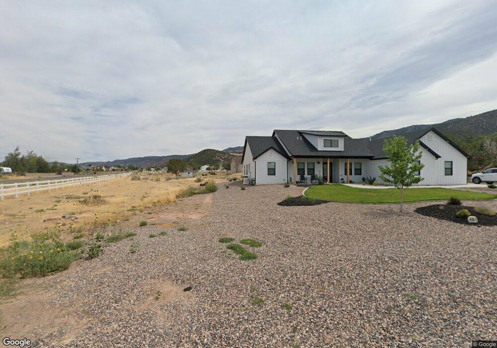
381 S Valley Heights Cir W Parowan, UT 84761
Estimated Value: $116,000 - $1,210,000
--
Bed
--
Bath
55,321
Sq Ft
$12/Sq Ft
Est. Value
About This Home
This home is located at 381 S Valley Heights Cir W, Parowan, UT 84761 and is currently estimated at $640,891, approximately $11 per square foot. 381 S Valley Heights Cir W is a home located in Iron County with nearby schools including Parowan School, Parowan High School, and Cedar City High School.
Ownership History
Date
Name
Owned For
Owner Type
Purchase Details
Closed on
Dec 1, 2020
Sold by
Kraft Scott A
Bought by
Wigginton Robert and Wigginton Barbara
Current Estimated Value
Purchase Details
Closed on
Jun 1, 2005
Sold by
Tripp Robert Todd and Tripp Diane M
Bought by
Kraft Scott A
Create a Home Valuation Report for This Property
The Home Valuation Report is an in-depth analysis detailing your home's value as well as a comparison with similar homes in the area
Home Values in the Area
Average Home Value in this Area
Purchase History
| Date | Buyer | Sale Price | Title Company |
|---|---|---|---|
| Wigginton Robert | -- | Security Escrow & Ttl Ins Ag | |
| Kraft Scott A | -- | First American Title Insuran |
Source: Public Records
Tax History Compared to Growth
Tax History
| Year | Tax Paid | Tax Assessment Tax Assessment Total Assessment is a certain percentage of the fair market value that is determined by local assessors to be the total taxable value of land and additions on the property. | Land | Improvement |
|---|---|---|---|---|
| 2025 | $2,745 | $340,700 | $77,618 | $263,082 |
| 2023 | $2,403 | $288,475 | $41,965 | $246,510 |
| 2022 | $2,582 | $269,705 | $38,150 | $231,555 |
| 2021 | $646 | $67,510 | $67,510 | $0 |
| 2020 | $586 | $54,050 | $54,050 | $0 |
| 2019 | $614 | $54,050 | $54,050 | $0 |
| 2018 | $627 | $54,050 | $54,050 | $0 |
| 2017 | $579 | $48,675 | $48,675 | $0 |
| 2016 | $611 | $48,675 | $48,675 | $0 |
| 2015 | $619 | $46,550 | $0 | $0 |
| 2014 | $649 | $46,550 | $0 | $0 |
Source: Public Records
Map
Nearby Homes
- 1025 W Old Highway 91
- 0 W Old Highway 91 Unit 24-253616
- 0 W Old Highway 91 Unit 108031
- 1144 375 South St
- 1112 W 275 S
- 257 S 1175 W
- 0 Lot 2 Blk 8 Plat C Unit 108795
- 6.81 ACFT Water Right: 75-251 Unit 1915 Priority
- 701 S Heritage Hills Dr
- 1.73 AF Water Right ~ #75-1
- 680 S Heritage Hills Dr
- 0 968 S 1650 W Unit 25-264445
- 403 & 404 Kari
- 1521 W 950 S
- 1435 W 200 S Unit 315
- 273 700 W
- 177 S 500 W
- 114 N 850 W
- 56 S 500 W
- 755 W 130 N
- 374 S 1050 W
- 518 S Valley Heights Cir W Unit 2
- 454 S Valley Heights Cir W
- 474 S Valley Heights Cir
- 474 S 1050 W Unit Phase 2
- 1600 W Old Highway 91
- 1600 Old Us Highway 91
- 1600 Old Us Highway 91
- 1600 Old Us Highway 91
- 1038 W Old Highway 91
- 1214 W Old Highway 91
- 0 411 S 1050 W Unit 22-231572
- 411 S 1050 W
- 1025 W Old Unit 91
- 1025 W Old
- 1214 Old Us Highway 91
- 1214 Old Us Highway 91 Unit 91
- 445 S 1050 W
- 0 W Old Highway 91 Unit 25-258909
- 1217 Old Us Highway 91