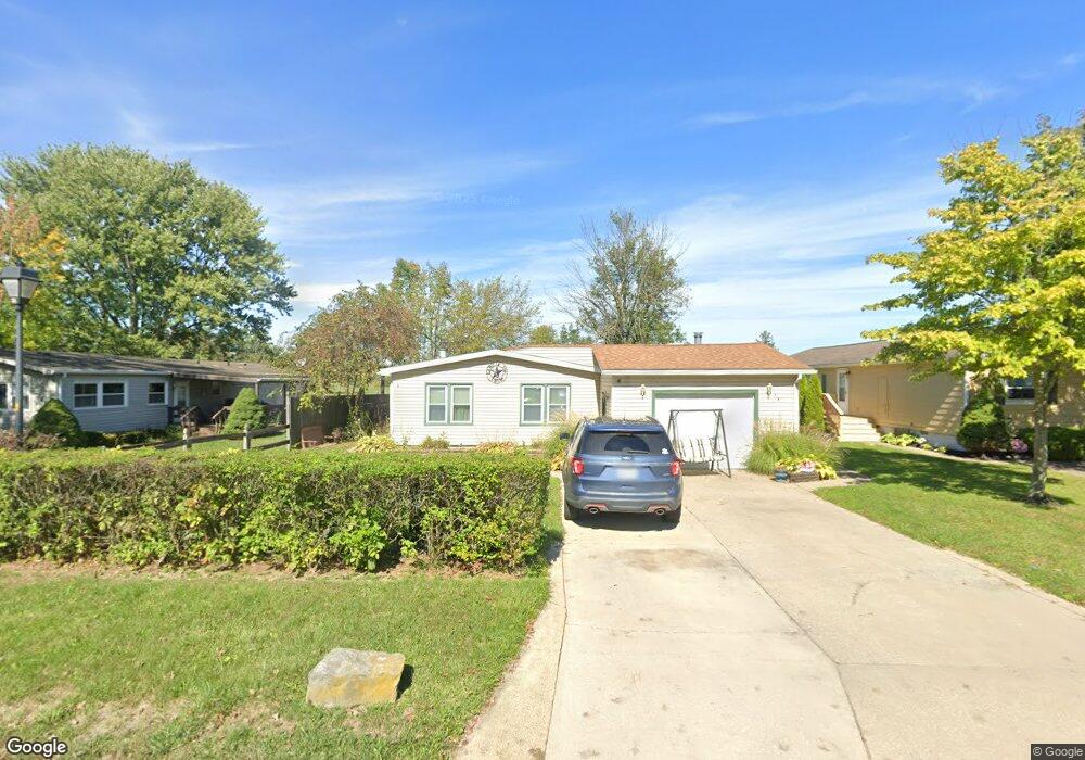
381 Stable Dr Lagrange, OH 44050
Estimated Value: $123,000 - $177,000
About This Home
This home is located at 381 Stable Dr, Lagrange, OH 44050 and is currently estimated at $149,739, approximately $116 per square foot. 381 Stable Dr is a home located in Lorain County with nearby schools including Keystone Elementary School, Keystone Middle School, and Keystone High School.
Ownership History
We collect this data history from publicly available records. To have your information removed, we recommend requesting removal directly through your county’s website.
Purchase Details
Purchase Details
Home Financials for this Owner
Home Financials are based on the most recent Mortgage that was taken out on this home.Purchase Details
Home Financials for this Owner
Home Financials are based on the most recent Mortgage that was taken out on this home.Home Values in the Area
Average Home Value in this Area
Purchase History
We collect this data history from publicly available records. To have your information removed, we recommend requesting removal directly through your county’s website.
| Date | Buyer | Sale Price | Title Company |
|---|---|---|---|
| $35,000 | Phoenix Title Agency | ||
| $108,900 | Elyria Land Title | ||
| $66,500 | Resource Title Agency Inc |
Mortgage History
We collect this data history from publicly available records. To have your information removed, we recommend requesting removal directly through your county’s website.
| Date | Status | Borrower | Loan Amount |
|---|---|---|---|
| Previous Owner | $105,633 | ||
| Previous Owner | $63,150 |
Tax History
We collect this data history from publicly available records. To have your information removed, we recommend requesting removal directly through your county’s website.
| Year | Tax Paid | Tax Assessment Tax Assessment Total Assessment is a certain percentage of the fair market value that is determined by local assessors to be the total taxable value of land and additions on the property. | Land | Improvement |
|---|---|---|---|---|
| 2024 | $2,053 | $41,206 | $6,689 | $34,517 |
| 2023 | $1,845 | $30,296 | $6,787 | $23,510 |
| 2022 | $1,833 | $30,296 | $6,787 | $23,510 |
| 2021 | $1,832 | $30,296 | $6,787 | $23,510 |
| 2020 | $1,752 | $25,590 | $5,730 | $19,860 |
| 2019 | $1,743 | $25,590 | $5,730 | $19,860 |
| 2018 | $1,459 | $25,590 | $5,730 | $19,860 |
| 2017 | $1,512 | $25,860 | $4,020 | $21,840 |
| 2016 | $1,501 | $25,860 | $4,020 | $21,840 |
| 2015 | $1,498 | $25,860 | $4,020 | $21,840 |
| 2014 | $1,305 | $24,620 | $3,820 | $20,800 |
| 2013 | $1,206 | $24,620 | $3,820 | $20,800 |
Map
- 387 Stable Dr
- 483 Stable Dr
- 476 Stallion Ct
- 490 Arabian Ct
- 339 Horseshoe Dr
- 78 Bass Ct
- 46 Perch Ct
- 718 Grey Wolfe Dr
- 38 Anglers Ln
- 657 Timber Wolf Ln
- 18022 State Route 301
- 18741 West Rd
- 0 Whitehead Rd
- 385 S Center St
- 40260 Whitney Rd
- 110 Railroad St
- 40871 Ohio 18
- 315 West St
- 509 William St
- 548 Appomattox Ct
Ask me questions while you tour the home.